Wednesday, September 12, 2018

THE CASTLE OF SCHOOLHOUSE HILL


If anyone was to tell you there was a huge old castle in Bar Harbor I think many would think you were off your rocker, but not if your a local.  In fact, most locals know of the Castle on Schoolhouse Hill and can describe it in detail, but the conversation always ends with - "but I have never been there."  Why the Castle like structure was build seems to be no mystery, it seems a wealthy family had it constructed to entertain their guests at.
The Castle is made up of a number of above rock walled rooms, with a series of stone steps.  The center piece of the Castle was a very large deep in ground swimming pool that had a series of round windows below the water level where people inside the castle could look out from below level into the pool while people were swimming.  It is said that there was once a series of very tall columns rising skyward that over looked one side of the pool, like a scene out of a roman movie.  The pool may still be there but the huge columns have been taken down.
Castle of Schoolhouse Hill - Bar Harbor, Maine

Three sides of the Castle grounds are encircled by high stonework walls like you see in many photos of old castles, and to one corner a stone tower rises up above the tall walls.  From the Castle compound it is said you can walk down a stone staircase that leads into the tower, and from there down another set of steps which leads outside the Castle walls where a walkway leads you along a long section of a towering wall, where there is an entrance to the more fasinating section of the Castle.  There is an underground room with a long hallway leading to yet anotther under ground room, just how many underground hallways and rooms remains a mystery, but I am told there are at least four rooms underground, each with hallways leading to them.
Maine Castle - Bar Harbor, Maine

I asked one local guy if he or anyone he knew had ever been in the underground section of the Castle, he replied that he had not but many people who go up to the castle to either party at night or crash for the night have, though he added people do so at their own risk.  He said a number of thick metal poles have been put in place to make the underground section of the castle more structualy sound.
So I have asked a number of times over the years that if anyone had any photos of this mysterious castle to please send them to me, and some have, for which I am most thankful.  Again, if anyone has photos they wish to share, please send them to me, as each new photo sheds a bit more light on this structure.
Bar Harbor Castle, Bar Harbor, Maine

As far as going to the castle, I have been told the land is posted and the current owner does not want anyone on the property.

If you wish to send along photos, fendermail56@yahoo.com
Castle of Schoolhouse Hill - Bar Harbor Maine

I also encourage anyone with knowledge of anything that has been written on this structure to let me know where I can find such articles.
Castle of Schoolhouse Hill - Bar Harbor, Maine

It is also worth noting that a number of locals have told me sections of the castle are slowly being torn down, so in time there will be no castle on Schoolhouse Hill.  The compound is what locals refer to as an empty mansion on the hill overlooking the Castle.


VIEW FROM THE CASTLE - School House Hill Bar Harbor Maine


Castle of Schoolhouse Hill Map - Bar Harbor, Maine

So I just had some one send me a few more photos, have no idea of when these were taken, but some sections of the castle in these photos have since been torn down, some still stand.  Sorry for the picture quality, I have no control over that.

BAR HARBOR CASTLE

Pool Area, now torn down - Bar Harbor Castle
THE CASTLE - BAR HARBOR MAINE
Schoolhouse Hill

THE CASTLE - Hamalton Hill
Bar Harbor Maine


THE CASTLE - SCHOOLHOUSE HILL
Bar Harbor Maine

ARTILLERY GUN - THE CASTLE
Schoolhouse Hill, Bar Harbor Maine


THE CASTLE - SCHOOLHOUSE HILL
Bar Harbor Maine

THE CASTLE - SCHOOLHOUSE HILL
Bar Harbor Maine


Keep in mind that this is post private property and the owners do not want people on the property.

UPDATE;

The reports coming from the area of Hamilton Hill (Schoolhouse Hill) are not good, much blasting has been going on in the area, and reports are that truckloads of dirt are being brought in and those poles of dirt are being bulldozed over sections of the castle, burying sections of it but leaving the otter walls in tact so you see the shell of what once was there.  So far only one area of the castle has been buried but nearby piles of dirt await to be plowed over other areas of the castle.  The turret or tower remains still up with its window overlooking Bar Harbor and the ocean, the fireplace inside the tower still in tact.  It appears as if the tower might be left in place along with some of the castle walls, but other sections of the castle including several side rooms appear destined to be filled with dirt, and this most likely will include the pool area with its round windows and the underground rooms around the pool.  In all directions trees are being uprooted and the land cleared and flattened, no doubt making room for new homes to be built.  I have been told an entire sewer system is being installed on Hamilton Hill and for this work to be done many trees were taken out.    As for the giant artillery gun, it no longer stands guard over the Castle.  It appears Bar Harbor will lose some of its history but gain some nice fine summer homes in exchange.
The history of the Hill's true name is at last known as well.  Locals today refer to the hill as Schoolhouse Hill, but many years ago, after the Hamilton Family purchased the property it soon began to be called Hamilton Hill, and true, there is nothing new there, but a couple recent articles I happened upon list the Hill's name before it started being called Hamilton Hill, and that was Malden Hill.  Once I began doing research on Malden Hill I began to find several old articles on the hill I had not seen before.


One of the rooms at The Castle being bulldozed in with dirt
Hamilton Hill - Bar Harbor
Tiles around the pool area of the Castle
Hamilton Hill - Bar Harbor
Lions Guard The Empty Mansion
Hamilton Hill - Bar Harbor

Pass at Your Own Risk - The Castle
Hamilton Hill - Bar Harbor

Tower of The Castle
Hamilton Hill - Bar Harbor


EMPTY MANSION OF HAMILTON HILL
Bar Harbor


Monday, September 3, 2018

THE OLD LAKE WOOD ROAD


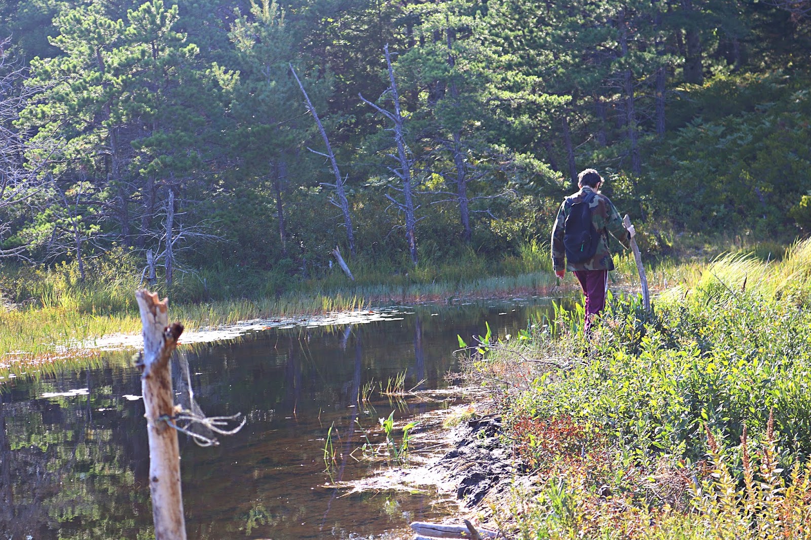
So today we did another adventure in search of the Fawn Pond trail from near the Breakneck Pond area and like all other searches in the past, we came up short again, but did come across a well hidden find.  We started out by the Breakneck ponds, the area where the Breakneck Road crosses the two ponds.  Right there you find the Breakneck Road, however today it looks much more like the Breakneck trail.  We did not cross the ponds but followed the Breakneck road on the same side of the ponds as the carriage road.  We followed the old road a ways until we came to an old trail going into the woods on the left, and followed it until it came to a body of water with a beaver dam over it.  We had been here in the past a few times but could never get across the top of the beaver dam because the water level was too high, but today, with a summer that has had little rain, we were finally able to cross the top of the dam, and as I had thought, there was an old road on the other side of the dam.  The road, more like a path today,  led us to some very high and thick brush but we were able to push through it with little effort, and you know where to go because it looks like a road went straight through the woods, just with brush growing up in it, and as you make your way through the brush you can see the worn trail on the ground.  This thick brush soon gives way to open trail which is very easy to follow.  Some distance along this trail we came to an abandoned pen area, a wire door, tall posts and a few layers of wire which surrounds a good size area.  I have come across these in other areas of the park,   I have photos and clearly it does appear to have abandoned.  I believe they grow tree's or certain brush in these large pens.
Crossing The Beaver Dam

With an open well worn trail we pushed on and further ahead we came to a small dump of sorts, metal cans, glass jars, old bottles, a pan and other items.  I have come across other little dumps throughout the park in the past and almost always all the glass bottles have been broken, but at this one I only saw on broken bottle.
Further along the trail a stretch of it turned rocky, kind of like you were walking up a dried brook, before the trail turned good again.  We than encountered  a long section with tall grass, almost like hay growing, but you still could see where the trail was.  A word of caution, as we moved along this section we stepped into a couple holes, the first was about a foot deep and nearly hidden by the grass, the second was over a foot and a half deep and we never saw it, thankfully no one was injured.  The trail than became well worn and open again until we came to four or five PRIVATE PROPERTY - NO TRESPASSING signs, and the path was blocked by several large granite blocks that you find throughout the park.  On tree's several feet from the signs was Park Boundary signs and at that point I was not too happy because I thought this trail must of been the Farm Pond trail.  So at this point we turned around and made the very long hike back to that beaver dam and crossed it just about at sunset and called it a day.  However once we looked over old maps we realized this old road once connected to the Old Norway Drive Road, beyond the no trespassing signs.  And at one point well along the old road we had seen a lightly worn path or road leading off to the right, had we taken the right lane we would of come out at the back side of Lake Road and would of been very close to Fawn Pond as well.
I am going to keep at this until I finally nail it, I think now we should of gone a little further down the Breakneck road - I know there is a path going into the woods further along, but that will have to wait until another day.
Other than that small dump area and the large pen, there is really nothing to see along this trail.
Walking Through Brush


WIRE PEN - ACADIA NATIONAL PARK
WIRE PEN


So after studying the old map, I marked off in red the route we took, it appears we just missed the hard right turn, I do recall a knoll right there, should of gone up it and checked it out, well, now I have something to do for another day.
So today we returned back to this beaver dam, crossed it for a second time and had another look around.  Not much to really report, but not wanting to cross the beaver dam again, we walked down below the dam to where a narrow brook ran and found a stone crossing there along with a very old set of stone steps leading up the banking on the other side of the brook.  The stone steps had all slipped out of place some and were crooked, and no doubt these stone steps were once a part of the Fawn Pond trail, at least it appears that way.  So just before the beaver dam, there is a faint path that runs through a section of thickets, on the other side is a well worn path leading through a short section of woods and turns left to the stone steps.

Trail begins along Breakneck Road at;
N 44 23.553
W 068 15.275

at water and beaver dam
N 44 23.536
W 068 15.358

Hidden stone steps by brook
N 44 23.549
W 068 15.375


The stone steps by the brook as they look today.  I have to say, it is a shame the Park Service continues to tell us they have no problem with us hiking these abandoned trails, yet they send teams of Ridge Runners out to them to toss dead branches across the trails.  If anyone else behaved that way they would be facing charges but Ridge Runners do it unchecked, on the very abandoned trails the Park Service says we are welcome to hike...it makes no sense at all.  I say this because since I documented this area, almost over night over a dozen large dead tree branches suddenly  found their way scattered across the start of the abandoned Lake Wood Road.
This photo was taken just as we came to the water, looking right, you can just see where the path runs through the brush, beyond the brush the path is easier to see.

There are a few things you have to keep in mind in order to locate this old road, and the first thing is the path itself.  At the start of the path, a large bush hangs over the start of the path, nearly blocking it from view...see photo.


So you really have to be looking for the start of the path...the good news is that the ground just in front of the bush is worn, but the trail does angle to the left.
The next thing to keep in mind is once you follow the path and see the water, look for a faint path that runs through thick brush on the right just before the water.  It is faint enough so that on our first two visits we totally missed it.  On the other side of the bushes the path is very easy to see, well worn and leads through the woods a short ways before making a left hand turn toward the brook.  Along the banking of the brook is a crooked set of stone steps, over time the large granite steps have shifted and are now slightly crooked.  At the base of the steps, there are some stepping stones to get you across the brook.  This set of stone steps was once part of the official Fawn Pond Trail, however once you get across the brook thick brush and ferns completely hide any signs of that path today.    But once you cross the brook and go up the banking on the other side you can see the beaver dam, but now your on the other side of it, simply make your way in that direction and pick up the trail or old road from there.

Sunday, September 2, 2018

THE METEORITE OF WITCH HOLE POND


WITCH HOLE POND - ACADIA NATIONAL PARK


I know, this is not an abandoned trail or anywhere close, but still, this story is rich with history and leaves one begging for answers.  Like where is this fairly large meteorite located today, is it still on display on a shelf at the Jesup Memorial Library, or does it lie in storage in a back room with no one knowing what it is today?  And where is this ledge which is located by Witch Hole Pond?  There is one section of ledge right by the waters edge, was that the ledge where the meteorite lay hidden for so long?  My gut tells me that is the ledge, since it is the only section of ledge close to the waters edge and there are woods all around that ledge.  Another burning question, in their excitement to remove the one large piece of meteorite, was other pieces left behind, still buried in the dirt by the ledge, I am sorry but the pirate in me looks at this as lost treasure just waiting to be found.  Anyways, here is the story as it appeared in the Bar Harbor Times back in the year of 1920...enjoy.


METEORITE DISCOVERED NEAR WITCH HOLE POND
BAR HARBOR TIMES
Nov. 10, 1920

History Of The Mount Desert Meteorite Or Shooting Star

Probably the meteorite was orginally part of a star or planet that exsisted and was destroyed untold ages in the past and this fragment, (71 1/2 pounds) at that time much larger, was shot off into space in the direction of the earth and continued to travel  towards it for millions of years till it came within the influence of the Earth's gravitation, when it continued to approach the Earth at a constantly increasing velocity till at the time it reached the Earth's atmosphere it was traveling at such a terrific speed that the friction of the air as it flew through same it caused to burst into flame and form a shooting star, which eventually fell on Mount Desert Island at Witch Hole and burned itself in the soft Earth until it struck a rock ledge where it remained almost completely covered by the ground till October 1919, when came men who were at work digging up stones in the woods to place on the submerged paths around Witch Hole Pond dug it up and were about to use it for a stepping stone, when Mr. Llewellyn Berry, who was present at the time, recognized it as a meteorite and it was laid aside in the woods, where it remained all the following Winter and Spring.
During the present summer it was arranged with Mr. Albert Eugene Gallatin to have the meteorite placed in the Jesus Memorial Library and accordingly Mr. Ernesto G. Fabbri, who had also seen it in the woods, accompanied by Mr. Berry, brought it out slung on a pole and placed it in the library, where, let us hope, it has at last found a permanent resting place after all its millions of miles of incessant travel through space.

WITCH HOLE POND
Acadia National Park

Sunday, August 12, 2018

THE CAVES OF ACADIA NATIONAL PARK


Over the years I have been asked a number of time, are there caves in Acadia National Park and where are they.  The quick and simple answer is yes, there are indeed caves in the park, but locateing them is another thing, and one can only come to the conclusion that the people running the National Park here have a serious problem when it comes to caves.  To put it bluntly, they don't want you to find them.  Bu8t that wasn't always the case, at one time the park service took great pride in some of the caves located in the park, such as the Day Mountain Cave, Anemone Cave and the Great Cave.  Even the Bear's Den appears on older maps and the Dorr Mountain Crevice Cave even has stone steps leading down into it.  Than there is the cave of Bald Porcupine Island, a cave where a very rare moss grows which has a brillant glow to it, and one scientist said that once you laid eyes on it you would never forget the sight of it.
Exploration of some of these caves comes with the risk to life, as people have been killed exploring some of these caves.  The cave at Great head is one case in point, a teenager was attempting to enter the mouth of the cave when a large wave swept up from the ocean and washed him out to sea.  A memorial plaque was placed around the spot where the young man's body was washed away.  Than there is the very tragic death of Douglas Rose, who became trapped in Anemone Cave by an approaching storm which stirred up the sea with waves so powerful he could not escape the cave.  Books and articles state that others have become trapped in the sea cave and drown as well, though the only official account of a drowning there was of Douglas Rose who was only nineteen years old.  In the mid 1800's two 12 year old girls fell from a cliff near Great Cave, one of the girls was killed.  Below are just some of the caves located within Acadia National Park.

The Great Cave - I have a blog on the history of the Great Cave and this is one of the once official caves that once had signs leading you to it.  It is located on an abandoned Great Cave Loop along the Precipice Trail.  If walking along the edge of sheer ledges is not your cup of tea, I suggest hiking up to the cave and returning back down the way you came, as following the second half of that loop will lead to sheer cliffs.
THE GREAT CAVE - photo by David Schortmann

THE GREAT CAVE BLOG


THE DEVIL'S OVEN - Another cave that was once an official cave with signs leading you to it along with railings to help you reach the mouth of the cave today is named Anemone Cave.  But it was not always named that, old newspaper accounts of the cave state its name as The Devil's Oven, and people have become trapped in the cave by rising tides and drowned.   Though they don't say this, I believe the tragic death of Douglas Rose may of played a role in the Park Service abandoning this cave.  There are a number of photos and maps to this cave online, simply follow the Schooner Head Road until you come to a four way intersection, turn left and at the parking lot look for a narrow paved path that leads through the woods.  When the path reaches the cliff, you are standing on the roof of the cave.  This cave can only be entered at low tide and the floor of the cave is extremely slippery.
ANEMONE CAVE, The Devils Oven - Acadia National Park

ANEMONE CAVE BLOG


Dorr Mountain Crevice Cave - When a video on Youtube discribed the location of this cave I knew exactly where it was located, but in all my trips up Dorr Mountain I had never seen the entrance to the cave - which is how the park likes it.  On my blog on this cave I give the GPS info, but you want to either go up the Homans Trail (my favorite trail on Dorr Mountain) or up the Dorr Mountain Trail behind the spring house at Sieur de Monts Spring area by the Wild Gardens.  Follow either trail until you come to a four way intersection.  Continue to follow the trail up the mountain, which does a slow climb.  Ahead you will come to a long flat area of trail, follow it until you come to a hard right and stone steps leading upward with towering granite walls to your left and right.  The steps turn right and end at a small flat area that almost looks like a small observation area.  Here you are only a few feet from the mouth of the Dorr Mountain Crevice Cave.  As your looking outward at the stunning view, the mouth of the cave is to the far left, you have to almost walk right up to it before you see it.  Look down at the ground for the opening to the cave with stone steps - if you don't look down at the ground you will not see the opening to the cave.  The stone steps clearly suggest this was once a main feature of this trail but later abandoned by the Park Service.

DORR MOUNTAIN CREVICE CAVE BLOG


The Bear's Den - This old bear's den dates back to the 1800's and once had a trail that led from bar Harbor up to the den.  I had searched for this den for some time but one evening my oldest son Wesley came home with news that he had located the cave.  This is very easy to locate but when you first see it don't be fooled, this cave or den goes sideways into the side of the mountain.  To reach this old bear's den simply turn onto the One Way section of the Park Loop road and drive until you come to a good size pond on the right hand side of the road, its the only pond that comes right up next to the roadway so you can't miss it.  Continue past the pond and park at a pull over up ahead at the curve in the road.  Cross the road and walk along the right hand side of the road, heading in the same direction as the traffic.  The rock ledge to your right will slowly drop and you will come to a wooded area.  From the side of the road look into the wooded area and you will see a large black area in the woods, that is the mouth of the bear's den - a worn path down the banking leads to the den.

BEAR'S DEN - INSIDE LOOKING OUT
ACADIA NATIONAL PARK

BEAR DEN BLOG


 ‎Hagornot Head - referred to as Picket Mountain on old maps, there once was three trails that led to the summit of  ‎Hagornot Head, yet today not a single trail goes to the actual summit.  The Beechcroft trail skirts around and below the summit and one has to ask, what became of those trails that went to the summit?  They were all abandoned by the National Park Service and information I came across at a Caving Site may hold the answer as to why no trails go to the actual summit today.  According to the Caving Site, there is a large Crevice Cave located somewhere on  ‎Hagornot Head and this cave has not been documented as far as I know, even the caving site does not give instructions to the cave.

The Great Hill Cave - I believe Matt, in his book "The Acadia You Haven't seen" refers to this cave as the road side cave, and for good reason, it is right beside the road.  From Eagle Lake (route 233) turn into the park by the stone arched bridge.  At the Park Loop road turn right, and just around the corner park at the pull over area.  Directly across the road is a granite ledge, make your way to the top of the ledge and look for an opening into a small cave.

Schistostega Cave - You will have to find a way to reach Bald Porcupine Island if you want to locate this cave and I do not know of its exact location other than it is located somewhere below the high Precipice on Bald Island.  The cave is sometimes refereed to as Goblins Gold Cave because of the extremely rare moss that grows inside the cave.  In fact this moss is so rare that it only grows in a few places in Maine.  Scientists have gone out to the cave to gather up some of the mysterious glowing moss from the cave.  Some have used ropes to reach the mouth of the cave, but it is said it is much easier to reach from coming at the cave from below.  How deep is the cave - no one knows.  Scientists had children go as deep into the cave as they could go and shine bright flashlights down into the cave and they could not see the end of the cave, but the problem is the further into the cave you go, the smaller the cave inside of the cave becomes.  I have a nice blog on this cave with a large newspaper article on it.

Schistostega Cave Blog


Day Mountain Caves - there are a number of well documented caves on Day Mountain with some instruction as to their locations, but one of those caves was at one time an official Cave with its own official Park Path leading to it.  This cave was at one time smaller than it is today, the Park Service had the inside of the cave enlarged and put in place iron rungs which served as a ladder to help you reach the mouth of the cave which is on the face of a granite wall.  When the Park Service decided to abandoned the Cave they had the iron rungs cut from the face of the cliff.  In Matt's book "The Acadia You Haven't Seen he gives instructions on how to locate this cave, as well as another nearby cave, but since the Park Service removed the iron rungs there is no way up to the cave today.
DAY MOUNTAIN CAVES

The Secret Flying Mountain Cave - this cave may not be everyone's cup of tea as it begins under water before going upward and out of the water into the side of flying Mountain.  This cave is said to have four rooms in it and a source of fresh water runs down through the cave to one side of it.  The Indians were the first to locate and make use of the cave, seeking out its safety when they felt they might be in danger.  Later the French Jesuits were shown the location of the cave and they also made use of it from time to time when they felt threatened.  Later a smuggler learned of the cave and when he smuggled goods from Canada to Boston, from time to time he found the law in pursuit of him, steered his vessel up somes Sound and sought out the cave to escape justice.  In more recent times two boys lobster fishing in the Sound came upon the cave and told their parents and others of the large cave with its under water opening, but no one believed the boys story.
Now you might think this to be a wild tale, but consider who is telling the tale, non other than the Rev. Oliver H. Fernald, who in his time was looked up to as a historian of the island.  The entrance to the cave, he wrote, is located where Flying Mountain "juts into Somes Sound," and at its boldest shore - at low tide the water there gurgles and swirls as if swallowed up in some unseen well-hole, only to be rolled out again with a new impluse.  He writes that the entrance is five feet below the low tide mark and that the passageway arches upward up into the mountain and once up in the mountain the cave opens into four chambers.


THE OVENS AND THE CATHEDRAL
Your walking along the shoreline when you come to a series of cave-like structures thatv resemble ovens, further ahead is a massive area of towering granite known as the Cathedral, and than you come to a ten foot high opening in solid rock, a tunnel were countless people over the decades have stood before and posed for a photo, well if you have stumbled upon just such a place, than you have located an area known as The Ovens.

THE OVENS BLOG


The Boulder Caves of Champlain Mountain Boulder field - If you have ever ventured up to the Hanging Steps, than you have passed by this huge boulder field.  I have made my way through sections of that boulder field and discovered a number of caves large enough for 7 or 8 persons to seek shelter in.  If you follow the directions in my blog for the Hanging Steps, once you pass under the crooked tree, just on the other side of it, instead of following the trail straight ahead, turn left and just below is a nice large boulder cave.  I have wanted to do a more deeper search of that boulder field for other boulder caves but never found the free time.  Just looking upward at all those much larger boulders and you have to believe there are a number of boulder caves just waiting to be located.

The Gorham Mountain Caves - not much has been written about the Gorham Mountain caves, but I remember many years ago talking to a park ranger who told us there was a number of "Hidden caves" on Gorham Mountain, and none of them could be reached from the main trails.  He had said the caves were either below or above the main trails and that some of the caves were once used by native Americans.  I have never gone searching for these caves nor have I come across anyone who has documented any of them.  The link below takes you to a website that talks about some of the caves and a tunnel on Gorham Mountain, worth checking out.

THE GORHAM MOUNTAIN CAVES


The Cooksie Drive  Cave of Seal Harbor - This cave is mentioned only briefly in part of a sentence;  "They were at work for a couple days at Anemone Cave at Schooner Head, and later at a cave on the Cooksie Drive near Seal Harbor."  This sentence appears in a piece titled Vitagraph Director Delighted With Scenery and appears to be a piece about filming a movie.  No other details of this cave are given.

Cave At Otter Point; 
Bar Harbor Record
May 19, 1887
A new road is being built from Aulick Palmer's residense at Otter Creek, to the end of Otter Point.  A wonderful cave has been discovered on the Western side of the point, and near it is a pit dug by some ancient Otter Creekers in search of the fabled treasuers of Captain Kidd.

(this was the entire piece which appeared in the newspaper back than, no further details.  It sounds like this was the construction of the Otter Cliff road with the cave being somewhere by Otter Point.


THE SPOUTING HORN CAVE


Crowds of people once flocked to the cliffs of Schooner Head to look down at the Spouting Horn Cave as wave after wave crashed into the cave and the rocks around it, throwing up huge plumes of ocean spray.  In the 1800's and early 1900's access to the cliffs was pretty much open to the public, but today I believe the cliffs lie upon private land.  I have no idea if the cave can be entered on foot during low tide, but if it could be, I assume the best approach would be by boat.  In one photo I have been able to locate it shows one woman park way down the cliff, totally crazy and I have no idea how she got there, see photos in blog.

BLOG OF SPOUTING HORN CAVE


THE ROCKEFELLER  CAVE

So  when I came across this old article, I was really excited by its title, because it would seem to suggest that the article was going to talk about many caves, but in fact only one cave is directly mentioned, that being a new cave to me, the Rockefeller Cave.  I don't have any more information on this once old sea cave except what is found in the beginning of the article.

TOM PATTEN AND THE CAVES OF MOUNT DESERT ISLAND
Bar Harbor Times
Dec. 26, 1923

Tom Patten of Seal Harbor who for years has studied, read and observed the geology of Mount Desert Island writes the following interesting article on the sea made caves of this island.
At several locations on this island in the faces of ledges and at different heigths above sea level;  are found apertures in the form of caves which plainly show the action of the sea in their excavation.
In front of the pinnacle on which is built the summer cottage of John D. Rockefeller, Jr, is one of those most perfectly developed caverns, so nearly alike those which exist at sea level, that it would not require a great stretch of imagineation to observe the fishes gliding along its sides, and one is tempted to look for Barnacles adhering to its walls and Periwinkles in the crevices of its rocky floor;  but time has removed all fossils from those old sea bottoms which were not preserved and covered by an accumulation of marine clay.
When we view this cave at an elevation of nearly two hundred feet above sea level, the question arises, how long ago was the sea at this elevation, and how long a period of time has elapsed since it was confined to its present bounds.
There are several conditions by which to judge this period if a key to the evidence could be found, and the evidence seems to be very conflicting.  In support of the minimum period since the elevation above the water is the fact that the edges and corners of the ledges still present the oval and circular form which the attrition of the glaciers gave to them, and also the granatic ledges have erroded scarcely an inch below the harder and more resistant quartz veins.  And this type of iron bearing Syonite very quickly commences to decay on the surface when civested of its covering of tile which the ice field spread upon it;  but other evidence is to be considered which would seem to place the period of submergence to a time far more remote.  It seems improbable that in the lapse of but twenty thousand years these ledges have gradually uplifted two hundred feet.  This is the time estimated by some geologists since the Champlain submergence.  No noticeable change in elevation  have taken place in historic time.  A sudden rise or uplift or a succession of thses would have displaced and rolled down many delicately poised boulders which were deposited on the crests of ledges when loosened from the melting glaciers.
Also it must have required many thousands of years to have reforested the land from a nucieus which had been driven many hundred miles to the South beyond the icy sheet, especially taking into consideration that the land to be reforested was but a bleak surface of stones and gravel.
The fact is also to be considered that the country was fully clothed with verdure before the dawn of historic time.  It is a question of consideration by those who are interested  in the work of nature, how remote was the period when the islands surrounding Mount Desert were submerged below the sea, and the highest hills  on our own island were a collection of minature islands surrounded by a shallow sea which broke over the tidal ledges of the lesser elevations.
The clothing of the country with forests also has a bearing on the date of occupation of the country with the represntatives of the human family.  It is not probable that the country was inhabited by the aborigines until it could support  and furnish food for the animals on which the savages subsisted.
The time which has elapsed since those sea caves were formed is but as a drop of water in the ocean when compared with the vast eons of the past when our old Azaie floor was laid down, but the age just preceding historic time seems to be especial interest to us.


THE CAVE OF LITTLE DUCK ISLAND

One of the first islands to come into conservation ownership on the coast of Maine,Little Duck is owned primarily by National Audubon. Acadia National Park also holds a conservation easement on a portion of the island.
A newspaper articles dated Feb. 28, 1923 talks about a cave on Little Duck Island where a man made his home in for some time, living mainly off of fish and sea food he caught along the shore.  The article does not state how deep the cave is, but did say that the entrance to the Duck Island Cave was twenty feet long and seven feet high.  It states the cave is located on the easterly side of the island.


LITTLE DUCK ISLAND CAVE GUIDE
ACADIA NATIONAL PARK


Thursday, August 9, 2018

THE SECRET CAVE OF FLYING MOUNTAIN


THE HIDDEN PIRATE CAVE OF FLYING MOUNTAIN
published in Bar Harbor Times - April 30, 1964

Legend has it that pirates were chased up into Somes sound and stashed their treasure away in a hidden cave.  This newspaper article states that today no one seems to know of this hidden cave, yet the cave does exist, as it is mentioned in an article by Rev. Oliver H. Fernald in a 1883 issue of the Mount Desert Herald.  Dr. Fernald knew that area well as he was born in Southwest Harbor in 1835.    He was a man deeply interested in the areas history, and he collected stories and ledgends of the islands early years.  The cave of Flying Mountain he named "groto of Mount Desert."
The entrance to the cave, he wrote, is located where Flying Mountain "juts into Somes Sound," and at its boldest shore - at low tide the water there gurgles and swirls as if swallowed up in some unseen well-hole, only to be rolled out again with a new impluse.  He writes that the entrance is five feet below the low tide mark and that the passageway arches upward up into the mountain and once up in the mountain the cave opens into four chambers.
The Indians of the island knew of the cave and went there from time to time in order to hide.  It was the indians who showed how to locate the hidden cave to the French Jesuits who established a colony at Fernald Point in 1613.
Over the years that followed the location of the cave became lost over time, but its location was once again discovered by two boys out lobster fishing along the Sound.  No one believed the boys had discovered a hidden cave and locals never checked out their story.
Legend says a smuggler learned of the cave and used it to store away his loot, which was not of gold nor coins.  The name of the smuggler was Capt. Lebion, and he smuggled tea and such things between Boston and Nova Scotia and headed to the cave when being pursued by the law out of boston.  a small narrow stream of water trickles through the cave, the water making its way down into the cave below from an opening if the cliff above the cave, and the water is said to be fresh enough to drink while hiding away in the cave.
I came upon this story in an old newspaper and thought I would share it.  A photo of the cave was pictured but the photo was so poor you could not make anything out in it.


For further research, I found that the The Southwest Harbor Historical Society has a reference to this cave,  Citation
Spiker, LaRue, “Flying Mountain Cave Once Pirate and Smuggler Resort.,”


UPDATE;
I found this newspaper article, but in my opinion it is a "story" spun around some facts of the day, as this is the only account of this cave having an above water wooden door with a secret narrow path.  The writer did have knowledge of some of the more believable parts of the actual story, for instance he knew about the under water entrance, that it is about five feet under water at low tide, the action of the water above the cave entrance, and about the two boys who rediscovered the cave one afternoon while out looking for lobsters.  He seems to have woven a good tale around what little was known of the cave, in my opinion, but you can read the old story and decide for yourself.

 THE GROTTO OF MOUNT DESERT
An Old Time Mystery

Mount Desert Herald
Feb. 15, 1883

It may not be generally known that there exists a remarkable Grotto, or cave, on Mount Desert Island which has figured in the history of its people for the last two hundred and fifty years.  It is certain that the Grotto and its approaches were known to the Indians when Southwest Harbor was first frequented as a resort by the then adventurous English and French navigators in the early part of the seventeenth century.
When Father Biard and his pious band first visited Mount Desert and preached the Gospel of "good tidings," to the wild and savage tribes, the Grotto was even then famous as a hiding place among those untutored and war like men.
And when the (unreadable) colonists were being hunted out of the island, as the sportsman follows the deer it is supposed the friendly Indians guided them in their birch canoes to where the Flying Mountain juts into Somes Sound and at its boldest shore, showed them that mysterious spot, where at low tide the water gurgles and swirls as if swallowed up in some unseen well-hole only to be rolled out again with a new impulse.  Just here at the depth of five feet at low tide is found the mouth of the hidden caves.
The wary Indians carefully guided hither their freight of living souls, showed them the entrance to the unsuspected cave, while one of them dove beneath the waves, and soon his familiar voice is heard issuing from the crevices of the rocks above them, encouraging them to follow.  And there in the bossom of the mountain, above the level of the sea, with its only entrance below the waves was the grotto of Mount Desert - a weird, dismal abode, divided into four rooms with apertures sufficiently capacious to serve as doors.  Here it is supposed those weary colonists found shelter, repose, and safety during the long weeks that Argel and his blood thirsty followers scoured the mountains and vales of our island for their destruction.  Whethet this rendezvous was mentioned in the annals of those colonists, or is more probable, the fact has been handed down to our time by tradition, I am unable to say.  Of one thing we are certain, that the locality of the grotto and its place of ingress were lost for a century or more, and that its particular position, and entrance were again found by two lads by the sheerest accident.  While sculling leisurely along the low tide in quest of lobsters, one of them remarked the peculiar swirl of waters, and soon his keen eyes detected the mouth of the cave.  With the adaptation of the duck for land or water, he was soon divested of his clothing, and with a plunge downward made the discovery a verity and once more the grotto of Mount Desert was known to the world.  But knowledge without application avails little.  The boys were doubted, their story was never tested, and their tale, like the one I am now writing, was soon passed by as an idle myth.
It was this boy revelation, however, that reached the ears of a daring free-booter who was seeking for some place in which to deposit his ill gotten gains.  This man visited the locality, heard the tale of the boys, clandestinely examined the spot, and left the island as quickly as he came, being reputed to be a speculator.  I have not time to tell of the daring exploits of a noted pirate during the years following this visit, of his attack and capture of a Spanish man of war, carrying the pay roll of the spanish navy and having ten millions in gold on board, of his merciless tax on the merchantmen of all nations, of his wonderful ubiquity;  of his escape when discovered into a trap within the range of Moro Castle, Havana and finally of his assault on the British frigate Shannon, when lying in the Boston Bay;  of his repulse, the retreat, and the chase which was continued for three days and only ended by running into Southwest Harbor at nightfall.  A score of British boats followed him as far as Greening's Island when twilight deepened the night, and the patrol of the harbor was continued until day break, that they might secure their prize.  But with the day came disappointment, every crack, bend, and cove from Fernald's Point to Somesville was searched but no vessel appeared.
It is now supposed that finding escape impossible they discharged their gold and other valuables during the night into the grotto, carried their vessel out of the "deep hole" in the river beyond, where there is a line and a half of water, scuttled her, and then took to their hiding place.  A stray boat without marks or oars was all that remained to human view of the once dreaded "Scourge of the Seas."  This must of happened scores of years since, as even the tradition has failed to impress the generation now living on the island.
When next visited by a noble smuggler, the rooms had been squared, the floors leveled, and the whole abode taken on the proportions of comfort and elegance.  The lack of light has been remedied by bulls-eyes in the over hanging rock;  the little rivulet, that gave its incessant supply of water, had been made to gather in a deep stone trough, and the doorway had been constructed far up the inacessible mountain side, which was carefully filled, when not in use, with loose stones and concealed by overhanging bushes.  To the doorway there was a narrow footpath, winding along the steepy sides of the precipice, where the foot of the (unreadable) had never trod, and which one man with a trusty rifle could guard against (unreadable) foes.  So peculiar were the advantages thus placed in the way of this smuggler that while I write them my take must seem like a novel.
We now pass to the exploits of Capt. Le Blon who in his day figured as one of the greatest smugglers on the american coast.  Tea, upon which the duty was excessive, was in demand where ever offered for sale.  Le Blon, therefore, hired an outbuilding in a little cove north of Halifax Harbor, N.S., made his purchases by night of prominent merchants in that city, disposited his wares in the old fishhouse before mentioned, from where the good schooner Juno of Newbury Port, of which he was the captain, took in her cargo and without clearance or entry made her run to the home city, but if he saw breakers ahead, Mount Desert and the grotto were the rendezvous, and a successful voyage was scored.
Oftentimes a cargo of sugar was run in from the West Indies, and the offers of her owners grew (unreadable) with her crooked gains.  there was no lack of merchandise with (unreadable) as long as the juno was afloat under the captainy of le Blon.
On one of his trips fortune had favored him as before, until he entered Boston Bay, when the eagle eyed customs officers sighted their prize in the offing and manned their boat for the chase.  Le Blon was as lynx-eyed as his pursuers, but hoped to reach land at nightfall so as to evade theofficers of government and land his goods, a valuable stock of silks.
The wind, however, died out, and his pursuers gaining on him, he determined to throw up his hand and take to strategy.  Having on board a choice stock of wines and French brandy, he received  the officers of government on board with open arms, called them below and treated and feasted them to their  hearts content.
In the meantime his trusty mate had gagged the remainder of their crew, secured them in irons, quietly lifted the hatches and transferred the most valuable wares to the boats of the United States officers, slipped them astern in care of cometent men who made their escape to Newburyport;  and before morning, when the officers began to look about themselves they found that they were therved.
All that remained in the hold was the bodies of five of the crew of the ship "Northern Light,"  which had been drowned on the coast of France and which Capt. Le Bklon had kindly consented to take back to America for internment at their homes.
The baffled officers reveal and threatened but when they reached the wharf at Newburryport made no objection to the burial of the deed.  The coffins were taken in hearses and carried to a receiving tomb from which they were to be buried next day.
On the (unreadable) it appeared that the tomb had been sacked, the coffins robbed, not of corpses but of French brandy.  The store window of Job Saunders Esq. showed a fine assortment of French liquors next day.  In the meantime the Juno lay in the harbor in charge of the officers of the law awaiting orders from Boston.
Le Blon ever on the alert, engaged a crew of swimmers, boarded her at midnight and by stealth cut the cable, cleared the deck and was underweight quicker then I can write these lines.  The involuntary prisoners were landed at Cape Ann, but the career of the Juno was near its close.  Not long after she fell into the hands of the British squadron, it being wartime, and was carried to Provincetown as a tender.  But the ubiquitous Le Blon followed her and cut her out, ran the gauntlet of the fleet and delivered her to her owners in Newburyport.  Shortly after she was sold to eastern parties and laid her bones, nearly forty years ago at Mount Desert near the grotto that concealed her ill gotten treasure.
Alas!  Alas!  Why were not the gold hunters and their burden bearers immortal?  The Juno has gone, the old captain has paid the debt of nature, Job Saunders is dead, but the grotto remains.  Somewhere in the rocky fastnesses of Somes Sound is that hidden cavern.  As once of yore the place of ingress, the narrow pathway along the shelf of rocks and the concealed doorway have been forgotten, yet if the locality and ingress could be again identified what hoards of wealth would again the lucky discover.
Oh!  wonderful Mount Desert, when thou coukldst could not hide thy children in thy deep valleys and dense forests thou didst conceal them in thy bosom.  When will thy wonders cease?

Monday, July 30, 2018

THE HANGING STEPS


The Hanging Steps is not a trail, the real name is the Orange and Black Trail, the half of the official trail the Park Service chose to abandoned.  The Hanging Steps was a Main attraction along the Orange and Black trail.  Rudolph Brunnow designed both the Orange and Black Trail as well as the once popular Hanging steps.  The most amazing feature of the Hanging steps is that they appear to "hang in mid air," with drop offs to either side of the steps.  Brunnow achieved this feat by way of using hidden iron bars to hold the huge granite steps in place.  They got their name, it is said, when a park ranger came to the site to view the steps for the first time and exclaimed, "They appear to hang in mid air," and from that day forward they were referred to as the Hanging steps.
CHAMPLAIN MOUNTAIN - HANGING STEPS - ACADIA NATIONAL PARK

Abandoned Trails of Acadia - The Hanging Steps
I have been asked a number of times, does the trail end at the Hanging steps - no, it continues on up to some cliffs, than makes its way through a section of woods before coming out at open granite.  From there you only have one way to go, follow the open granite downward until it joins the lower section of the Precipice Trail at the base of the Turn around, a huge boulder in the trail with a few iron runs placed in a way to make it hard for inexperienced climbers to get past.  With just a little bit of looking you can find where the trail continues at the top of the Hanging steps.
THE HANGING STEPS - Orange and Black Trail - Acadia National Park
Above is perhaps the best photo of the Hanging Steps I have seen to date, and the photo was taken by David Schortmann.   I want to thank him once more for his contributions to our sites.


SIGN IN LEDGER - ROCK CLIMBERS TRAIL
Within a minute or so after starting down the unmarked trail you come to this huge boulder with a sign in ledger.  The ledger is there for the rock climbers in case some one is reported missing, that might of had an accident while rock climbing.  Rangers can take a quick glance at the ledger and know who went up by rope and who came down and when.
ROCK CLIMBERS TRAIL - GRANITE WALL STRAIGHT AHEAD
So as you can see, the first half of the Orange and black trail, the abandoned half, arrives at the official Precipice Trail, than followed that trail upwards a ways to the area of the boulder field.  Around that point, the Great Cave trail went left, and the official half of the Orange and Black trail goes right.  In the photo above, is the path from the road to the high wall of granite where you turn left, and below is the wall of granite with a right turn ahead, which leads up to a very twisted tree you need to pass under, or over.
AT GRANITE WALL - VIEW LOOKING LEFT
From the map, you can see a path just beyond the Precipice parking area, an unmarked but well worn path that enters the woods.  This path today is mainly used by rock climbers who go there to practice their climbing skills.  You will come to a towering wall of sheer granite, the rock climbers use gear to climb that wall, turn left and follow the path to the corner where it turns right, goes upward and under a very crocked tree.  Continue ahead until the path takes a right turn and continues upward, here you will begin to see stone steps.  From here the trail is easy to follow until you reach the top of the Hanging Steps.
CONTINUE TO FOLLOW SIDE OF GRANITE WALL

pass under the twisted white birch

Pass under its twisted branches and look up - that huge impressive  boulder seems like its ready to drop right down onto the path where your standing.
HUGE OVERHEAD BOULDER

start of stone steps

THE HANGING STEPS - ACADIA NATIONAL PARK


The Hanging Steps - Acadia National Park


 DEATHS IN ACADIA NATIONAL PARK VIDEO


IRON RAIL NEAR TOP OF HANGING STEPS - ACADIA NATIONAL PARK


VIEW FROM TOP OF HANGING STEPS - ACADIA NATIONAL PARK
While the abandoned section of the Orange and Black trail is not too hard to follow, we have added extra GPS points for those who might venture beyond the top of the Hanging Steps.  There are a couple places where GPS numbers further up might come in handy.

HANGING STEPS
trail begins
latitude  44 20' 50"N
longitude  68 11' 15"W
right turn
latitude  44 20' 49"N
longitude  68 11' 22"W
right turn
latitude  44 20' 50"W
longitude  68 11' 22"W
to woods
latitude  44 20' 50"N
longitude  68 11' 21"W
woods path
latitude  44 20' 51"N
longitude  68 11' 21"W
woods path
latitude  44 20' 52"N
longitude  68 11' 20"W
open granite
latitude  44 20' 53"Nlongitude  68 11' 20"W
open granite
latitude  44 20' 55"N
longitude  68 11' 19"W
Precipice Trail
latitude  44 20' 57"N
longitude  68 11' 19"W

HANGING STEPS TRAIL
HANGING STEPS TRAIL
BEYOND THE HANGING STEPS - TRAIL ENTERS WOODS
WOODS TRAIL BEYOND HANGING STEPS
BEYOND THE HANGING STEPS - TRAIL HEADS TOWARD PRECIPICE TRAIL AND OPEN GRANITE

UPDATE

So with new information on a section of the Hanging Steps end of the Orange and Black Trail (the end now abandoned by the Park Service) we returned to the area in hopes of locating those stone steps we had missed.  We did locate them, but it did take a little searching, this section of trail we had missed is a loop that runs through the center of the boulder field, and I would reccomend for most people going the way we outlined on the map will be your shortest and safest route.
Now for the missing section of the trail, once you come to the sheer climbing wall and turn left, than right, you want to approach that old sideways tree blocking the route.  About halfway to the twisted tree, to the left, there are two large sections of granite with a narrow passage way between the two large sections of granite, you pass through that narrow spack and continue to follow the path, which is stone and at times you have to stop and search were to go next.  Around a corner the path gets really narrow for a short section, granite on one side of you and about a five foot drop on the other.  Once past that you come to stone steps and stone stairway, clearly the earthquake some years ago that made a mess out of a number of official trails also made a mess here as well, as it quickly became clear that some sections of stone steps were missing, and in one spot some large boulders had fallen down onto the trail.  From here it appeared the trail went off in two directions, one continueing up through the center of the boulder field to a look out spot, and the other moving straight ahead in the direction of the hanging steps, joining up with the smae area we have marked out on the map.
Because this section is hard to locate and not so easy to follow, as I said, the way we have marked out on the map is much easier and safer, but if you are looking for an adventure, than searching out these hidden stairways might be for you.


Abandoned Trails of Acadia National Park - The Book