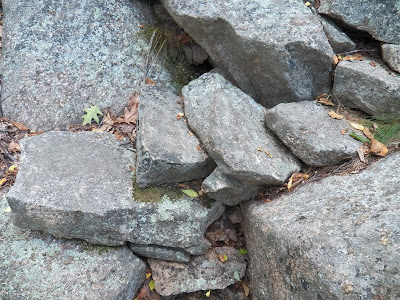
The Hanging Steps is not a trail, the real name is the Orange and Black Trail, the half of the official trail the Park Service chose to abandoned. The Hanging Steps was a Main attraction along the Orange and Black trail. Rudolph Brunnow designed both the Orange and Black Trail as well as the once popular Hanging steps. The most amazing feature of the Hanging steps is that they appear to "hang in mid air," with drop offs to either side of the steps. Brunnow achieved this feat by way of using hidden iron bars to hold the huge granite steps in place. They got their name, it is said, when a park ranger came to the site to view the steps for the first time and exclaimed, "They appear to hang in mid air," and from that day forward they were referred to as the Hanging steps.
 |
| CHAMPLAIN MOUNTAIN - HANGING STEPS - ACADIA NATIONAL PARK |
 |
| Abandoned Trails of Acadia - The Hanging Steps |
 |
| THE HANGING STEPS - Orange and Black Trail - Acadia National Park |
 |
| SIGN IN LEDGER - ROCK CLIMBERS TRAIL |
 |
| ROCK CLIMBERS TRAIL - GRANITE WALL STRAIGHT AHEAD |
 |
| AT GRANITE WALL - VIEW LOOKING LEFT |
 |
| CONTINUE TO FOLLOW SIDE OF GRANITE WALL |
 |
| pass under the twisted white birch |
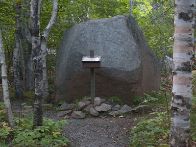
Pass under its twisted branches and look up - that huge impressive boulder seems like its ready to drop right down onto the path where your standing.
 |
| HUGE OVERHEAD BOULDER |
 |
| start of stone steps |
 |
| THE HANGING STEPS - ACADIA NATIONAL PARK |
 |
| The Hanging Steps - Acadia National Park |
DEATHS IN ACADIA NATIONAL PARK VIDEO
 | |
| IRON RAIL NEAR TOP OF HANGING STEPS - ACADIA NATIONAL PARK |
 |
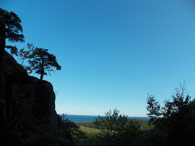
| VIEW FROM TOP OF HANGING STEPS - ACADIA NATIONAL PARK |
HANGING STEPS
trail begins
latitude 44 20' 50"N
longitude 68 11' 15"W
right turn
latitude 44 20' 49"N
longitude 68 11' 22"W
right turn
latitude 44 20' 50"W
longitude 68 11' 22"W
to woods
latitude 44 20' 50"N
longitude 68 11' 21"W
woods path
latitude 44 20' 51"N
longitude 68 11' 21"W
woods path
latitude 44 20' 52"N
longitude 68 11' 20"W
open granite
latitude 44 20' 53"Nlongitude 68 11' 20"W
open granite
latitude 44 20' 55"N
longitude 68 11' 19"W
Precipice Trail
latitude 44 20' 57"N
longitude 68 11' 19"W
 |
| HANGING STEPS TRAIL |
 |
| HANGING STEPS TRAIL |
 |
| BEYOND THE HANGING STEPS - TRAIL ENTERS WOODS |
 |
| WOODS TRAIL BEYOND HANGING STEPS |
 |
| BEYOND THE HANGING STEPS - TRAIL HEADS TOWARD PRECIPICE TRAIL AND OPEN GRANITE |
UPDATE
So with new information on a section of the Hanging Steps end of the Orange and Black Trail (the end now abandoned by the Park Service) we returned to the area in hopes of locating those stone steps we had missed. We did locate them, but it did take a little searching, this section of trail we had missed is a loop that runs through the center of the boulder field, and I would reccomend for most people going the way we outlined on the map will be your shortest and safest route.Now for the missing section of the trail, once you come to the sheer climbing wall and turn left, than right, you want to approach that old sideways tree blocking the route. About halfway to the twisted tree, to the left, there are two large sections of granite with a narrow passage way between the two large sections of granite, you pass through that narrow spack and continue to follow the path, which is stone and at times you have to stop and search were to go next. Around a corner the path gets really narrow for a short section, granite on one side of you and about a five foot drop on the other. Once past that you come to stone steps and stone stairway, clearly the earthquake some years ago that made a mess out of a number of official trails also made a mess here as well, as it quickly became clear that some sections of stone steps were missing, and in one spot some large boulders had fallen down onto the trail. From here it appeared the trail went off in two directions, one continueing up through the center of the boulder field to a look out spot, and the other moving straight ahead in the direction of the hanging steps, joining up with the smae area we have marked out on the map.
Because this section is hard to locate and not so easy to follow, as I said, the way we have marked out on the map is much easier and safer, but if you are looking for an adventure, than searching out these hidden stairways might be for you.
 |
| Abandoned Trails of Acadia National Park - The Book |
The East Face Trail is a part of what used to be the Orange & Black Trail, which started at High Seas (used to be Brunnow's residence) & went up to cross what is now the Park Loop Road to the East Face, then beyond the Precipice & Great Cave, down the Hanging Steps & to points beyond. Like many "lost" places on today's maps, the Hanging Steps are easily found once you know where to start...in this case, from the dirt path climbers use past the Precipice parking lot. Not as much of a boulder climb as the Great Cave, but with an overhanging birch tree added in, a fun quick hike to find them. Once past the birch tree, hang a right in the direction you just came from & they're not far ahead.
ReplyDeleteThanks for these instructions, I now know what I did wrong when I went to that area last year, I went straight and failed to hang that right. I will give this another try in the coming months. I also did not know the Black and Orange trail had continued on past the East Face trail, so that also is helpful. I did about a third of the East Face Trail nearly 30 years ago and was very impressed with it. Many any steps as I recall.
ReplyDeleteActually, there are some steps if you take a LEFT at the birch tree instead of going under it. If you take a left and go over about one or two flat boulders, they go up to the right. The steps go in two directions. They hug the cliff on the left of you head toward the hanging steps, and to the right hugging the precipice of you go to the left, going up quite a ways. I believe there is an intersection right before the steps disappear that either crosses the Boulder field - or is a voewing area that gives a clear view of the ocean from the boulder field. There was a trail that went to the top through the field, though I couldn’t determine for sure the path. The steps hugging the cliff may have continued as well. Inhiked to the top and it altars there may have been a trail going up the face once you get to the “corner”, but I ran out of time and energy to explore yesterday. We know there are many abandoned trails in the area, and most of them hook together in some way...
ReplyDeleteThe next time I get in that area I will check that area out and give it a closer look. I know there are some nice boulder caves in that boulder field. One day instead of turning right above that twisted tree, we continued straight following the granite wall and did find an old path along the wall which led us to the top of the boulder field, it got pretty steep new the top, not much up there but the view was something else.
ReplyDeleteYes, I did find those other steps, I have to return another time and get the GPS but there are a few other locations with steps, all once part of the original trail, however, giving directions to those steps seems more confusing than having people simple go straight up past the tree. I have been told one set of hidden steps leads up through that boulder field to an observation area close to the top of the boulder field, have not yet located that stairway, but it begins not far from the steps you are referring to. Nice find Al.
ReplyDelete