Saturday, May 18, 2019

REMAINS OF JACK PERKINS ESTATE - BAR ISLAND

REMAINS OF JACK PERKINS ESTATE


Jack Perkins is an American reporter, commentator, war correspondent and anchorman.  He won a primetime Emmy Award for Outstanding Informational Series and was nominated Primetime Emmy Award for Outstanding Achievement In Sports Programming.  Mr. Perkins and his wife Jo lived on Bar Island for some 13 years in a small house, until they decided to move, and he sold his land, about 12 acres which he owned, to the National Park Service in 2003.  Today the entire island is part of Acadia National park, though some can be confused by the Private property sign left in place after Mr. Perkins sold the property.  Most likely the Park Service left that sign up as a way to discourage people from wandering around the remains of the Perkins house, where at least two large fireplaces can be found along with partial rock walls and empty window frames.
He and his wife now make their home on another island: one of the barrier islands off the coast of Sarasota, Fla.


The main trail on Bar Island, which runs through fields and woods to the islands summit dates back to 1867 and the trail was reopened by the National park Service in the 1990's.  At one time long before there was a National Park here, the town of Bar Harbor had voted for and approved money to build a stone arched bridge to Bar Island, the plan also called for a roadway to be built around the outskirts of the island as a way to attract more tourists to the area.  And in later years the the Ferry Terminal on Eden street was almost built in Bar Island.  That plan also called for a automobile bridge to be built to the island and hundreds of parking stalls to be created by hauling fill over to the island to create the parking lot on.
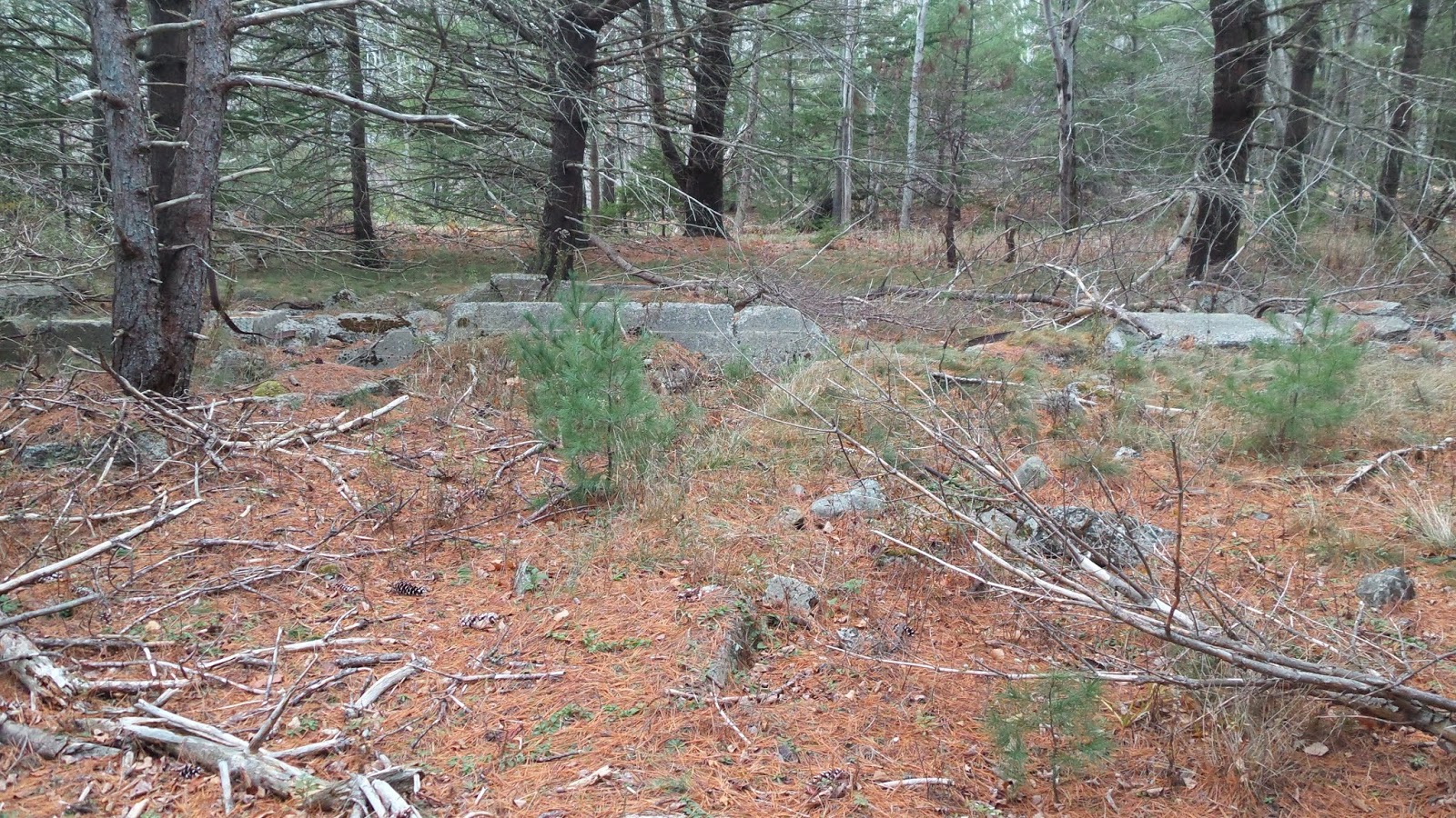
the fascinating thing about Bar Island is there is so much to find and discover, if you wander about off the main trail.  Just when you locate the remains of Mr. Perkins house, just beyond, hidden bty trees and brush, is an old road which continues around the side of the island, passing old fireplaces and foundations as it does so.    To the back side of the island is a beach, but reaching it is not easy, and high cliffs overlook it.  There are also a few hidden worn trails to find, such as the Glacial Rock Trail, as well as a couple others, but you have to really search to locate them.  After Mr. Perkins moved away the island has become an increasing place for people to crash for a few nights or even weeks and in recent years some people here on work visas have made the island their home in summer and early fall, living out of tents, so as you explore off trail, don't be surprised if you stumble upon an illegal camp site or two.


THE BICYCLE INN
Cottage Street, Bar Harbor


NICKERSON, SPRATT, AND GREELY
West Street, Bar Harbor


HOTEL PORCUPINE
Bar Harbor, Maine


FIFIELD AND JOY
Bar Harbor


ABEL HUNT - UNDERTAKER
Bar Harbor, Maine


Friday, May 17, 2019

THE SOUTHWEST HARBOR CAUSEWAY DAM

When we lived on the quiet side of the island one of the places we liked to go to with the kids was the Causeway Dam.  We always parked at a nearby friends house, whose first showed us the path to the dam.  At the end of S. Causeway Dam is a house with a small driveway.  In the corner of the driveway is a well worn path through the trees and to the shore, where there are steps leading up to the top of the dam.  The dam is pretty wide, but there are railings on either side of the walkway, which crosses over to the Golf Course. 
I did ask our firends if the land owners minded people going through their yard, we were told no one ever complained about it.  Also, one guy told me he thought the path was written up in the deed as a public right of way, but he said he wasn't 100% certain about that.

SOUTHWEST HARBOR DAM
Southwest Harbor, Maine

SEAWALL'S SMALL HIDDEN BEACH

SAND DUNE BEACH

Located along the rugged coastline in Seawall Maine is a small extraordinary sand beach, the sand is fine,  with beautiful sand dunes serving as a backdrop, and off at a safe distance rolling waves crash against rugged granite.  Locals are drawn to this unique beach on hot summer days, some go there to relax or picnic, some to meditate, and others arrive just to take in God's creation, yet this small beach is rarely crowded  and numerous times I have found myself  in complete solitude with the entire beach mine and mine alone.  Just around the bend to the left lies Seawall Picnic Area where locals and tourists alike compete for choice picnic tables, further down the shoreline to the right, just out of view, is an accessible cove with granite mining sites not far from the shore.

DIRECTIONS;

Drive or take the bus to either Seawall Picnic Area or Seawall Campground across the road from the picnic area.  If your exiting the campground, go right, if your exiting the picnic area go left a short ways, there you will see a large field with a small shed in one corner and a worn path running through the field toward the water beyond.  Follow the path to where a sloping rock wall is built up, walk along it until you arrive at the sand beach and sand dunes.Arrive in the evening an enjoy the rising moon shining down on the waves.


SEAWALL CAMPGROUND
Acadia National Park

SEAWALL'S SMALL SAND BEACH
Acadia National Park


BICYCLE INN
Cottage Street, Bar Harbor, Maine


PORCUPINE HOTEL
Bar Harbor


W.H. DAVIS BUCKBOARDS
School Street, Bar Harbor, Maine


Wednesday, May 15, 2019

TILTING ROCK IN ACADIA NATIONAL PARK

Follow route 3 towards Otter Creek, you will drive past the small village of Otter Creek, once you have passed through the village, keep your eye out for a road on the left that is named Cooksey Drive, I did a post on a cave once that involved that road.  Not far beyond Cooksey Drive you will come to a small pull over with a couple large boulders and a trail, that is where you want to be.  This small pull over is before you reach the Day Mountain parking area though the pull over barely looks like a pull over, rocks block the start of the path, an old abandoned road.  If you are using GPS  the pull over is at about 44.301725 - 68.224228.
GPS for Tilting Rock - N 44.30302  -  W 068.22625

You are not going to go up this trail very far, perhaps 150 to 250 feet there abouts, keep your eyes on the look out for a faint path that goes off to the right.  This is not an easy path to follow, but trail phantoms help out now and than by marking the way somewhat, so watch for rock piles as you progress forward.  The good news is that the once popular Tilting Rock is not too far in under the cleft of Day Mountain.
Some interesting information on Tilting Rock, at one time a group of vandals in the early in the fall of 1922 went to the site and knocked off the top of Tilting Rock, citizens were so upset a $100 reward was quickly posted for information leading to their arrest.  It states the top of Tilting Rock was replaced back to where it belonged and "fixed" in a way no one would be able to remove the top off it again, which suggests the top was somehow bolted down into place.

One important note, be expected to be impressed as the stacked rocks known as Tilting Rock is much larger than they appear in photos and really, photos do this structure no justice, it will for many years to come rank as one of your top finds.

TILTING ROCK -DAY MOUNTAIN
Acadia National Park

Top of Tilting rock Forcibly Removed

Sept. 13, 1922
Old Newspaper Clipping

$100 REWARD FOR FINDING CULPRITS

Top of Tilting rock Forcibly Removed by Knaves or Fools - Is Object of Great Scientific Interest.

The following letter from the Chairman of the Bar Harbor Path Committee, offers a reward of $100 for the detection and punishment of the persons guilty of forcibly removing the top from Tilting rock, one of the most interesting of Mt. Desert Island's features.

TILTING ROCK - DAY MOUNTAIN
ACADIA NATIONAL PARK

To the editor of the Bar Harbor Times;
May attention be directed to the most unfortunate and wanton injury of an interesting feature of Mount Desert Island in the recent forcible removal of the top of Tilting Rock.  This showed the action of the sea-waves during that remote period of time connected with the gradual and partial submersion of the island and for many years has been an object of study and scientific observation on the part of those who find so much in this vicinity to indicate the wonderful changes of nature not only during that mysterious period of the ice age, but when the island was almost entirely under water and the ocean in this far distant period of the past dashed against the mountain sides at an elevation of some 1300 feet above its present level.  Tilting or Chimney Rock is located at the entrance to the trail leading to the summit of Day Mountain and its description and photograph were inserted in the interesting article on the geology of Mount Desert Island written by Professor Bascom of Bryn Mawr College and lately reprinted and distributed by the joint path Committee.  Sp it is not possible to prevent the thoughtless and deplorable injury to these various objects of interest and study on our Island and also maintain the signs and pointers to guide those using the trails and paths that at least in the Bar Harbor District are so continually removed and destroyed.  Not long since Pulpit Rock was displaced from its position in Green Mountain Gorge where it had been left by the mighty glacier that passed over the island many thousands of years ago and it doubtless took much time and labor to move this relic of the past from the spot it had for so long occupied.  The top of Tilting Rock that now lies prostrate at its base could not have been forced from its position without careful preparation and several must have been engaged in this nefarious and utterly contemptible act.  Steps have already been taken to restore this impressive and interesting feature connected with our beautiful Island's past in that far off age of mystery and wonder and although the displaced portion may weigh some ten tons it is believed it can be replaced and so secured that any further attempt to remove it will be defeated.
It is certainly a source of profound regret that some action must be recommended for the future to prevent, if possible, some willful and utter disregard of what so concerns the interests and pleasure of the general public and the Bar Harbor Path Committee offers a reward of $100.00 for the detection and punishment of those who were engaged in the work of destruction at Tilting Rock and guilty of the damage and desecration to it.
Frederic Delano Weekes
September 12, 1922
Chairman


DAY MOUNTAIN PARKING AREA
JUST UP THE ROAD FROM SMALL PULL OVER WITH TWO BOULDERS AND PATH
Acadia National Park

Start of the old abandoned road, is at about GPS 44.301725 - 68.224228.
Tilting Rock GPS - N 44.30302  -  W 068.22625

ABEL HUNT - UNDERTAKER
Bar Harbor


CHARLES RILEY CATERER
Cottage Street, Bar Harbor


GREEN MOUNTAIN DRIVE
Bar Harbor


HOTEL SHERMAN
Mount Desert Street, Bar Harbor Maine


AN INTRODUCTION TO OUR SITE

We cover abandoned trails and forgotten sites located in and around Acadia National Park, and as such the content of our site is unique in that much of the information is covered in detail and in many cases can only be found here.  Many but not all of the sites I have personally visited and recorded my findings and while many of the locations talked about are accessible, some locations do have a degree of danger, such as nearby cliffs.  
Abandoned Trails was started with a simply quest, to find the location of the route the Green Mountain Railway once took from Eagle Lake to the summit of Green Mountain, today named Cadillac Mountain.  Research to that led to a short piece on The Great Cave, located along one side of the Precipice and abandoned today, and research on the Great Cave led to a map with some writing on it, along with an X, Spot where the young girl fell to her death."  While researching the death of the 12 year old school girl which occurred just above the Great Cave, which led to another short piece on something called the Hanging Steps, and with each new piece of research came clues to other sites to be investigated and documented, and that is how the site took off.
Some sites I document I have not been to, such as The Great Cave and the Great Cave Loop, now abandoned, I did post updates to my research on the site and possible locations, but it was  David Schortmann, along with a group he was with, who gets the credit for locating a cave that was once one the Parks gems but after abandoned, its location became lost to time.  Days later Matthew Marchon would visit the cave and give us the first video of the cave, Nick Thorndike would supply us with the location of an almost hidden staircase by the cave leading to the second half of the Great Cave Loop, and Zhanna Galas would visit the site and give us GPS numbers of the trail and cave location, as you can see, this is how things often work out at Abandoned Trails, its rarely ever one person, its a team effort with different ones adding new pieces of information over time, something that I encourage on any site we cover.

Over the years I have been contacted a number of times asking if I would be willing to sit down for a interview - I don't do interviews and almost anything you would want to know can be found on my websites, however, if you still have questions, email them to me and I will do my best to answer them.
I have also been asked a number of times over the years if I would accompany some one out on the trails,  and I don't do this either.  If you have followed my blog you are aware I suffer from foot issues which have greatly limited how much walking I can do, which is why for the past several years the amount of content I have been able to post has declined.  
Over the years I have been contacted and asked to write an article for a publication, I do not write articles because even though I have written two books, I really don't consider myself to be a writer.  Everything I post is there for anyone to draw information from and use in any article or publication you want to use it in.
I have been contacted from time to time and asked for personal information - we do not give out personal information on anyone.  If you need to contact some one and if I have the information, I will forward that person and let  them know you want to reach them and leave it up to them if they wish to respond back.
If you have photos you wish to share on the site feel free to submit them, we may or may not use them, make sure to state if you want your name posted with the photo or if you wish to remain "unknown".
I do not do speaking events.
I know a number of you are wondering why I haven't gotten around to investigating information you have sent me on one site or another,  I will try to get to as many as I can but again, I am limited in how much walking I can do these days because of foot issues but I will try to get to as many requests as I can as I am able to.

You can email me with questions,  at fendermail56@yahoo.com

If you need further information you can contact Mathew Marchon, a fellow adventurer and explorer of hidden places, he has been very helpful to me over the years and is very knowledgeable on the caves and abandoned trails in Acadia National Park, and has written two books on the subject, The Acadia You Haven't Seen Vol. 1 and 2, and recently he just put out a book titled "A Beginners Guide to Bushwhacking," and any time I have had any questions for him he has taken the time to respond - his website is at the link below.


BREWER ICE HOUSE AT EAGLE LAKE

Located along the quiet shore of Eagle lake, with yards of the Eagle lake Carriage road lie the remains of the old Brewer Ice House.  There are large sections of the foundation as well as areas of collapsed walls, and in one area a large square flat slab that once served as a step into the building.  This site is incredibly easy to locate, just a couple minutes walk from the Eagle lake boat landing.  A search of the nearby woods reveals large old cans as well as rusting parts of an old delivery truck.
To find the foundation, from the Eagle lake Boat landing, go left and follow the Eagle lake Carriage Road a short ways, stopping when you come to a stone bench on the left over looking the lake.  The large foundation is in the woods behind the stone bench.
I had read that at one time the first ice house the Brewers had was by Witch Hole Pond, where they cut blocks of ice from the pond before relocating the business to the shores of Eagle lake.

STONE BENCH - EAGLE LAKE
Brewer Ice House Foundation In Woods Behind Bench
Acadia National Park


Sunday, May 12, 2019

ABANDONED PICKET MOUNTAIN PATH

The lost Picket Mountain Path is a very old path, dating back before the creation of what is today a number of very popular hiking paths.  As is evident on the old map, the Kane Path, and  Canon Brook Trail had not been constructed, and interestingly there was no trail along the back side of the Tarn.
I had read somewhere in the past that the person who owned the land on Picket Mountain and had their own path up the mountain, but over the years that path fell in rough shape.  This map shows other nearby abandoned trails as well, the Meadow Path which ran from the Sieur de Monts Spring area over towards the Beaver Pond and connected to the also abandoned Black and White Trail, and the White Path, which I had read was pretty much destroyed  when years later the Park Loop Road was build over it.
This lost Picket Mountain (now named Huguenot Head) path is not an easy path to locate, this is due to the fact that much of the path crosses over granite and up through a boulder field, but after spending a couple hours at it we did locate the path,, which is marked today by rock piles along much of the route.  Interestingly, I came across this piece in an old paper, stating that this trail was in fact a memorial path;

NEW PICKET MOUNTAIN PATH

Bar Harbor Record
Sept. 16, 1914

I have also to announce that Mrs. C. Morton Smith has just made an equally generous offer to present a memorial path in memory of her late husband, and that she has decided, on the recommendation of the committee, to have it on the western side of Picket Mountain, where it will lead from the gorge Road opposite to the entrance of the Kane Path to the summit of the mountain slope from which some very fine views of the ocean to the north and south are obtained.


A clue as to the route the path took is in the map itself, it followed the path the brook took.
You can see on the map that the Dorr Ladder Trail comes out to the Otter Creek Road (route 3), the Lost Picket Mountain Path begins just up the road, and has a clear landmark as to the start of the path.  As your leaving Bar Harbor and pass by the Tarn, look for a small paved pull over on the left hand side of the road, the brook and start of the path are close to that pull over, just inside the woods.
We could not find the actual start of the path, so we hiked up through the woods along the brook and once we got up aways, we began to criss-cross the area until we located the first rock pile, from there one rock pile pretty much led to the next until we exited the woods and came out at a boulder field which appeared to run right straight up to the now Beachcroft Path, though back in the day this path would of gone right up to the summit of Picket Mountain, since the Beachcroft Path had not yet been built.  Dusk was coming on so we never got to follow it all the way, but we did take some photos along the way.

OLD MAP OF HUGUENOT HEAD (Picket Mountain)
Champlain Mountain - Acadia National Park


OLD HUGUENOT HEAD PATH
Champlain Mountain - Acadia National Park


OLD HUGUENOT HEAD PATH
Champlain Mountain - Acadia National Park


ABANDONED HUGUENOT HEAD PATH
Champlain Mountain, Acadia National park


ABANDONED HUGUENOT HEAD PATH
Champlain Mountain - Acadia National Park


Thursday, May 9, 2019

BAR HARBOR SHORE PATH

I was looking over older photos of Balance Rock along the Bar Harbor Shore Path, interesting to see how over the years the rock has faired.  The early photos where the rock narrows to a point were taken around 1900.


Though the Shore Path is not an abandoned path or trail, over the years the length of the Shore Path has shrunk as newer land owners closed off sections of the path from the public.  I had heard at one time the Shore Path ran almost all the way to Compass Harbor, back in the day.  I had also read where a turret or tower was located along the Shore Path, a photo of it is below, though I don't know if it is still there today or was torn down at some point.  It may of been along the section of path no longer open to the public.


The Bar Harbor Shore Path begins at one corner of the Town pier, next to Agamont Park, with two old large cannons overlooking the start of the path.  At over a century old the path winds along the shoreline offering fine views of the Porcupine Islands, including Bald Porcupine Island where a deep cave is located and where a mysterious bright glowing fern grows, according to several articles this strange moss only grows in this cave.  A break water can be seen at low tide extending from Bald Porcupine Island almost to the shoreline.  The start of the path also passes one of the oldest inns along the water front, the Bar Harbor Inn before passing Grant Park, a perfect spot for afternoon picnics.  You can also view Egg Rock Lighthouse and the  Schoodic Peninsula off in the distance. and the famous Balance Rock is a perfect spot for photos.  Sadly the path today ends after crossing a short footbridge and turning toward Wayman Lane, but back in the day there was a time the path continued onward, passing a turret along the side of the path, with the path ending by Cromwell Harbor.  The path dates back to about 1880 and has some steep drop offs along some sections of the path, so caution should be used if your hiking the three froths of a mile path with young children.


\
SHORE PATH EXTENDING TO COMPASS HARBOR
BAR HARBOR SHORE PATH

DREAMWOOD BALLROOM
Ireson's Hill, Bar Harbor
JELLISON'S BARBER SHOP

Cottage Street, Bar Harbor

DOYLE'S MARKET
School Street, Bar Harbor

THE BELMONT HOTEL
Mt. Desert Street, Bar Harbor
W.H. SHERMAN
11 Cottage Street, Bar Harbor

BREWER BROTHERS GROCERY STORE
West Street, Bar Harbor