Sunday, September 15, 2019

KEBO MOUNTAIN'S LOST STAIRWAY LOCATED


Kebo Mountain for many years has kept an incredible secret, and I am not making reference to the origin of the mountains name, I am referring to the myth of the mountains  lost stairway...or is it a myth?    Like a dog chasing its own tail, I have run in circles over the years determined  to locate this hidden gem which articles referred to but maps kept hidden.  I was not along, a number of experienced  trail detectives have gone forth in search of it and fallen short.  I approached my search the same way I had done to find other abandoned trails, searching the base of the mountain  with the objective being to find some stone steps and from what I have read I was not the first to take this approach.  As it turned out, I was not the one who located this thrilling discovery,   that honor would go to  Jennifer Maher Galas, her approach being to seek out signs of the lost stairway from the top of the mountain. and it paid off big time.
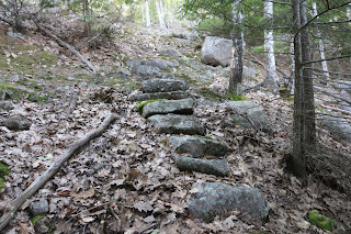
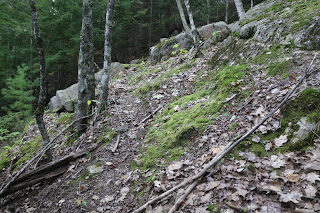
The trail itself  is not far from the summit, where it starts out as a dirt trail, loosely concealed by a pile of dead tree branches, a guaranteed sign something the Park Service did not want you to find was in that area.  The trail moves downward and to the left where the impressive granite stone steps begin.  The steps themselves have not fared so well over the years,  but a good section of the stairway is intact as they lead you down an increasingly steeper side of the mountain before they end.  The mountain side here is pretty steep and some of the steps may of simply slid off down the mountainside, but at this point you simply make your way straight down to flat ground,  where the Stratheden path becomes accessible.  Follow it right to reach the Sieur de Monts Spring area, go left to come out on the  One Way section of the Park Loop Road across from the Gorge Trail.


As seen here, pile of odd tree branches often block start of abandoned trails
Main Kebo Trail to left, abandoned trail to right


And there it was, sticking out like a sore thumb at a turn in the Kebo Mountain  official Trail,  one nicely stacked pile of tree branches  serving to block the start of the lost Kebo Mountain Stairway trail.
As soon as I spotted that pile of tree branches I knew it was the start of the abandoned trail and stepped over them, following what   to this day is a pretty good clearing where the path ran.  As I progressed I spotted those unique rock signs, one tiny rock on a much larger one, and within minutes we were at the stone steps.


rock on rock often used to mark abandoned trails

Stone Steps Kebo Mountain Lost Stairway Trail

Stone Steps Kebo Mountain Lost Stairway Trail


Stone Steps of Kebo Mountain Lost Stairway Trail
Acadia National Park - Kebo Mountain
Section of worn path below stone steps
Kebo Mountain lost Stone Steps Trail - Acadia National Park

Deer keeping an eye on us
Acadia National Park


KEBO MOUNTAIN - Acadia National Park


DIRECTIONS;
From the Park Loop Road where the official  Kebo Mountain Trail begins by the middle of a long curve in the road, follow the trail to the right, the Kebo Trail is steep so bring water and take rests as needed.  You will come to the summit of  Kebo Mountain, marked by a pile of rocks and a wooden sign.  Continue to follow the trail which at one point will begin to go downhill before it straightens out.  This is a saddle between two peaks, follow it and at one point the main trail takes a right hand turn, and that turn, to the left and along the side of the trail is a neat pile of tree branches that look out of place, as if they were placed there to block something, that is the start of the lost Kebo Mountain Stairway Trail.  If you go past that spot, the trail begins to climb again, so the abandoned trail is just before the main trail begins to go uphill again.

I will add a map for this soon.

Trail Begins behind pile of tree branches;
44 22.306  -  068 13.089

small rock on large
44 22.300  -  068 13.055

stone steps begin
44 22.307  -  068 13.050

stone steps beyond tree
44 22.308  - 068 13.038

trail near base of mountain
44 22.313   -   068 13.027

rock on rock
44 22.323   -   068 13.019

rock on rock
44 22.329   -   068 13.003

rock on rock
44 22.331   -   068 12.993

trail joins  Stratheden Path
44 22.337   -   068 12.989

Sunday, July 28, 2019

LAKE WOOD - ACADIA NATIONAL PARK'S SECRET BEACH

If  I was to tell you hidden in the woods off of the Crooked Road there was an absolutely stunning lake, that it fell within the boundaries of Acadia National Park,  and the National Park Service did all it could to keep it an undiscovered area in the park, you might think I was crazy,  but  it does exist and for some unexplained reason,  they do not promote this incredibly beautiful body of water..  So how does the National Park Service keep this accessible body of water a secret, several ways;  they don't promote it, the only sign marking the site is a common street sign and the road leading up into deep woods is a narrow dirt road which at first leaves one with the feeling they are driving across private property.    In fact, the only sign you are about to enter National Park property is the long metal gate off to one side of the road, the same type of gate you see throughout the park.
I am not one to go around carrying a thermometer  or taking the temperature of a lake, but I have read blogs that claim the Waters of Lake Wood are some of the warmest waters on all of Mount Desert Island, and judging by all the locals that frequent the lake, they may be right.  Over the years the Lake earned a reputation of being the place to seek out for skinny dipping and many claim that practice continues today on the furthest end of the lake.  The beach area is quickly filled with young children on hot summer days, while teens to adults head down along either side of the lake to their favorite swimming area, with the ultimate destination along the shore is a nice open ledge above the water used for diving from.  this diving area is reached by a path near the first parking area, when the path reaches the shore the diving area is to the right.
If you have an old map or know where the trail is you can also access Fawn Pond from Lake wood by way of the abandoned Fawn Pond trail.  That blue street sign is very misleading, it reads  "Lake Wood Pond Rd. PVT. "  which is a bit of a mystery sine the road is not private and is very much  accessible to the public.  Like I stated earlier, the National Park service would  prefer you not discover this location.


LAKE WOOD
Acadia National Park

 The first or upper parking lot has an unmarked path across from it, with a simple sign, no alcoholic drinks, the path does have a couple places with rocks and roots sticking up in the path, but overall is fairly an easy walk.   The path is easy to follow and gets you much further up the side of the lake, where the path reaches the waters edge, to the right not far away is a ledge people like to dive off of and some nice areas to sit along the shore.   On this day, despite the sign of no alcohol, a group of eight were walking along the path with one guy carrying a 30 pack of beer - oh well, maybe he was from another country and didn't read English.  In all I would estimate there was between 30 to 35 people of all ages at Lake Wood Pond today, about 12 of them at the sand beach at the head of the pond, the little ones were having a blast in the warm water.
The sand beach can be reached from the lower parking lot further in, where their is  a path with a gate across it leading to the small beach.  The sand beach may be small considering the size of the pond, but the more than inviting warm waters of the pond more than make up for it, and for the kids,  inflatable pool toys are welcome.  Once you step around that gate, several yards past the gate look for a path leading through the woods on the right, the path becomes more worn the further you follow it and ends where the Park Property ends and the property of Iris Farms begins. That unmarked path was once the other half of the Lake Wood Pond Road, abandoned today, the open and well worn path makes for an enjoyable walk through the woods with a brook to the left of the path.  When the park property ends the path comes to a no trespassing sign, and just beyond the path comes to a field behind Iris farm.
If this pond, as large and beautiful as it is were located any other place other than Acadia national Park, any city or town would consider it a gem and put it on display for all to see, but clearly the National Park Service seems content to hide it away in hopes not too many people discover it.  I do have to add this one note, I find the street sign to the place a bit confusing - Lake Wood Pond Rd.  PVT. - what to hell is up with the private label, Lake Wood is open to the public and should not be listed as a private road - just saying, wake up National Park Service.  And yes, the pond is a favorite swimming hole with the locals.
We ended up not going into the water, but really today there was no need for that, simply finding a spot under the trees along the shore of the lake was enough, it was so much cooler at  Lake Wood with Young's Mountain rising in the background.

LAKE WOOD BEACH - CROOKED ROAD
ACADIA NATIONAL PARK


How to locate the nearly unmarked entrance to Lake Wood;

From Hull's Cove, turn onto the Crooked Road and follow it about .7 miles, once you come to the Public Works area with dirt piles, begin watching the left hand side of the road for a distinct blue street sign, Lake Wood Pond Rd. PVT.  The narrow dirt road is not very long and you will soon come to the first parking area.  Continue to follow the dirt road to the second parking area if your heading to the beach, which is not one of the larger sand beaches on the island.  Also note the sign as your entering, this is a day area only and you must leave at dusk..

ENTRANCE TO LAKE WOOD
Acadia National Park
Lake Wood Pond Rd. PVT. 

LAKE WOOD BEACH
Acadia National Park
Hull's Cove, Crooked Road


LAKE WOOD
Acadia National Park
Hull's Cove - Crooked Road


Tuesday, July 23, 2019

THE OLD POTTERS SHOP

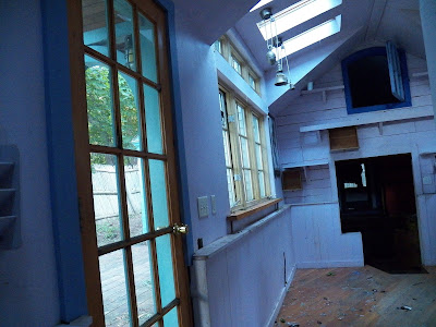
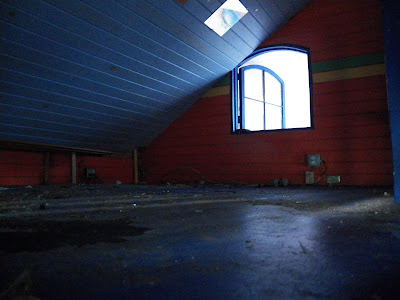
NOT an abandoned trail - just saying.  When the power company purchased the land on Prospect Street off route 3 in Bar Harbor, I was pretty certain this old building was going to be torn down.  At some point No Trespassing Signs were posted on the property and an article came out in the local paper stating the property was once known as the Potter's Shop, and that an effort was going to be made to preserve and fix the building up to how it once appeared, however with each passing year the building has continued to fall into despair.


Saturday, July 20, 2019

GREAT HILL WATER RESERVOIR


This large abandoned reservoir located on the side of Great Hill is one of three that the early Bar Harbor Water Company built to get water from Eagle Lake to in town Bar Harbor. Other then the Stone Tower, this is perhaps one of the easiest abandoned locations within Acadia National Park to locate. It is as easy as 1,2,3,4.

1. Drive up West Street from by the town pier.

2. Cross route 3 and drive straight ahead up West Street Extention.

3. Park by Duck Brook Road just inside park and walk along road to stone bridge.

4. Pass under bridge and look for worn path leading up banking on left, on that small hill is the abandoned Great Hill Water reservoir.

The walk from where you park to the stone bridge is very short, the hike up the hillside no more than 4 or 5 car lengths and you will be standing on the rim of the water reservoir.


The Great Hill Water Reservoir is an abandoned site and there are no signs pointing the way but locating it is very easy. In the nearby woods is the remains of one or two stone buildings which served as part of the reservoir system.
STONE BRIDGE ALONG DUCK BROOK BRIDGE ROAD


There was two more reservoir's that were built, the largest and last one was on Cunningham Hill, also known as North Ridge. Another reservoir was built on Scott's Hill, today better known as Schoolhouse Hill, which is also the site of the remains of The Castle.

Old Reservoir
N 44 23' 28"
W 68 13' 48"


Here is a view of the Duck Brook Bridge road taken from the foundation, you can also see another path that leads to the foundation, though that path is a little more steep.
DUCK BROOK BRIDGE ROAD SEEN FROM OLD FOUNDATION

Below is a flume which helped carry water to the reservoir on Great Hill.

BAR HARBOR WATER COMPANY FLUME


ABANDONED GREAT HILL WATER RESERVOIR
Acadia National Park

Go-Pro Video of the Great Hill RESERVOIR 


GREAT HILL ABANDONED WATER RESERVOIR
Acadia National Park

Friday, July 19, 2019

SCOTT'S HILL & THE BAR HARBOR WATER COMPANY

Years ago while researching the Bar Harbor Water Company, I became interested in the three reservoir's the company constructed.  I had located one by accident nearly thirty years ago while aimlessly toaming through the woods along one side of Great Hill, , but it would be much later that I discovered exactly what it was I had found that day.  At first I was convinced I had found the huge foundation to a mansion or perhaps a Hotel, yet it did not look like any foundation I had ever seen before.

GREAT HILL RESERVOIR
Acadia National Park

GPS TO GREAT HILL WATER RESERVOIR

Stone Arched Bridge on Duck Brook Road
44 23' 27" N
68 13' 45" W

AT RESERVOIR ON HILLSIDE OVERLOOKING ROAD
44 23' 28" N
68 13' 48" W

Once I did become aware that it was one of three reservoir's built by the Bar Harbor Water company, I than began to do some research and came upon a document titled, "The History of the Bar Harbor Water Company."  Up to that point I had been studying old maps of the island for some years, and was fascinated when I read that no one knew where the location of Scott's Hill was, the site of a second reservoir - which surprised me, because i was pretty certain I knew exactly where Scott's Hill was located. You see, one of the old maps I liked to study had the names of land owners on it, and I knew from that map that a Mrs. Scott owned land on top of what many call School House Hill today, in fact she owned a large piece of land there.

SCOTT'S HILL MAP (Schoolhouse Hill)
Bar Harbor Maine

And if you look at a map, the reservoir on the side of Great Hill lines up perfectly with School House Hill, or Scott's Hill.  I contacted the local water company by email with my findings and never heard back from anyone...oh well, I simply went back to continuing my research into these reservoir's, and have since made even more discoveries.

SCOTT'S HILL (Schoolhouse Hill)
Bar Harbor, Maine

In a Bar Harbor Record article on the Bar Harbor Water Company, dated Feb. 9, 1893, it states that Mrs. Scott owns a Cottage on top of Scott's Hill, and goes on to state the elevation of her cottage.  It goes on to list other land owners on Scott's Hill and gives their cottage elevations.  I went back to that old map with the property owner names listed on it, and sure enough, the property owners in that old newspaper article line up with the property owner names on that old map, so there is no question now of where Scott's Hill was located.


I went back and reread that report of the History of the Bar Harbor Water Company, because I was pretty certain I noticed another mistake in that report.  It states that though it is not know what the reservoir on Scott's Hill was constructed of, it is believed it was constructed of stone.  This is not correct, at least according to old newspaper articles from the late 1800's which state that the reservoir on Scott's Hill was constructed of wood.  I know from that report that people from the Water Company did a search for that lost reservoir and could not locate it, however if it was constructed of wood, one would not find evidence of it all these years later, even if you were searching on the right hill.

POST CARD SHOWING VIEW FROM SCOTT'S HILL
Bar Harbor, Maine

A third and final reservoir was constructed on a place named Cunningham Hill, I did research on that and learned that Cunningham Hill was also known as North Ridge??  I have not had any luck tracking this third and largest reservoir down, but the Water Company report states the third reservoir had to be build because the one on Scott's Hill did not furnish enough water pressure.  Not long after the third reservoir was constructed the entire reservoir system was abandoned in favor of pipes.


PHOTO SHOWING VIEW FROM SCOTT'S HILL
Bar Harbor, Maine.

GREAT HILL WATER RESERVOIR
Acadia National Park

VIEW OF DUCK BROOK ROAD AND BRIDGE FROM RESERVOIR
Acadia National Park

I gave the GPS for the Great Hill Water Reservoir, and I will put up a simple map soon, but for now I will say even if its your first time to Acadia National Park, you can easily locate this abandoned Reservoir.
From bottom of Main Street in Bar Harbor by the town pier, follow West Street until you come to intersection with Eden Street - route 3.  Continue straight ahead and up over the hill until you come to signs of entering the park.  Just ahead, on the right, is the Duck Brook Road - the road is blocked to automobiles, but you will not need a car or bike.  Park there and walk a short ways to the Stone Bridge, just after passing under that bridge, up on the hillside is the abandoned Water Reservoir, worn paths there lead right up to it, the path closest to the side of the bridge simply takes you to the Park Loop Road above.

BAR HARBOR WATER COMPANY FLUME


GREAT HILL RESERVOIR MAP
Acadia National Park


Thursday, July 18, 2019

THE GURNEE TRAIL

Some of the very first paths on Mount Desert Island where what was known as Village Connector Path and were usually built because of the danger back than of walking along often narrow dirt roads, which was the case with Eden Street back in the day.  It was a very narrow dirt road with a narrow bridge crossing over Duck Brook.  A rough side walk ran up along Eden street all the way to Duck Brook, as is the case today, but from Duck Brook onward to Hulls Cove, you were pretty much on your own.

THE GURNEE TRAIL - Acadia National Park

People in both Hulls Cove and in Bar Harbor began to voice that they would like to see a Village Connector Path built, from Duck Brook Bridge to a brook in Hulls Cove..  Before any money could go into such a venture, the town of Bar Harbor wanted to know a few things, was such a connector trail needed, and once built would people use it.  The answer to both questions proved to be a sound yes, and money was set aside for such a connector path.
The Village Connector Path was built, so what became of the path that became known as the Gurnee path?

THE GURNEE TRAIL
ACADIA NATIONAL PARK

The simply answer is that it was abandoned, but unlike many of the trails the National Park Service would abandoned without any rhyme or reason, the Gurnee trail actually had a very sound reason for abandoning it, large sections of the trail were beinjg eaten away over time.
That's right, eaten away - each time improvements were made to Eden Street and route 3, those improvements cut into sections of the Gurnee Path.  When it came time to widen route 3 and build a new and wider bridge, it left sections of the old trail cut up in places, and dangerously close to the edge of the ledges along the Bluffs.  Following a park report that studied the connector path, the report came to the conclusion that the trail could be reopened, but at significant cost, with a bulk of the cost being at the area known as the Bluff.  Recommendation, the path would not be reopened.

THE GURNEE PATH
ACADIA NATIONAL PARK

I have to admit, I was curious as to just how close to the edge of the Bluff the path came, remember, a few different times over the years the road below was widened, and each time it brought the Gurnee Path closer and closer to the edge of the Bluff.

GURNEE PATH APPROACHING THE BLUFFS
ACADIA NATIONAL PARK

I made my way to the start of the path where it began to cross the Bluff, and sure enough, the path runs right up along the side of the Bluff for a short ways, enough so as to make it very dangerous due to how close to the edge it came and due to loose rocks and gravel.  And as the Park report stated, it would cost a bunch of George Washington's to fix the problem, since to your immediate right is the edge of the Bluff, and to your left is a tall wall of solid granite, the passage way through is set in stone, as they say.  In my opinion they would have to blast in some areas, and use jack hammers in others, so I do not see this path ever being reopened.

GURNEE PATH
ACADIA NATIONAL PARK

And now, we have just gone through one more widening of route 3, my guess is the path along the section of the Bluff is totally gone now, and how much damage might of been done to other areas of the Gurnee Path is unknown, but I do plan on going in and seeing how much of the path remains in tact.
The amazing thing is that if you were simply wandering through the woods and came upon sections of the Gurnee Path, you would swear you had come to an official hiking trail, so good is the shape of some sections of the old trail.  Locating a long section of the trail still in very good shape is as simple as 1, 2, 3
1;  walk along Eden Street (route 3) past the College of the Atlantic, past the Ferry Terminal, and continue until just before a curve in the road,
2;  just before the curve look for signs of an old dirt driveway on the left and follow that driveway to a set of steps (see photo)
3;  walk up the steps and continue straight ahead up the hillside about four car lengths and you will be at the trail.

STONE STEPS ALONG DRIVEWAY
GURNEE PATH - ACADIA NATIONAL PARK


Once at the good section of the Gurnee Trail, going right will find pine trees growing up in the center of the path in places and some areas of brush before you reach what appears to be the end by a drop off area and a wall of solid granite.  Just before that, to the left, is a gully I followed upward and made my way past that dead end, than made my way back down to the other side of the trail, which quickly takes you to sheer drop offs as the trail continues toward the Bluffs, this is one of the danger areas of the old trail, beyond this the trail moves upward and away from those drop offs and the trail forward is very well defined and worn.


At the trail, if you go left, the trail is pretty open and easy to follow,  It reaches an area where telephone poles cross the trail, and it appears the trail ends there, which it kind of does today.  From the telephone pole area, the path turns left and heads toward route 3 - Eden Street, but quickly ends at a sheer drop off where the widening of route 3 destroyed  a section of the trail.

Above is a photo of the path near a drop off with a pine tree growing up in the center of the path, to one side of path is the drop off, to the other side is a wall of granite and rock.

VIDEO OF THE GURNEE PATH

Start of old driveway along rt. 3 Eden Street
latitude       44 24' 14" N
longitude    68 14' 3" W

stone steps
latitude       44 24' 15" N
longitude    68 14' 4" W

Worn Gurnee Trail
latitude       44 24' 15" N
longitude    68 14' 5" W