Spent a few hours down along Duck Brook following two days of rain, the brook had roared to live with rapids and white water everywhere I turned. Just before the falls, at the old Duck Brook swimming hole, the light was just right so I could see the bottom of the pool and could see stepping stones where the abandoned Duck Brook Trail crossed the pond at one time right there, today the steps vanish into deep water. The roar of the brook was so loud in places my gopro had trouble hearing my commands...
when you see these up in the trees in Acadia National Park know Santa placed them there so he knows who has been naughty or nice...
So more on that trail we discovered on Friday, returned on Saturday, weather was really nice, thought for certain the trail was the old Young's Mountain Trail, it was well worn, almost as worn as an official trail, but after some distance it began deteriorating right before our eyes, and entered a wetland area, so we did like we always do, crisscrossed the woods on dry land looking for signs of the path, when we discovered yellow pieces tied in trees, and a worn path, followed it which followed a dry stream bed. The hike only became worse the further we went, but as long as the yellow tape could be seen I decided to push ahead, video taping the entire hike, little did I know just how much more hostile the going would get. The yellow tape led us up long steep sections along the mountain side, I do not like heights and wanted to quit, my son urged me on, so we continued. We finally exited the woods, coming out on bare open granite and the yellow markers ended so we kept moving straight ahead through brush and trees, and stepped out onto a well worn path...I recolonized the path at once and replied, we aren't on Youngs Mountain...we are on Mcfarland Mountain. I shot video of the summit and told my son, no way I am going to upload that mess we recorded getting here. We started our way down the mountain side, I needed to get some video of the remains of the old ski slope, and heard the sound of something rushing towards us, my son went into a defensive position and I realized it must be a large dog, it was, it raced past me, did a quick circle around my son and raced back up the mountain side, meanwhile my son seemed to be in pain grabbing one arm, I asked if the dog had bit him, he said no, but was getting a bad cramp in his arm from reacting so quickly. About this time a woman's voice called out from higher up the mountain..."Sorry if my dog disturbed your hike...where did you guys come from?" Fair question, I replied we had gone up the mountain side from Breakneck Ponds, "you came from Breakneck lake," she asked, I replied, yes, we hiked up from Breakneck Ponds. She wished us a nice day and we headed off in separate directions, , as I approached the ski slope remains we spotted a white car by the air quality station, I told my son, she must of been a ranger, because you need a key to the locked gate to get into that area. I shot my video and turned to see the white car gone. Out by the main road what appeared to be four college students came out of the area of the ANP headquarters on Eagle Lake road and headed toward us...as it turned out at least one had followed our website. So despite much of the day being a total waste, I like the video I shot of the summit and was glad to have gotten video of the ski slope area, but I never had any intention of going up Mcfarland Mountain...some times it just works out like that.
Was out and about today and located two cameras strapped to trees, one by eagle lake aimed at an unmarked trail and one on the old abandoned Breakneck road. I hope today was not the last good day of the season, got some nice photos and located another abandoned trail, though I did nit stumble upon it until just before dusk, its well worn and can't wait to get back to it and document it.
So I recently had to download a copy of one of my colored maps on the printer...ouch, too much color, too dark, not printer friendly.....so I been slowly redoing my maps, the first two are completed;
This is a video of the first Green Mountain Carriage Road, information for its location provided in old articles which state for some distance it followed the old survey road, then went off in a different direction; those articles also spoke of the wire gate that was used to close the Green Mountain Carriage Road to traffic when no one was nearby to collect the fee for taking the road, that old wire gate is seen in the video.
According to an old newspaper article dated September 22, 1897, it states that when Mr. Walden Bates worked on a trail, he would scout the trail out and blaze the path the trail was to take, an assistant, a Mr. Chambers, would cut out the path that Mr. Bates blazed, the article stated. In September of 1897 Mr. Bates, accompanied by Mr. Chambers, was working on trails on Sargent Mountain and staying at Currin House by Eagle lake. Mr. Bates stated that Monday evening that several connecting trails had been blazed which would render mountain climbing on the island more delightful once the new trails were open.
Unfortunately Mr. Bates assistant's first name is never revealed in the story. I thought I would add this post because I had come across a piece on the National Park Service site that stated no one really knows how Mr. Bates went about his trail work...now we know,
I don't usually do requests but one of our loyal followers wanted to see a video of what a Phantom Trail looked like, which is a trail someone build and was never an official hiking trail, because they were never an official trail they can be a little more difficult to follow and on this day sun flare was a real pain.
Just got my latest video uploaded, THE BRACKEN GHOST TRAIL, it was a pretty nice day so we did two videos in one day, this ghost trail on and by request, a video of a Phantom Trail, which I hope to get uploaded this evening.
In the coming days I will be uploading several new videos, all shot with my Gopro 7 black, one is uploading now, the old Fern Trail, once it is ready I will add a link below to it.
Really big finds today on Cadillac Mountain, did a gopro of the old carriage road, found another section of the green mountain rail trail, along with railings and other parts from the train, and located the final spike just short of where the summit house once stood. I will be doing posts on todays finds this evening with photos. Some of the pieces looked like railings
I just updated my Buckboard Road post with new information, this evening I decided to give it one more try and see if I could locate the exact start of the old Buckboard Road, which was actually the Green Mountain Carriage Road, built after the Green Mountain survey road was built. I got lucky and decided to check out an area where the ground was more lighted and bingo, there it was. I also revisited the old wire gate and learned that I was wrong about the wire having rusted free from its bolt, there was a second section of wire that has rusted free, but the main wire gate is still rock solid in place.
Finally located one of the two stairways that were built from Duck Brook up to the Duck Brook Road and did a post on it. I do have to add that the condition of the stairway is in rough shape and the side of the banking it runs down is steep in places. At the base of the steps, the final three or four steps are larger and much easier to spot, on the other side of the brook is the remains of another old path which at one time might of led to a second stairway, it moves through the woods a short ways from the water, in the direction of Duck Brook Bridge and at one point it appears a couple large boulders fell across the path.
In an area of the woods I like to call Fawn Woods, due to the fawns I have seen there, is an old dirt road, which leads in a half circle to the remains of what was once a small building. It appears these remains were once the location of a tea house, something that was very popular back in the day, In Hulls cove there was the Tea Cupm Inn, and a tea house was once located by Great Head over by Sand Beach, and there was plans to place one on Newport Mountain (Champlain Mountain), but it was never built. Then there was the once popular Russian Tea House, but why place a tea House in the woods by the intersection of West Street Extension and Cleftstone Roads? It actually would be a perfect spot, one of the abandoned trails up Great Hill ran right by there, as did the Royal fern Trail which began at How Park, and a stones throw away was the only major road through that area, a now abandoned entrance into Acadia National Park. The Tea House remains are easy to locate, once you enter the park along West Street Extention, park by the blocked off Duck Brook Road, across the road and slightly to the right the old dirt road begins just in the woods with a hill to the left, follow the base of the hill until you come to the remains of a stone foundation.
some one wanted to know what I take along with me for gear when documented a site, and really I don't take a whole lot. I always carry a cell phone, a GPS device, my gopro 7 black in case I need to shoot video, and my Canon T7i with a Canon 70-300mm lens for wildlife, and a 24mm prime lens for basic photos. I also carry a few sheets of paper and pen for note taking, bug spray and that's about it.
So I was doing research on Abby's Retreat and came across a very old map of Bar Harbor, Abby's Retreat was on it, success...it was not until later that night that I studied the map and thought, wow, it even shows the old Bar Harbor Water Company Flume over Duck Brook, then I realized something didn't look right, it was way too close to the Eagle Lake Road, and on the wrong end. I followed what I at first thought was Duck Brook and realized it was not Duck Brook but Eddie Brook that this section of flume crossed, arriving at Eagle Lake and near the base of Schoolhouse Hill. Details are everything and the person who drew the map knew the area well, one end of West Street had not been built yet, and neither was West St. Ext which would of followed the brook some distance. This section of flume could very well be coming from the area of the Great Hill Water Reservoir.

Wow, what a day it was today, spent much of the day slow walking the four abandoned roads off of the schooner Head Road, then spent some time over by Oak Hill walking those abandoned trails. A good number of cars hovering around the edges of the park, Schooner Head Overlook Parking area was really busy with people venturing down by Anemone Cave. By days end most had left, but one group decided to make the area around the cave their private campsite and had a fire going. Unless they are reading this as I type, they have no idea Rangers are headed their way, that should get some one a date in Federal Court.
Just put up a new video, An Explorers Guide to Acadia National Park which you can see on Youtube at the link below.
AN EXPLORERS GUIDE TO ACADIA NATIONAL PARK
So I been busy with the new Gopro 7 Black, filmed four locations with it including the Gurnee Trail and Anne Archbold site along with today doing the secret Park Ranger Trail, still have not watched any of the videos from the Gopro, just assuming they came out good, should have something up soon. Rehiked the Gurnee Path, the Bracken Trail and the secret Park Ranger Trail and visited a few other locations. I have two or three abandoned trails I have not documented yet that I would like to tackle in coming months. Also just picked up a new pair of $140.00 New Balance walking shoes, most comfortable walking shoe I ever owned and I highly recommend New Balance - your feet will thank you.
How Park was owned by Charles How and was made up of over 100 acres of land, which was decided up into house lots. By today's standards we might consider it something like a subdivision for the wealthy. One section of the park was sold for the construction of the Turrets a piece in an old newspaper states, and other lots were sold where some of Bar Harbors nicer homes were built. Cleftstone road formed one border of How Park, and directly across from it sat the tiny triangle How Memorial Park with its mysterious sculptor of a woman and young children, a local artist did the art work in honor of Mr. How, but I have yet to find the story behind the artwork.
So we explored the nearby woods in the area of the old Bar Harbor Water company today, off of Eagle Lake road, entered the old dirt road and several yards in hung a left up through the trees to an open area above, there is another old dirt road up there, which we ended up following today. We did do some off road exploring and explored the woods on the other side of that second dirt road, and came across yet another area where a dozen trees or more had paint on them, with long rubber bands attached to the trees with metal tags at the end of each band. The first site we discovered like this was off of the Schooner Head Road, and this second site is just like the first one, but with more trees marked. Just like with the first site, a metal marker is in the ground stating this is the property of Acadia National Park and please do not disturb.
The first site off the Schooner Head Road I gave the directions to, as it was along an old abandoned road, this second site is off in the woods so I am not giving the exact location of it.
Wow, what a beautiful day it was today, ventured into the woods and went to the Anne Archbold remains to test out my new gopro and discovered two women there taking photos. I think I am going to like this new camera a lot, though I haven't had a chance to look over the footage we shot yet. The other site just up the rpad from Anne Archbold site has a nice honets nest in the fireplace, so beware.
n the process of upgrading my equipment, just ordered a gopro hero black 7, hoping to cover some trails with it, there was a few things I did not like about the Gopro 8 so went with the 7. Can't wait to get out and put it to use.
Hiked the old survey Road and the old Green Mountain Carriage Road today, it was sad to see the old wire gate, often mentioned in old articles and which once closed the old road to passing carriages when no one was there to collect a fee, has finally come untone from the iron bolt and loop which held it in place. Its just another piece of history rusting and fading into time. There are metal rings bolted onto stone on both sides of the old road, but today I noticed something I had not seen in past visits, right in the center of the old road, sticking up several inches is a metal rod, most likely leaves and weeds kept it hidden from view, which is why this time of the year is ideal for exploring.
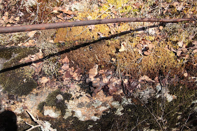 |
Undone section of wire gate, below it is the rusted bolt that once held it in place.
|
 |
| Metal ring on other side of road- GPS N44 22.403 W068 13.973 |
For those who have asked, sorry this took so long, but yes, the Great Hill Water Tower is still there and I just put together a better map which should help you out.
 |
GREAT HILL ABANDONED WATER TOWER
ACADIA NATIONAL PARK |
Due to the virus outbreak, Bar Harbor is asking tourists NOT to come here this year, and Acadia National Park has now been closed to everyone...it is my understanding you are not even allowed to walk into the Park. This Closure even applies to Ocean Drive, the stretch of the Park Loop Road which usually remains open, the entire park and museums run by the Park Service are all closed. If there is a change and the park reopens, I will post it.
So I just updated my camera, moving from a Canon T61 to a Canon T7i, these Rebel cameras are just amazing. I want to give the fine folks at Tri State Camera, Video and Computers a big thank you, I had found the body only on Ebay for a really good price, but then did a Google search and their store came up, they were having a sale and I was able to pick up the camera for under $470.00, nearly $50 lower than anyone on Ebay, and that was for camera body only (I already own a bunch of lenses). So I was really surprised when it arrived three days later not only with the camera, they had also tossed in a free Canon battery and battery charger and camera strap, so I am very pleased with the folks at Tri State Camera, Video and Computers.
If you looked for a comment box on our blogs, they have been turned off due to three persons who decided they had nothing better to do with their time then raise hell with them. As always, I can be reached at the email address below;
fendermail56@yahoo.com
YOU CAN'T GET THERE FROM HERE
In the majority of cases, when we come across trail head signs, they either mark the beginning or end of a trail, and when we come across a trail with no sign, the majority of time it signals either an abandoned trail or a trail where someone has "borrowed" the trail head sign. So the other day, with spring in the air, I ventured down along Harbor Lane and spotted a set of trail head signs behind one of the mansions. The signs appeared to be fairly old, and the one marked Sargent Mountain Trail, well, was pointing off toward the ocean. I like to draw a map or two now and then and had thought I was fairly good with directions, but I am pretty certain you can't get to Sargent Mountain Trail or any of the other trails on the trail post, from Harbor Lane.
 |
| Acadia National Park Trail Head Signs |
The 2019 Edition of Abandoned Trails of Acadia National Park is now ready for free download
ABANDONED TRAILS OF ACADIA NATIONAL PARK - 2019 EDITION
Free download is also available for my ebook Footprints In Time;
FOOTPRINTS IN TIME - STORIES FROM MOUNT DESERT ISLAND'S PAST
Books that list me or one of my websites as a source include;
UPDATE; Anyone following my blog knows for some time we been trying to track down the Lost Kebo Mountain Stairway, that lost stairway has now been located and documented and you can read up on it at the link below. As it turned out, the lost stairway was hiding in plain sight, sort of. A pile of dead tree branches along the Kebo Mountain Trail was a dead give a way to the start of the trail, though we would of never thought of looking for the trail from the mountain top had it not been for Jennifer Maher Galas, who was the one who located the trail.
THE LOST KEBO MOUNTAIN STAIRWAY LOCATED
Just posted on what I am calling one of the worst auto accidents in Acadia National Park that I am aware of, leaving one fighting for their life ad three dead. I did visit the scene and took a few photos of where the car made its first contact with a large tree.
CAR CRASH ON PARK LOOP ROAD LEAVES THREE DEAD
Here is a link to a video we just did of the old Anne Archbold estate located in the woods off of Cleftstone Road.
VIDEO OF ARCHBOLD ESTATE
Got out by Bubble Pond the other day, checked out the far end of the pond and near the base of Cadillac Mountain discovered a nice fire ring not far from the water - see photo below.
There are a few mysteries still to solve in Acadia National park, one of them being Adam's Grave, which old maps show was in the general area of Great Snake Flats not far from the Featherbed. I would not be surprised if it was a large rock shaped like a headstone.
Another mystery site is something I have not found on old maps yet, but it is referenced in trail descriptions a couple times in old newspapers, and was called the Great Hole Path. From what little is written it appears it was once located in the general area of Witch Hole Pond. Not sure what the Great Hole was, but it certainly would be a great find.
DUCK BROOK EXPOSED
A few years ago me and my youngest son got a treat of a lifetime, in large part to to the extremely dry year we had. Up to that point, it would of been unthinkable to even attempt to walk right up the middle of Duck Brook, pass up through the Duck Brook Falls and continue all the way up to the Duck Brook Bridge off of the Duck Brook road, yet due to the dry year we had, we got to do just that. Just behind Duck Brook Falls there was once a good size dam, shown in old photos, we could find no signs of it as we passed through the now dry falls. We did find evidence of stepping stones in different areas as we advanced up the center of the brook, old newspaper articles states that several hundred stepping stones had been placed along one side of the brook, we were all too happy to discover the ones we did, one example of those stones in photo below.
 |
| STEPPING STONES ALONG DUCK BROOK |
You will not see these ghost prints from the past during normal weather as they are below the surface of the water most of the time, and I suspect the dam that was build where Duck Brook empties into the sea might have something to do with the higher water levels of the brook. But even back in the day, Duck Brook was an unpredictable brook and hikers often were turned back by the higher water levels, according to one old newspaper articles. It stated that a second Duck Brook Trail, or path, had to be built way up along the top of the high steep bank which borders both sides of the brook. That second path may of been where the old cast iron water pipe was laid, or it might of been between the water pipe and the brook, its exact location is not spelled out in the old article.
As we continued to walk the brook, we came across areas of the old trail that were further back from the water, with the ground built up in places and rocks placed under thoese sections of old trail to built it up, as seen in the photo below.
 |
| RETAINING ROCKS ALONG DUCK BROOK PATH |
From the angle I took the photo you can't see the path, my aim was to capture the rocks used back than to support the trail. I had read that two stone stairways had been built to get hikers from the Duck Brook Trail up over the high steep banking so they could connect with the old Witch Hole path., so we kept an eye out for any remaining evidence of those two stairways, and am pretty certain we located one such spot along the banking. The photo below I had at first identified as being one of those stairways, but soon heard from a fellow explorer that this most likely was the area where the Bar Harbor Water Company's wooden flume crossed over Duck Brook, and after doing more research, I tend to agree.
 |
SITE WHERE WOODEN FLUME CROSSED DUCK BROOK
Acadia National Park |
The ground down by where the water would be is scattered with perfectly square granite stones, and these stones continue all the way up the steep banking, in a couple places two or more stones are still side by side. And it was the same for the second location and I could only imagine what it must of looked like back in the day. Due to the steepness of the banking and its height and the very fast waters of the brook most of the time, not many get to experience the brook as we did that day and should another dry season come along, you may want to walk the brook as well, it is an experience you won't soon forget.
 |
DUCK BROOK BRIDGE
Acadia National Park |
If anyone is wondering where we been, the year began so good, than I stubbed my toe, the same toe that has caused me major problems for the past several years. If your not familiar with my problems with my foot, one day while walking in town I stubbed my toe on the curbing, than came down on the foot awkwardly, which caused me to have a sprained toe. As weeks went by the pain increased to the point where I could not apply any pressure on that foot. A trip to the doctors revealed my toe injury had brought on gout. Most people have enough uric acid in their body to come down with gout, but most will not, and many cases of gout are brought about by an injury to the toe or foot. We been trying ice, raising the foot in the air, staying off the foot, nothing has worked this time around, so they just started me on meds which will lower the uric acid levels, which should stop the swelling and pain. WE WILL BE BACK...I am confident the meds will work.
TWO TRAILS REMEMBERED
I think some would be surprised to see all the places I have explored on this island, poking in and around the woods and mountain sides for all of the twenty something years I have lived her, but I been actually exploring here for nearly forty years, staying here at local campgrounds for one to two weeks each year. Sadly, many of those years of exploring was not documented or photographed, since I was not into that at the time, it was more of a "let's look over old maps and see what we can find." In those years I have discovered many places, and many I have written on, but not all. Some sites I have not written on simply because I feel they have a low interest value, while other sites I know the Park Service would not be pleased to see put up on line, so I don't post on every find.
Two places I explored and did not document was the old Green and White Path from the Otter Creek Road up to the Bowl, and the Red and White Trail, from Enoch Mountain to where it connects with the upper portion of the Champlain South Ridge Trail.
The Green and White Path follows a brook up to the Bowl and as I recall, it was steep in some places but well worn and easy to follow, though I was with my oldest son at the time and this was nearly twenty years ago or there about, so I have no idea what condition that trail is in today. I actually stumbled upon the Red and White Trail while exploring Enoch Mountain. Most explorers that attempt to climb Enoch Mountain do so by hiking up to the Bowl, walking along the edge of the Bowl a ways and than making your way upward, which I have done myself about half a dozen times over the years, though that route is not my favorite way to hike up Enoch Mountain. That section of trail, by the way, is part of the old Blue and White Trail, which I have also followed from Enoch to where it connects to the Red and White Trail, and I do recall it was not easy following sections of the Blue and White. My favorite route up Enoch Mountain is by beginning along the Park Loop Road and following a brook inward about halfway between the Precipice and the fee station. We would go into the woods and right up to the base of the mountain, than follow it to the left until you reach a far comer area, where a boulder field of sorts runs upwards at a steep angle. I suspect that boulder field, narrow but well defined, may of once been part of a old trail. At the corner I would turn left and continue to follow the base of the mountain a ways to where a faint path leads upward. At one place early on you reach a spot where it takes a little effort to get up over a section of granite, from there it is a straight shoot upward to the peak of Enoch Mountain. Going up that route, which I have done about a dozen times over the years, once at the peak of Enoch you really have two choices, head down to the Bowl, or head down to a steep dip between Enoch and Champlain. It is at the base of that steep slide where rock piles pick up the old Red and White Trail. By the way, I refer to that steep area as the slide and should you ever pass that area you will learn why I call it the slide. As I recall, you really need at least two people, one to scout ahead because the rock piles, in places, are not within sight of one another and we did have a few times when we thought we would not be able to find the next rock pile, but we kept at it and once it joined the Champlain Trail, we followed that trail down to Sand Beach. At that steep dip between Enoch and Champlain, there is but one way down, it is very steep with many small loose rocks, below the rock piles of the Red and White pick up again, you want to bear right, not left. The rock piles to the left lead downward through the woods and just end.
Another trail leads from the summit of Enoch off in the direction of the Precipice, we have followed that some distance a few times, though the further you follow it the harder it gets and before long the path and rock piles go away. There are no official trails on Enoch Mountain and there are more than a few places where one could fall and become injured.
 |
GREEN & WHITE - RED & WHITE TRAILS
ENOCH MOUNTAIN
Acadia National Park |
The cover of my new book which I hope will be available in Libraries by end of August
I recently posted on my blog, "Stories from the past" a story about the war over a memorial for fallen soldiers, it was pretty headed debates with members of the American Legion threatening to resign over it. In that story, the debates, and anger, centered around a large rock on the Kebo Valley Golf Course property, below we believe this is that rock, as it was the only rock ten feet tall on that property.

As promised, I had posted and said we would soon be announcing another find, the hold up was we wanted to do more research to make certain we had indeed made the find we thought it was. That find is the remains of the Red Rock Spring Bottling Plant as well as Red Rock Spring, the water which played a key role in the entire operation. I just put a blog up on this find, but i do have to warn anyone considering venturing into the area of the Spring, the water is very deep in places, we measured a depth of between 3 feet to over 5 feet deep, and the large granite blocks surrounding the spring are some what loose. In the spring itself you can see the walls of the spring lined with bricks.
Just posted an update to this with another great find.
RED ROCK SPRING LOCATED
Love hearing from those who have contacted us and given us a heads up on locations to check out, we are hoping this will be a very productive year. We may not be able to check out each and every site but promise to get to as many as we can.
Tom St. Germain, author of "Trails of History: The Story of Mount Desert Island's Paths from Norumbega to Acadia,"
presents a great talk on the trails of Acadia CLICK HERE FOR VIDEO
COLLEGE OF THE ATLANTIC
WOW...How did that happen...just looked over my notes and realized I never delivered a copy of Abandoned Trails Of Acadia National Park to the College of the Atlantic Library, we will be dropping by today with a copy...sorry it didn't get over there sooner.
While digging through old newspapers trying to track down anything on the mini-Precipice Dorr had built on a cliff along Spring Street, across from the swimming area, I happened on a story, that at first I passed right by, but decided to return back to it and was glad I did, because in the coming 5 to 6 weeks we will be posting a new find, one that has eluded me for some years, but new details should finally bear fruit - stay tuned.
THE CAVES OF ACADIA NATIONAL PARK
So I recently got some good news, there is a good chance a publication will be doing a story on some of the caves in the National Park here, from information and photos our site provided. We were also contacted by an established writer doing a story on the death that took place on Newport Mountain in the 1850's, we were able to supply details on that tragic death and that book should be coming out also this coming year, so stay tune and we will post updates when the time comes.
THE GURNEE TRAIL
I recently came upon a letter for the proposed building of the Gurnee Trail which I found interesting and have added that letter to my blog on that trail.
THE GURNEE TRAIL
STEPHEN PERRIN
Sadly Stephen Perrin passed away Feb. 19, 2019 and his passing is a great loss.
THE LOST RUDOLPH BRUNNOW TRAIL UPDATE
From the first time my youngest son located this lost trail, my gut instincts have told me this was a trail used by work crew, but others I talked to about this trail were not convinced such a work crew trail ever exisited. Why I thought this once was a work crew trail is because it does show up on older maps, but it is unmarked and outlined in a lighter markings, suggesting it never was a true hiking trail. Here is what I found in the book, Trails of History;
"As the Orange and Black Path descended below the cliff over which Brunnow hoped to scale, he built a second connecting path across the freshwater meadow (todays Bliss Field) . A rock staircase, currently abandoned, leads up to the Orange and Black Path. This short trail provided quicker access to the business at hand, the building of the Precipice Trail."
What is described there is exactly what we located, an abandoned trail with a stone stairway, leading up towards the Orange and black Trail, and making an easy access to the Precipice Trail, which was in the process of being constructed at the time this work crew trail was made. It cuts more than 3/4 of the hiking time off of the Orange and Black Trail, allowing work crew to access the upper section of the Precipice Trail much quicker and it explains why on old maps this trail remains un-named and outlined lighter than the other trails on the map.
Seems the word has gotten out on our Abandoned Trails book, my daughter contacted me and told me there was a waiting list for the book in the Augusta area.
Its like Christmas all over again, I just happened upon a gold mine of very old history on Eden, Maine and will be slowly uploading most of the findings on my new blog, Early History of Eden, Maine. There is a ton of information so this will take a while, two blogs I have so far posted are only part way done,
EARLY HISTORY OF EDEN, MAINE
EAGLE LAKE
Eagle Lake was not always known by its current name, over the years it has under gone a few name changes. On John Peters plan of the French Grant the lake is designated as Young's Pond. Years later the lake became known as Great Pond, but in the middle of the 19th century the name of the lake was once again changed, after Ferderick Edwin Church, one of the early rusticators, spotted an eagle soaring over the lake, from that day forward the lake would be called Eagle lake.
STORM BEACH COTTAGE
So recently I have heard from a few people wanting to know why I removed certain information on my Storm Beach Cottage blog - I was asked to alter that blog due to the fact that Storm Beach Cottage - the only remaining structure once owned by George B. Dorr, is rented out by the National Park Service to a private resident, and that being the case, I can understand the Park Services concerns with people disturbing the privacy of the people renting the cottage, much is the same case with the Bass Harbor Lighthouse, that also is rented out to private residents, which is why there are large signs telling visitors they have to be out of the area of the lighthouse by sunset. I have photos of the cottage up on the Blog, as does another website, which also has the GPS information, but out of respect for privacy concerns, we decided to remove a few pieces of information - if you do use the blog post to check out the cottage, remember, respect the renters privacy.
STORM BEACH COTTAGE BLOG
GOOD ROADS DAY
I thought this article from May of 1915 was such a gem, and something one would never see in the modern times we live in, and it speaks to the strength of the community back than. Bar Harbor called upon its citizens to turn out for a Goods Roads day, stating they wanted every available adult to show up at town hill to help the road crew rebuild a length of road there. School children from grade 8 through high school were also encouraged to show up and lend a hand, with any child taking up the offer being given that day off from school. In exchange for your work, there will be good conversations with your neighbors and a free picnic lunch. I had heard of Barn Raising parties, and even house raising parties, but this is the first road raising party I have ever heard of and I am sure the turn out by the community must of been great.
COTTAGE STREET SHOOTING RANGE
So tonight I( was going through old newspapers and discovered yet another amazing thing about Bar Harbor, it once had a shooting range in one of the downtown buildings on Cottage Street, I just love uncovering things like this. The building that Eden Rising is located in was once the Odd Fellows Hall, and they had a shooting range built in the basement of the building where locals could bring their guns and get in some target practice.....who would of guessed, came as a complete surprise to me. If I had to guess, I bet the shooting range was taken down and the area used for storage these days.
RIFLE RANGE ALONG COTTAGE STREET
OCEAN DRIVE
Being one who enjoys reading old newspapers, one bit of mystery I have often encounted in a good number of old stories if this road often referred to as Ocean Drive. I know today many refer to the section along the park Loop Road that follows the ocean as Ocean Drive, but back in the late 1800's and early 1900's, there was no Park Loop Road. As it turned out, the answer to just what this Ocean Drive was I found explained in an old newspaper article, where it referred to "Ocean Drive, a local road many locals also refer to as the Schooner Head Road," so there you go, another mystery solved. Back in those days the Schooner Head Road, as shown on some older maps, ended near Sand Beach, at a small house by the beach owned for some years by a Mr. Woodbury.
SHIP SUNK OFF GREAT HEAD
I was just reading an old newspaper article and had to share this bit of a gem;
Just read where during the Fox filming of "Queen Of The Sea" a ship was purposely sunk in the waters off of Great Head in Sept. of 1917. The newspaper article states "The sinking of the ship was one of the most spectacular incidents of the new picture." The article went on to state that "so spectacular was this scene that the crowd on the rocks applauded."
So I just came across this 1926 article where a Navy Submarine paid a visit to Bar Harbor, I posted it in my blog
STORIES FROM THE PAST, and this must of been a huge event back in the day - some sixty or more citizens of Bar Harbor got to go out on the submarine and make a dive. This story reminds me of the early years when I first moved here, it seemed that at least once a year Navy Vessels paid visits here, my oldest son got to go on a few of the vessels, than the vessels stopped coming...sad the tradition had to come to an end.
A ROAD BEING BUILT TO WHERE?
So I was reading through old newspapers this evening when one headline caused me to nearly fall out of my chair;
 |
NEW ROAD TO BE BUILT UP CHAMPLAIN MOUNTAIN
ACADIA NATIONAL PARK |
I can only imagine how people reacted to that headline...WTH...wait, deep breath, the newspaper got the headline wrong, the story below the headline stated a New road was to be built up Cadillac Mountain.
Spent part of the day walking along a section of the Cromwell Harbor brook, looks a bit hiostile and in a few areas it was - what a way to spend a few hours
 |
KANE TRAIL - THE GATES OF EDEN
ACADIA NATIONAL PARK |
This photo was taken in the Fall at the intersection of the Kane Path and the Dorr Mountain Ladder Trail. On old maps Dorr labeled this area as "The Gates Of eden." yet Dorr gave no indication as to which direction one was to tread to enter into Eden.. One could make a strong case that moving from this intersection toward the Tarn and Sieur de Monts Spring area, this was the direction dorr was referring to, yet others could make as strong an argument that Dorr was in fact referring to the Kane Path as it moves on toward the Cannon Brook Trail and the Gorge. others would make a good case that Dorr had in mind the stunning views one encounters along the Dorr Mountain Ladder Trail.
I myself think Dorr stated it best, here in this spot is the Gates of Eden, and no matter what direction one journeys off in, one is entering into Eden
MERRY CHRISTMAS to one and all, hope your holiday was a great one, and don't drink too much eggnog...
Below is just one of a number of very nice letters we were sent from different libraries that now have a copy of Abandoned Trails Of Acadia National Park - anyone wanting to view a copy, check with your lcal library, if they don't have a copy on hand they can request it through the inter-library loan program from a library that does have it, the service is free.
Sadly I just learned of a drowning that took place at Witch Hole Pond in July of 1896. Little Jimmy Elkhorn, known by friends as Pond Lily Jimmy, drown in a bed of lilies after his boat over turned on the pond.
JIMMY ELKHORN DROWNS AT WITCH HOLE POND
Click on Link to download a free copy;
ABANDONED TRAILS OF ACADIA NATIONAL PARK - THE BOOK
Still slowly fixing up our site, placing helpful links on blog posts, redoing a few maps, and wishing we had one more good week of weather, we still have a few more projects we want to tackle but that might have to wait until next spring.
THE STORY OF SIEUR DE MONT SPRING
 |
| STORM BEACH COTTAGE - ACADIA NATIONAL PARK |
This afternoon we got over to the Compass Harbor area, and ventured down the Oldfarm Road where we got photos and GPS of Storm Beach Cottage, the old George B. Dorr guest house. Dorr lived out his final years in this cottage after giving his beloved Oldfarm estate to the National Park, which within ten years after getting it would tear it down. It was an amazing day and until recently I had no idea the structure still stood - and is being used by the Park Service as housing.
Last week we covered Sunset Hill, which has always had a few trails on it, though it is hard to tell if any of them were ever official trails. While hiking to the summit we uncovered an illegal camp site and took photos and got GPS info on it, clearly it was an active camp site with gear inside the tent. Also got a sunset photo from just below the summit.
 |
| Illegal Tent site - Sunset Hill, Acadia National Park |
 |
| SUNSET ON SUNSET HILL - Acadia National Park |