Saturday, October 27, 2018

ANEMONE CAVE - THE DEVIL'S OVEN


Once years ago you could pick up a trail map of Acadia national Park and find Anemone cave clearly marked on it.  Than the National Park Service decided to abandon it, like so many other trails in the park, and it suddenly stopped appearing on any map produced of Acadia National Park.  Signs were removed, even the steel railings that got people safely from the cliff down to the cave entrance were cut and removed.  Today there is no signs at all that an ancient sea cave is even there, even though the sea cave has gone nowhere - it is still there.

ANEMONE CAVE - SCHOONER HEAD - ACADIA NATIONAL PARK


There are two ways to reach the start of the Anemone sea cave trail.  The first method is the easiest.  Drive along the one way section of the park loop road, keep driving as if headed to Sand Beach.  You will see the entrance station coming up in awhile, where they collect fee's for entering the park.  If you don't have a park pass, don't panic, you will not be passing through the fee station.
As you approach the fee station, be in the left hand lane, and turn onto the road just beofre entering the fee station - this takes you to Schooner Head Overlook parking lot.  You drive straight into the parking area by going straight  at the four way intersection.  Left is the Schooner Head road which leads to route 3.  Right goes to Great head trail.

ANEMONE CAVE - ACADIA NATIONAL PARK


At the parking lot, you will see a sign by a wooden rail fence.  The sign use to tell you about Anemone cave.  Follow the narrow paved path down through the woods.  It will come out at the top of a high cliff.   at this point you are standing on the roof of the cave.
Many make their way down to the cave entrance from the right of the cliff, footing can be slippery and the way down steep.  Another approach to the cave entrance is from the left, the way I like to take.  Simply follow the narrow rough path along the top of the cliff, until you come to a long gully that heads down toward the ocean, moving toward the right, back in the direction of the cave.  The gully will pretty much lead you to the entrance of the cave.  The cave can only be entered at low tide, and a good pair of shoes is a must, as the inside of the cave is wet and very slippery.

 the second way to reach Schooner Head parking lot is by taking route 3 out of Bar Harbor, heading in the direction of Otter Creek.  Once you pass the town ball fields, you will begin to go uphill, near the top of the hill is Schooner Head Road.  Take Schooner head road to the four way intersection, and turn left into the Schooner Head parking area.
One other way of reaching the sea cave is to simply get onto the free Island Explorer bues, you want the Sand Beach bus for this.  Tell the driver when you board the bus you want to get off by the entrance fee station.  Now walk to the road before the fee station and keep walking until your at the Schooner Head parking area (it is a very short walk).


MAP OF SAND BEACH
ACADIA NATIONAL PARK


THE DEVIL'S OVEN - Anemone Cave
Acadia National Park


ANEMONE CAVE - THE DEVIL'S OVEN GPS

path begins at parking lot;
latitude    -    44 20' 23" N
longitude  -    68 10' 38" W

cliff and roof of cave;
latitude    -    44 20' 25" N
longitude -    68 10' 36" W

ANEMONE CAVE
Bar Harbor Times
September 3, 1959

"A leisurely tour of Schoodic's shoreline will reveal its infinite variety."
At the parking lot at the foot of Champlain Mountain, a sign explain's, "These are the highest cliffs in Acadia National Park."  They rise, almost sheer, 800 feet.  Their formation is due to the work of the great ice-sheet which rode over the mountains from the North.
"If you wish, you may climb these cliffs via the Precipice Trail that starts from here.  There are iron rungs and ladders to make your ascent possible.
There are three signs at the Anemone Cave parking lot.  One speaks of Schooner Head, visible from that point.
"The seaward face of the headland has the likeness in whitened rock of a schooner under full sail.  It also has a Spouting Horn - a wave-carved cave with the roof fallen in.  Schooner Head is private property.
At the cave end of the new path leading down from the parking lot the sign says, "ANEMONE CAVE;  few examples of the sea's destruction power along Acadia's shore are more dramatic then Anemone Cave."  Here is this zone of complex and intensely cracked rock, the surging waves of countless storms have bored their way 82 feet into the cliff.
"When the ten foot tides recede from the cave's darkened interior, pools of sea-water remain to form the home of myriad and colorful plants and animals.  Most conspicuous of these is the bright pink enamel-like crust lining these tide-pools.  It is a living plant...a correlline alga.  And looking like reddish-brown rosetles are the many sea-anemones,  These flower-like animals resembling miniature dahlias give Anemone Cave its name.
About half of the tests were authored by Freeman Tilden, a National Park Services writer.  Mr. Tilden is the author of a book, The National Park;  What They Mean To You And Me, which is available in most of the bookstores on the island.
The signs themselves were manufactured in the Park Shop by the maintenance staff.  Most of them are set just a few degrees off horizontal well below the line of vision so that they do not obstruct the view.  The lettering of the text stamped into the face of the unpainted wood is legible and easy to read.
Similar signs have been erected in most of the National Park areas, and there will be more erected in Acadia in time to come.

Cave can be entered at low tide

DEATHS IN ACADIA NATIONAL PARK


SCHOONER HEAD - ACADIA NATIONAL PARK
THE MODERN SHOE REPAIR SHOP
Southwest Harbor Maine
SIEYE de MONTS PARK
Bar Harbor

LAFAYETTE SPORTS SHOP
28 Cottage Street, Bar Harbor

BAR HARBOR TEA COMPANY
Eden Street, Bar Harbor

ST SAUVEUR HOTEL
Mount Desert Street, Bar Harbor

U - DRIVE IT TAXI CO.
Cottage Street, Bar Harbor


College student dies in sea cave during climb

By Diana Graettinger, BDN staff • October 14, 1993 12:00 am
BAR HARBOR — A rock-climbing adventure ended in tragedy Tuesday night when a 20-year-old College of the Atlantic student died after he became trapped in a sea cave on the side of a cliff at Acadia National Park.

Rangers speculated that extreme cold temperatures, pounding rain, assaultive winds and high tide prevented Douglas Rose from climbing up the face of the cliff to safety, and that he may have drowned. They said the cave could be reached only by the climbing rope he had descended just hours before.


During a briefing at ranger headquarters at Acadia National Park on Wednesday, Chief Ranger Norman Dodge described what led to one of the most dramatic recovery efforts he had seen at the park during his 18 years of employment.

Dodge said that Rose, with fellow climber Paul Ryan, 20, an employee at Cadillac Mountain Sports in Bar Harbor, were at Great Head to challenge one of the most difficult rock-climbing areas at the park.

Wednesday was a difficult day for Rose’s friends and classmates at College of the Atlantic, whose faces reflected the horror they felt while they stood quietly in the back of the room listening to Dodge recount the tragic events that led to Rose’s death. Rose was a junior at COA.


Rose’s parents, Clayton and Sue Rose of Manchester, Conn., were notified of their son’s death and they arrived in Bar Harbor at 4 a.m. Wednesday, when they were sequestered in a motel.

Although Rose’s parents were contacted in Connecticut, school officials said their records showed Rose’s home address as Wilbraham, Mass.

The climbers walked about a half-hour Tuesday, across rocky terrain, to get to the climbing area, then lowered themselves on two ropes to the floor of the cliff after securing their equipment, Dodge said. At low tide, they made their way across boulders and into the sea cave, where they attached their equipment to the top of the cave and were able to walk across the ceiling.


Dodge said the two men were experienced climbers, but that they encountered problems when the high tide interfered with their climb out of the sea cave. He said that in order to leave the cave, the men had to make a “Tarzan-type swing” out of its mouth to reach the vertical ropes.

“The wind and wave action, the weather and the tide seemed to come faster than they had seen it here before. The waves were coming directly into the cave, so the climbing window was shortened,” he said.

Dodge said the men realized the urgency, and left their climbing gear behind.


Ryan was the first to make the climb back. “He (Ryan) went well into the ocean before he reached the vertical (line). The surf was high, and it was difficult, but he said that he cooled himself mentally and just climbed up like he ordinarily would,” Dodge said.

Once he was about halfway up the face of the cliff, Ryan looked back to his companion and offered words of encouragement.

“He (Rose) fixed his equipment on the rope, swung out to the vertical and went well into the water, where there was serious wave action and surf. … Although he was putting out a lot of effort and trying to climb, because of fatigue or maybe hypothermia — because they had been out in the cold all day and they were wet — he was unable to ascend the rope,” Dodge said.

After about 45 minutes of trying to help his friend, Ryan attached Rose’s rope to the cliff and made his way in the dark to the Bar Harbor Police Station.

“He arrived at the Bar Harbor Police Station around quarter-past eight last night, and this incident happened around 5 p.m., so a long time had passed,” Dodge said.

Rescuers and a 40-foot U.S. Coast Guard boat rushed to the scene.

“So last night, in the blackest of downpours and with the wind howling like a hurricane … a member of Mount Desert Island Search and Rescue was able to climb down the rope to a point where he could see into the cave. He could see that Rose was tethered on a rope and pretty much free-floating in the surf and face down,” Dodge said. “He made a determination he was dead.”

Rescue efforts were halted until 6 a.m. Wednesday.

“This time a ranger climbed down and was able to pendulum-swing into the cave. He got within 15 or 20 feet of the body when the surf really picked up. He was completely submerged two or three times and we had to pull him up,” Dodge said.

The rescuers returned to the site at 1 p.m. They climbed down to an area that was accessible by foot. A ranger then crept across the face of the rocks, and attached the safety ropes that other rescuers would use to cross the bottom of the sharp cliff and recover the body.

Dodge said the ropes the men had climbed down on Tuesday had been severed by pounding wave action during the night.

As the surf continued to sweep the rocks, onlookers sitting on the side of the cliff watched the recovery efforts. At 2:30 p.m. a climber had secured the ropes and made the lateral climb back. Other climbers, using the strength in their arms and legs, and at times suspended in midair with their backs to the sea, then moved carefully across the outcropping. It took them about 10 minutes to reach Rose’s body.

The body was placed in an evacuation bag containing flotation jackets, a line was tied to it, and the line was thrown to the Bar Harbor harbor master’s boat and the crew recovered the body. The recovery was completed by 3:30 p.m. Rose’s body was taken to a funeral home in Bar Harbor.

COA student Josh Jamieson, who said he had once roomed with Rose, described Rose as a very likable person.

“He was a nice guy, an outdoorsman. He enjoyed his outdoor activities and did them well. He was generally a well-rounded guy, and he had a lot of friends,” he said.


VIDEO OF ANEMONE CAVE - ACADIA NATIONAL PARK


Tuesday, October 23, 2018

BEAR BROOK - JACKSON LAB CONNECTOR TRAIL


Back in the day, before Bear brook Picnic Area was a picnic area, it was a small campground.  And where Jackson Labs is today there use to be a horse racing track.  So it only makes sense that at one time those two areas would of been connected, and as it turns out they are connected still to this day by way of a secret trail in the nearby woods.  Today the trail is most often used by workers at Jackson Lab who want to get into the park quickly for a picnic or a hike.
JACKSON LAB - THE MOUSE FACTORY - BAR HARBOR MAINE


But before you can find the hidden trail, you first have to locate Bear Brook Picnic Area, and the park doesn't go out of its way to point it out to you.  Once you drive past the one small sign for it, you have to be ready to brake and turn into it, but many become distracted by the pond on the right with Champlain Mountain towering over it.
And to make matters worse, the entrance to the picnic area is at an odd angle, turning into it ends up pointing your car in the direction you just came from.  It is little wonder that Bear Brook Picnic area see's very little use, and on many a summer day you can go there and find the place nearly empty.  You kind of get the feeling the Park Service doesn't want the public finding it.

BEAR BROOK PICNIC AREA TRAIL - Acadia National Park


To locate Bear Brook Picnic area, drive along the One Way Section of the Park Loop Road, drive past the turn off for Sieur de Monts Spring, pass under the stone bridge ahead, than you will continue uphill and around a long curve, at the top of the hill the road straightens out, and if you look to the left you can see some of the picnic tables.  Switch to the left hand lane and put your blinker on to turn left, slow down, and look for a very sharp turn on your left leading into the picnic area.
Jackson Lab - Bear Brook
connector  path
PARKING LOT ENTRANCE
latitude       44 21' 46"N
longitude     68 12' 2"W
start of path
latitude       49 21' 43"N
longitude     68 12" 0"W
picnic area
latitude       44 21' 38"N
longitude     68 11' 56"W

Once at Bear Brook Picnic Area, the map is fairly easy to follow to locate the hidden trail.  Walk up over some flat granite and the well worn trail is there.  It is not a long path and leads to a rear parking lot of Jackson Labs, with route 3 just ahead.


BEAR BROOK PICNIC AREA - Acadia National Park


I had always heard that Bear Brook Picnic Area was once a campground, and that there was once a horse Race Track located somewhere between the picnic area and Jackson Labs.   As it turns out, there are still a few signs of that old horse track, located in the nearby woods.  Once you enter Bear Brook Picnic area, turn right and park.  Enter the woods to the far right, and not too far in you will see some of the old fence posts still up, while others are leaning over or flat on the ground.  The fence posts run in the direction of Jackson Labs, close to the rear of the building.
The GPS numbers for the general area of the fence posts is as follows;  Latitude 44 21' 42" N Longitude 68 11' 53" W.

ROBINHOOD PARK HORSE SHOWS
Bar Harbor


JACKSON LAB BEAR BROOK UNMARKED PATH
ACADIA NATIONAL PARK

JACKSON LAB IN 2019
Bar Harbor Maine
MORRELL PARK RIDING SCHOOL
Bar Harbor

ROBINHOOD PARK HORSE SHOW
Bar Harbor
THE LADIE'S SHOPPE
Main Street, Bar Harbor

LITTLE KEBO INDOOR GOLF COURSE
Main Street, Bar Harbor

THE MOUNT DESERT NURSERIES
Bar Harbor

MAIN STREET SHOE HOSPITAL
91 Main Street, Bar Harbor


GREAT HILL - BRACKEN TRAIL, Acadia National Park


BRACKEN TRAIL - ACADIA NATIONAL PARK

At one time the Bracken Trail began at the corner of the Eagle Lake Road - RT 233, and the Cleffstone Road.    The trail made its way through the woods close to route 233, before crossing the Park Loop Road.  The Trail than ran a short ways through a field, moving to the right, and once it reached the woods it turns left and makes its way to Duck Brook Bridge Road.  From There it crossed the road and ran through the woods, passing along the back side of Brewer Mountain before reaching the area by Breakneck Ponds.  It served as a connector trail to the Breakneck Road, Mcfarland and Young's Mountain and the Fawn Pond Trail.
Today only one section of the trail remains, and it is quickly becoming a ghost, or phantom trail.  To locate it, drive from Bar Harbor up route 233 - the Eagle Lake Road, and turn into the park just before the large arched stone bridge.  Turn left onto the Park Loop road and pull over at the small dirt pull over area just before the bridge.  The start of the trail begins there.  From the Duck Brook Bridge Road end it is extremely had to locate the trail, as it is hidden behind tree's and brush.


ABANDONED BRACKEN TRAIL - Acadia National Park

ABANDONED TRAILS - BRACKEN TRAIL, Acadia National Park
When the trail reaches some over grown sections as in above photo, just keep in mind that this trail runs in almost a straight line and the next worn section is not far ahead.

ABANDONED TRAILS - GREAT HILL - BRACKEN TRAIL, Acadia National Park
BRACKEN TRAIL - Acadia National Park

DUCK BROOK ROAD - BRACKEN TRAIL, Acadia National Park
From the Duck Brook road, the trail begins just in the woods to the right behind  pole P53  15.   The trail is harder to follow if you begin on this end.

DUCK BROOK ROAD - Acadia National Park

BRACKEN TRAIL GPS NUMBERS

Start of Trail
latitude           44 22'53"N
longitude         68 13' 54"W

Trail enters woods
latitude            44 22' 55"N
longitude          68 13' 56"W

slight turn
latitude            44 22' 55"N
longitude          68 14' 1"W

slight turn
latitude            44 22' 57"N
longitude          68 14' 7"W

turn
latitude             44 22' 57"N
longitude           68 14' 12"W

slight turn
latitude             44 23' 0"N
longitude           68 14' 17"W

Duck Brook Road
latitude              44 23' 1"N
longitude           68 14' 19"W


ABANDONED BRACKEN TRAIL - Acadia National Park

                                                         CLICK TO ENLARGE MAP

GREAT HILL - BRACKEN TRAIL, Acadia National Park

ABANDONED BRACKEN TRAIL - Acadia National Park

SUNNY MEADOWS TEA HOUSE
Seawall, Maine


BAR HARBOR TEA CO.
Eden Street, Bar Harbor


COTTAGE STREET VETERINARY HOSPITAL
Cottage Street, Bar Harbor


MRS WORCESTER'S DINING HALL
Mount Desert Street, Bar Harbor


THE RODICK HOTEL
Bar Harbor


HOT SODA
DOE & CONYA DURGGISTS
Bar Harbor


Sunday, October 21, 2018

THE GREAT CAVE - ACADIA NATIONAL PARK


THE PRECIPICE - ACADIA NATIONAL PARK


In the 1800's Mount Desert Island had already become home to several major attractions, long before the establishment of Acadia National Park.  Places like Sand Beach and Thunder Hole, than called Thunder Cave were favorite destinations for outings and picnics which continued into the 1900's.  Some of the more interesting areas of natural beauty included dangerous hiking trails, with names like the Orange and Black Path, the Bear Brook Path, The Beehive and the ever popular Great Cave Path.  The popularity of the Great Cave, a wonder of nature located just off of the Precipice Trail,  dates back to the early 1800's when entire families would hike up to the cave and spend the afternoon with picnic baskets in hand, the cool air of the cave was a welcome relief to the summer heat.
The Great Cave - rediscovered and photographed by David Schortmann
Acadia National Park
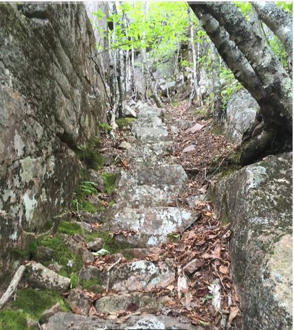
The Great Cave carries with it a somewhat odd history in the fact that after Acadia National Park was established, the National Park Service decided to make the Great Cave one of its star attractions.  Mr.  Rudolph Brunnow was put in charge of constructing a loop, which began at a lower section of the Precipice Trail, which he also designed, with the Great Cave Loop running up through the center of a boulder field and on into the woods above, once in the woods follow the rock wall and look for signs of stone steps. Once you reach the  entrance of the cave, if you decide to continue along the second half of the loop, outside the cave, facing the cave move to the left of the cave and look for an almost hidden stairway.  Many will find the second half of the loop will take them out of their comfort zone so returning the same way you reached the cave may be a better option.    Off to one side of the cave, nearly hidden from view, is a unique stairway leading up and over one side of the cave where the path runs through woods and finally narrow ledges which connects the Great Cave Loop to the Precipice Trail near the top of the Precipice.

THE PRECIPICE - Acadia National Park

At the time the National Park Service was struggling to get more hikers to the area of the Precipice, and it was felt by adding an official path to the cave would do the trick.  Perhaps it worked too well, because years later the national Park Service abandoned the Great Cave Loop, removing signs and disguising the starting point of the path so hikers wouldn't stumble upon it.  For many years the exact location of the Great Cave was thought to have been lost forever, with only brief references being made of it in an old book or on a couple old maps.  I dedicated an entire section of my website to just the Great Cave and for years posted any and all clippings I came across onto the site, hoping one day the Great Cave would once again become accessible to the public.

Abandoned Trails of Acadia - old map of Great Cave
 One day I got an email from David Schortmann, him and some friends had finally discovered the exact location of the Great Cave, and he sent along a number of photos of the cave, the Great Cave, abandoned and lost for so many years, had finally been located.
I believe it was Matthew Marchon who gave the world its first video of the Great cave, and Zhanna Galas gave us the GPS information, and than Nick Thorndike provided a photo of the nearly hidden stairway leading up and over the cave, up to that point the second half of the Great Cave Loop was still a mystery.
PRECIPICE TRAIL - CHAMPLAIN MOUNTAIN - Abandoned Trails Of Acadia National Park

 One question we get asked a lot is, can i visit the cave without having to deal with the narrow and dangerous ledges of the Precipice?  The answer is yes, as long as you return the same way you took to reach the cave, in other words, avoid following the second half of the cave loop, because it does led to narrow ledges.  In fact, the most difficult part in visiting the Great Cave is getting past a section of the Precipice Trail known as the Turn-around.  It is located a short way into your hike up the Precipice, a gigantic boulder with the first set of iron rungs you encounter.  The Turn-around was designed to be difficult as a way to get hikers with less experience to turn around and abandoned their hike up the Precipice.
There is a workable way to avoid the Turn-around entirely, but it will add some hiking time to your journey.  Hike the Orange and Black Path, just up the road before the Precipice parking area, and follow it until you come to the Precipice Trail, it joins that trail very close to the start of that boulder field which leads to the well worn path in the woods above.

GPS for The Great Cave
Talus Slope along Precipice Trail
44.349697 - 68.189670
Split with Official Precipice Trail
44.349656 - 68.189792
First Sign of Trail in woods
44.349473 - 68.190019
Stone Steps to Cave
44.349164 - 68.190296
The great Cave
44.349101 - 68.190362
(supplied by Zhanna Galas)


CHAMPLAIN MOUNTAIN - THE GREAT CAVE
Acadia National Park


VIDEO OF THE GREAT CAVE

Stone Steps - Great Cave Trail - Acadia National Park - photo submitted by Nick Thorndike


Historic hiking trails Rudolph Brunnow had a hand in designing included The Precipice, The Great Cave Loop, the Orange and Black Path, The Beehive, The Red Path (Schooner Head Path) and the Murphy Lane Path.  Mr. Brunnow had plans to connect the Red Path where it ends at Schooner Head Overlook on to the Ocean Path which begins by Sand Beach, but for whatever reason that section of trail was never built.  As a point of interest, Mr. Bunnow had a special "Workers Path" built closer to the Precipice, which ran from his front yard at High Seas and connected to the Orange and Black Trail, an almost hidden path today we uncovered and is mentioned in the book, Trails Of History.  Mr. Brunnow employed donkeys to get building supplies to the mid section of the Precipice Trail, though it is unknown if donkeys played a role in the construction of the Great Cave Loop.

PRECIPICE TRAIL CAUTION SIGN
ACADIA NATIONAL PARK

George B. Dorr, in honor of the work crew that helped build the Precipice Trail, built a miniature version of the Precipice trail by Glen Mary Park in downtown Bar Harbor.  It was on a cliff with ladders, metal bridges  and iron rings so people could go there and practice before attempting to hike the real thing.  There are no signs of this mini Precipice today.
If your considering doing the Great Cave Trail, I highly recommend you go as far as the cave, than make your way back down the way you went up, unless narrow ledges don't bother you.  The upper portion of the  trail, from the cave upward leads to an area of narrow ledges, and  connects to the upper portion of the official Precipice trail.  Perhaps the hardest part of reaching the boulder field  which leads up toward the woods and the dirt trail, is getting past the section of the Precipice Trail known as the turn a round.  Some people who can't deal with the turn a round get past it by taking the Orange and Black trail, up the road not far before the Precipice parking area.
THE PRECIPICE
ACADIA NATIONAL PARK

                                                       CLICK TO ENLARGE MAP

VIDEO OF THE GREAT CAVE

YOUTUBE VIDEO OF THE GREAT CAVE

 TRAGEDY AT THE GREAT CAVE

Abandoned Trails of Acadia National Park - The Book


GLENWOOD COOKING RANGE
GREEN AND REYNOLDS COMPANY
Bar Harbor


KOZR KORNER TEA ROOM
Seal Harbor, Maine


TESTA'S HOTEL AND RESTAURANT
Main Street, Bar Harbor


THE LOFT ANTIQUES
11 Holland Ave., Bar Harbor


MAINE CENTRAL RAILROAD


WEST END DRUG CO>
Bar Harbor


WEST END HOTEL
Bar Harbor


CRITERION MOVIE HOUSE
Cottage Street, Bar Harbor


THE MOUNT DESERT NURSERIES FLOWER STORE
Main Street, Bar Harbor