Saturday, July 4, 2020

IS THIS THE FINAL RESTING PLACE OF THE WAUWINET?

Hidden beneath the calm waters of Eagle Lake a ghost vessel of sorts lies at rest on the lakes murky bottom, a vessel with the unusual name of Wauwinet,  Considering the size of the lake, the Wauwinet was a pretty large vessel capable of ferrying 100 passengers across the lake.  How such a massive vessel arrived at the lake is a story in itself, it had to be slowly dragged to the shores of the lake from a pier in Bar Harbor, with the progress being painfully slow.  The arrival of the vessel to its new home was vital to the future success of the Green Mountain Railway Company, which was to operate a cog train from the shore of the lake to the summit of Green Mountain, today named Cadillac Mountain, and to reach the vessel one journeyed out to the large on large horse drawn buckboards, where  the buckboards would slowly fill with anxious customers as they made their way from one hotel to the next.


Books and old newspaper accounts describe different accounts of how the Wauwinet ended up in a watery grave, one account  states the vessel was stripped down and moved into Nick's Cove where it was sunk, and that today, on a clam day, you can take a boat out on Nick's Cove and look down into the water and see some of the timbers of the vessel.

But there are two other accounts of what happened to the Wauwinet and both accounts place the vessel not too far from the wharf the Wauwinet called home.   One says the vessel was hauled  a short ways out on the lake and sunk, while another account paints a more dramatic picture,  with the vessel becoming surrounded by ice as it made its way to the pier, the pressure from the froming ice on the lake wrecking havoc with the sides of the vessel and sending it to its current resting place.
I am not a detective but I do like pouring over old maps and it dawned on me, if I used Google Maps, could I find evidence of where the large vessel lay on the lake bottom?  Two things jumped out at me as soon as I brought up the map, first there is an outline of a pier under water, in the same area the pier for the Wauwinet was located in, why would the pier be under water is a fair question one might ask, with an easy answer.  Back in the Day, the Bar Harbor Water Company needed to stabilize the water level of the lake, this was done by building up the shoreline in certain areas and constructing a dam which raised the level of the lake, drowning sand beaches and piers along the edge of the lake, lawsuits followed from angry landowners whose acreage was reduced by the rising waters of the lake.
The next thing that jumped out at me was a large object which resembles a large vessel, a short ways out from shore, about at the spot two articles placed it at. 


On the map I marked the only spot on the lake in that area that appears to be an underwater wharf. I also marked an object under water, not far from the wharf, that looks like it might be the remains of a large vessel. How large was the Wauwinet, large enough to carry about 100 passengers. And in an old newspaper article a fisherman states he was out on the lake on a calm day and could see sections of the vessel under water.

As for the story of Nick's Cove, at least on Google and Bing maps I have not discovered any evidence of a vessel at the bottom of the lake in that location.  Nick's cove got its name from Nick Currin who owned and operated Currin House by the shore of the lake.  Currin House was a place  one could catch a good nights sleep or fill ones stomach with a home cooked meal.


This person places theIS THIS THE FINAL RESTING PLACE OF THE WAUWINET? not far from the wharf 


Friday, July 3, 2020

DUCK BROOK SWIMMING HOLE

If you are searching for a secret hidden swimming hole where vainly a soul passes by, I have a spectacular location very few know of - but don't be fooled, this swimming hole was once a very popular spot sought out by many.  I am of course speaking of the Duck Brook Swimming Hole, a favorite in days gone by featuring spectacular white waters from an above falls cascading  down into a deep pool of calm cool water.  as much as I would like to say you would be the only one taking advantage of this crystal clear body of water,  others have indeed discovered this hidden gem, as proof I offer up the six pack of beer I stumbled upon tucked in the water between some large rocks.  Found treasures or not, this is a go to location on any hot summer afternoon.

Directions;
From Bar Harbor, drive up West Street, at the bottom of Main Street by the town pier.  You will come to a stop sign at Eden Street, continue straight across Eden Street, heading uphill along West Street Extension.  You will come to signs saying you are entering Acadia National Park, and just ahead on the right is a small area to park at the start of the Duck Brook Road.  Follow the road on foot or bike, you will soon pass under a stone arch bridge, a little further ahead near a small curve is a old pull over with a well worn path, go past that, just ahead is a very sharp curve, as you approach the curve look on the right hand side of the road for a rough path leading down the embankment and toward the woods.  Also, from the roadside looking toward the woods there is a darker shadow where the path runs downhill through the woods a short ways, the path then goes right, by now you should hear the roar of Duck Brook Falls.  There will be a very narrow path on the left that drops steeply downhill, avoid that path as it is very steep and leads to a section of white water above the falls.  Continue straight ahead you should be seeing the towns water pipe by now, and you will come to one, then two and then three locations where you can go down the banking to the brook, the first spot is higher and steeper, the next two locations are much closer to the water and not as steep.  By now, over the roar  you should be able to see the white water as it plunges downward into the large calm pool of water.
Back some years ago a woman whose son died from cancer told the story about this secret swimming hole along Duck Brook her son use to love to go to and swim, he would stay there for hours, and I have since been told that Duck Brook Falls was his secret swimming location.  Since learning that a few of our followers have also sent me messages about that location.

DUCK BROOK FALLS SPILLING INTO SWIMMING HOLE
BAR HARBOR - ACADIA NATIONAL PARK


Thursday, July 2, 2020

FAWN WOODS ROAD


I named this area of the woods Fawn Woods and for good reason, on almost any day you can walk through these quiet woods and spot deer, some times up to six or seven, and some times with their new born baby fawns, in fact some of my best deet photos were taken here. There are traces of old roads that criss cross these woods but the main road is well defined and easy to follow. Drive up West Street Extension and park by the entrance to Acadia National Park. Walk along the left hand side of the road a short ways and you will see a old dirt road down the banking, it does a wide loop through the forest, rejoining the Park road further up the hill.

As your walking along the road, you will see where another road once ran off to the left through a field, there are usually deer in that field. Just beyond that, on the right, is another road, more defined, which runs through an opening and up onto a high section of branite where a very large bolt is bolted into the granite, with a very large piece of chain in it, have no idea what that was used for. Further along, on the right, is signs of one or two more roads and for some reason the ground has been built up here with a large amount of small stones, and towering over this flat open area is a small hill of towering granite, the tallest section has the remains of either an old foundation or a built up area of many stones on both sides of the towering granite, yet the top section of the hill is small, most likely too small for even a small size house – could this area have been a support for a section of flume that might of run from there over to the Eagle Lake Road?

From there the road beings a right hand turn, with the remains of a road heading left toward private property. The road makes its right hand turn and now you can begin to see a good number of tire ruts where most likely truck
tires sank down into the muddy ground. The road goes up hill a bit and levels off and once again you can now see the other side of that hill of granite with the built up section made up of many stones., lining the hill side as neat as a tall wall, and right there, running up along the wall of stones and making its way to the top of the granite hill, a well worn path. From the top, looking out toward Bar Harbor you are treated to some nice views, but beware, there are drop offs all around, one wrong step could result in a very nasty fall. Beyond you can follow a path along the top of the granite hill, to where you come out at a drop off directly across from the Duck Brook Road, with a path to the left leading down to the road, or you can go back down the path you came up and continue to follow the old road to where it does a deep drop downward before leveling out and making its way toward the Park Road.
Back before West Street Ext. was built, when the entrance to the park from town was off of the Bloomfield Road, this upper section of dirt road would of run over toward that abandoned entrance road, andf the first section of dirt road would of run over to one end of the nearby Bloomfield Road.. Because of all the deer traffic this section of woods and fields are sure to be ripe with ticks, just keep that in mind.

It is worth noting that one old map I saw years ago showed a Great Hill Path to the summit that began by the corner of Cleftstone and West Street Ext, and ran right up through this area, and it is interesting that both sides of the hill further back from the road, with built up sides of stones, might of played a role in that old Great Hill path.


path to top of hill with built up rock wall to right


UPDATE;

I was out looking for deer the other day, following what I like to call the Fawn Woods Road, simply because of all the great deer photos I have taken in that area, when I ran into two individuals who were also walking the old dirt road.  They had some new information on exactly what those remains are of up on a small hill along the road, it was once a tea house.  This makes sense because old maps show a path leading from about where the corner of West Street Extension and Cleftstone Road are today, and making its way to Great Hill and the summit.  Back in the late 1800's and early 1900's it was popular to place these tea houses along hiking trails, and one was planned for Newport Mountain (today named Champlain Mountain),  and one was located along the Schooner Head Road over by Great Head.  People today don't realize how important of a role Great Hill played on the path system in this area of the park, but once many trails either began or ended at Great Hill, trails like the Fern Trail, The Royal Fern Trail, the Bracken Trail, Fawn Pond Trail, the Duck Brook Trail, with several once official trails along the base of Great Hill and up to its twin peaks.   According to one old article plans were in the works for extending the Carriage Road system up over Great Hill, with the new section of carriage road running down along where West Street Extention is today, but those plans were never carried out.


Monday, June 22, 2020

ABANDONED ENTRANCE INTO ACADIA NATIONAL PARK

Today visitors to Bar Harbor can easily reach one of the major entrances into Acadia National Park by turning left at the end of Main Street and driving up West Street, crossing Eden Street and continuing up West Street Ext. right into the park, but that was not always the case.  Before West Street Ext. was constructed, the main entrance into Acadia National Park would of been more complicated, You would have to drive out onto Eden Street, turn up onto Highbrook Road, drive past How's Park, turn onto Champlain Road and finally arrive at a four way intersection.  Directly ahead was the entrance into the park, which passed through a short section of forest before coming to a right hand turn, where todays Duck Brook Road is today, the section closed to cars.  That curve or corner was well known as Reservoir Corner, because just a short ways down the road, up on the hill side, sat the Bar Harbor Water Company water reservoir, whose huge foundation and walls still stand today.
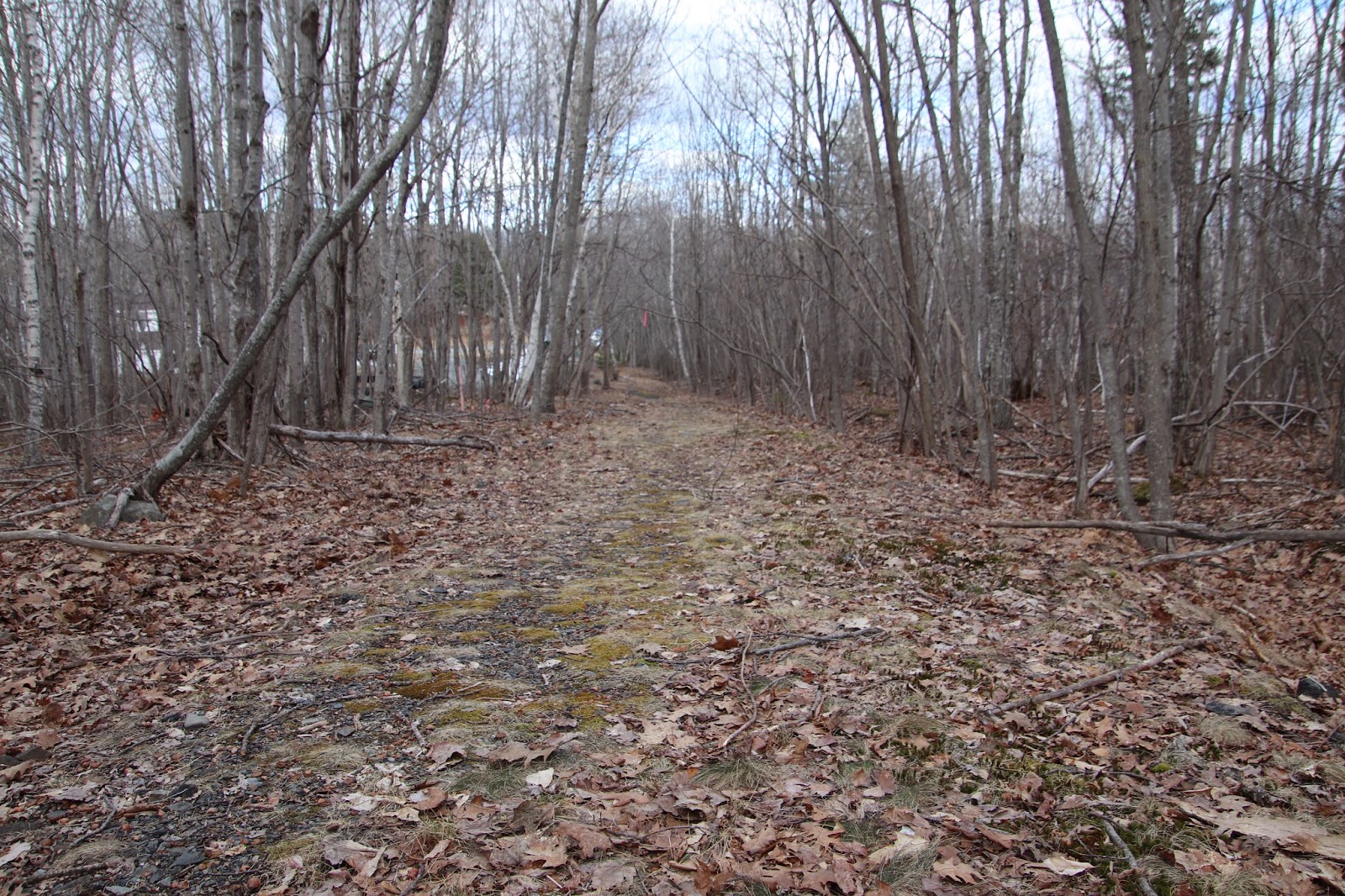
At the intersection of Champlain and Highbrook Roads there is a stop sign, directly across from Champlain Road there is usually a large storage container or dumpster, behind the storage container is a worn path that follows the edge of the woods, not far along the path turns into a road, and at different areas of the road you can still see the old pavement.
If your looking for the easiest way to locate this section of abandoned road, drive up West Street Ext. into the park, just ahead on the right is the blocked off end of the Duck Brook Road,  park there.  Walk along the road, not far, following the large granite stones along the right side of the road until they end, the abandoned section of road can now be seen.  It is a short walk and easy to follow.
Over toward one corner of the woods, shown on the map, is the remains of an old structure.

ABANDONED ENTRANCE TO ACADIA NATIONAL PARK MAP
DUCK BROOM ROAD


DUCK BROOK ROAD OFF WEST STREET EXT.
ACADIA NATIONAL PARK


START OF DUCK BROOK ROAD OFF WEST STREET EXT.
ACADIA NATIONAL PARK

The old foundation remains are located at
N 44 23.355   Wo68 13.610


Wednesday, June 17, 2020

ABBY'S RETREAT - LESS OF A MYSTERY TODAY

A fascinating mystery of sorts began to unfold one day while pouring over old maps, when my eyes fell upon two words - Abby's Retreat," which led me to my next body of research, what was 'Abby's retreat?  A nursing home?  A home for recovering alcoholics?  A private club where the wealthy gathered?  This name fascinated me from day one and I began diving through old records in search of an answer.   My research led me to an old treasure of a book titled  "Sherman's Bar Harbor guide" - a book loaded with gems from cover to cover, and what follows was taken straight from its pages;

THE HIGHBROOK ROAD

The Highbrook Road winds gracefully over the hills with many noble views of the bay and mountains.  Two of the chief cottages are close together on high ground, with prospects of amazing grandeur.  The larger of these is Mossely Hall, belonging to William B. Howard, a celebrated railroad king of Chicago.  It is said to have cost upwards of $100,000.  Not far distance is Stanwood, the summer place of the Hon. James G. Blaine, with rich flower beds and shrubberies, and fine views of Frenchman's Bay and its islands and Green Mountain.  On the crest of the hill stands the handsome red granite house built by McKim, Mead and White, in 1887-88, for Capt. George M. Wheeler, USN.  The hill was bought by Capt. James B. Eads, the engineer of the Mississippi jetties, and Capt. Wheeler, and on Capt. Eads death his portion was added to  the Wheeler estate.  For fifteen years this noble and sea-viewing eminence has borne the name of Abby's Retreat, in memory of a dear old island lady  who for many years use to visit its summit (then her own property), to look out over the ocean and dream long dreams of the past.  ( We are presented with an older woman looking back on her life  and dreaming of its recollections, and perhaps what might of been, the sea spread out before her with sky and birds above, her dreams richer then any of the views before her with perhaps a few conflicted feelings now and then, of regrets of having sold the property her heart found so much comfort in).   In the white winters of her fourscore years she asked the rich Bostonian who bought the place to give it her name and with gentle courtesy he did so.
To the westward of Abby's Retreat is Woodbury Park, with the new cottage built by W.R. Emerson for H. Le Barre Jayne of Philadelphia

The book reveals Abby's Retreat was both a person as well as a intriguing place, but one ghost the book never gives up is exactly who Abby was.  The property that made up Abby's Retreat was owned by Capt. George M. Wheeler, USN. and Capt. James B. Eads. , and in an age when homes had names, we are not provided with one here, but we do learn the home in question was a handsome red granite house built by McKim, Mead and White, and Stanwood, the summer place of the Hon. James G. Blaine, was nearby.  And while Abby herself may forever remain anonymous, we are teased with the fact that she was "a dear old island lady  who for many years use to visit its summit (then her own property), to look out over the ocean and dream long dreams of the past. "
Now if you have a nose for such things and experienced at digging through old deeds, you might be the one who finally reveals Abby's full name, a task I will leave to others to follow up on.   The insightful aspect to this story is that even after Charles T. How obtained the property it would continue to be recognized as Abby's Retreat.
 The Bostonian who ended up buying the place most likely was Charles T. How, as he owned some 100 acres in that general area at one time and he was from Boston, a lawyer and real estate dealer.  We also are treated to the fact  that Woodbury Park is located Westward of Abby's Retreat, this would place it in the area of the Hampton Inn and the edge of the cliffs by the Blue Nose Inn, as it is near the summit but on the crest of the hill.  Sometimes history can be a stubborn guidian of her past and it just may prove Abby's true identity will remain a mystery, poking her head out from old maps and books every now and then amazed at the effort we give to the chase, but as for Abby's Retreat,  it is much less of a mystery today and one can only believe with its inns and hotels, Abby would find comfort in the fact that people travel from near and far to do as she once did, take in priceless views and dream.

In the old map below the roads run differently then they do today, West Street Ext hasn't even been built yet.  On the map, Woodbury Park is the tiny triangle just above its name,  and just above that is the name Abby's Retreat, which would suggest its location might be just above its name.


So I just came across this piece in the Bar Harbor Record which now gives us the name of the estate before it became known as Abby's Retreat;

Bar Harbor Record
November 6, 1895

LIKES BAR HARBOR

Major George M. Wheeler, of the United States Engineering Corps and Mrs. Wheeler have returned to Washington.  They went in the drawing car Whitcomb.  Major Wheeler has been beautifying the grounds about Avamaya , his summer home here and delights staying in Bar Harbor until the snow flies.

Bar Harbor Historical Society on their Cottages section says this was latter named Blair Eyrie, was later torn down and Summit House built, which also was torn down to make room for the Hamption Inn.


Bar Harbor Record
October 16, 1895

Walter Paris, the celebrated artist, is spending a few days in Bar Harbor sketching the scenery.  Mr. Paris is preparing sketches from the tower of Avamaya, the summer home of Major George M. Wheeler on Highbrook Road which when transferred to canvas will make a panorama view about seven feet in length.  Mr. Paris like all other artists who visit Mount Desert Island is delighted with the scenery.


Bar Harbor Record
August 8, 1896

Miss Shaw's concert at the residence of Mrs. George M. Wheeler, "Avamaya," Norman and Highbrook Roads, crest of Abbie's Retreat Hill, kindly tendered Miss Shaw for the purpose, is to take place Saturday morning at eleven o' clock.  Miss Geraldine Morgan's artistic playing on the violin is a rare treat always, and Mrs. Perkins has a beautiful, pure soprano voice, and sings with artisic style and musicial taste.


Bar Harbor Times

September 15, 1920

Mr. Charles T. How is making a very pretty place of the cottage on the Abby's Retreat Road, which he purchased of Mr. James Eddy last autumn.  Its grounds will form a delightful preface and pleasing introduction to the beauties of Woodbury Park.

Thursday, June 11, 2020

THE FERN TRAIL - ACADIA NATIONAL PARK

The old Fern Trail, or path as they were once called, began off of the old Gurnee Trail, I have not been able to find that small section of trail from the Gurnee Tail up to the Park Loop Road, but from the Park Loop Road over to the wet land area of the Witch Hole Pond Carriage Road I had documented a number of years ago, it is well worn and easy to follow.  Today I explored a section of woods in and around the area of the Wet Lands and located where the Fern Trail picked up again, and was surprised at just how well worn the trail was as well as in good shape, it was clear the trail gets traveled often.  The easiest way to locate the Fern Trail is at the Duck  Brook Bridge where the Carriage Roads begin, cross the bridge and straight ahead is a worn path entering the woods, the trail comes out close to the wet land area, as I exited the woods there I could not help but notice a line of rocks stops right by where the trail comes out onto the carriage road by the wetlands.  The line of rocks leads left toward the wetlands and directly across from the start of the open area of the wetlands, to the right, the Fern Trail picks up again as it leads through the woods to the Paradise Hill - Park Loop Road.  Back in the day a well worn path across the roadway would of led down to the Gurnee Trail.
So back at the Duck Brook Bridge, where did the Fern Trail go to from there?  The Fern Trail would crossed a bridge in the area of the duck Brook Bridge and entered the woods across the Duck Brook Road, and run left along the side of Great Hill, until it came to the area of the Great Hill Reservoir, where the Fern Trail would of joined the Royal Fern Trail.  The Royal Fern Trail began at How Park and ran up to the Great Hill Reservoir and from there up to the summit of Great Hill.  AA number of Old newspaper articles state that the Royal Fern Trail was not a pleasant Trail to hike, it was often wet or muddy and the ground uneven and rough with rocks and roots.

Near the end of the trail where it comes out at the Park Loop Road, just to the right, facing the mro9ad, is a small foundation, I enclosed one photo of it.

Start of Trail;
Cross Duck Brook Bridge,
unmarked trail straight ahead behind sign

Middle of path
(Witch Hole Carriage Road)
N 44 23.904
W 068 14.078

starts again across from wetlands
N 44 23.918
W 068 14.101

Path at Park Loop Road End
(by storm drain)
N 44 24.123
W 068 14.078

Old Foundation
N 44 24.079
W 068 14.055

Abandoned Fern Trail
Acadia National Park


Tuesday, June 9, 2020

THE OLD PARADISE HILL ROAD

The old Paradise Hill Road lies on Paradise Hill, and has a carriage road, the Paradise Hill Carriage Road, which loops around the hill.  To locate the old road, starting at Duck Brook Bridge carriage Road off of Duck Brook Road, cross the bridge and go right, this will take you to Witch Hole Pond, at the first carriage road signs, go left, turn right at the next carriage road signs, (post #2) you will be heading for the section of carriage road with a sign "Hull's Cove Visitor's Center" (post #1).  Directly across from post #1 climb up the hillside on the other side of the road until you come in sight of what will look like an old stone wall, this is actually payers of stones that built up the side of the roadway.  It is nearly impossible to get lost here since Paradise Hill is completely circled by a marked Carriage Road.
Carriage Road intersections have numbered posts so you know where your at at all times.  The map does not show the old road, only the direction you want to go to reach it.

PARADISE HILL MAP
Acadia National Park

Old Paradise Hill Road
Sides Built Up With Stones
Acadia National Park


As you can see from the photos, you can use the stones along the side of the road as a guide, and in long sections you don't even need a guide, a couple times we did lose sight of the road but quickly picked it back up again.