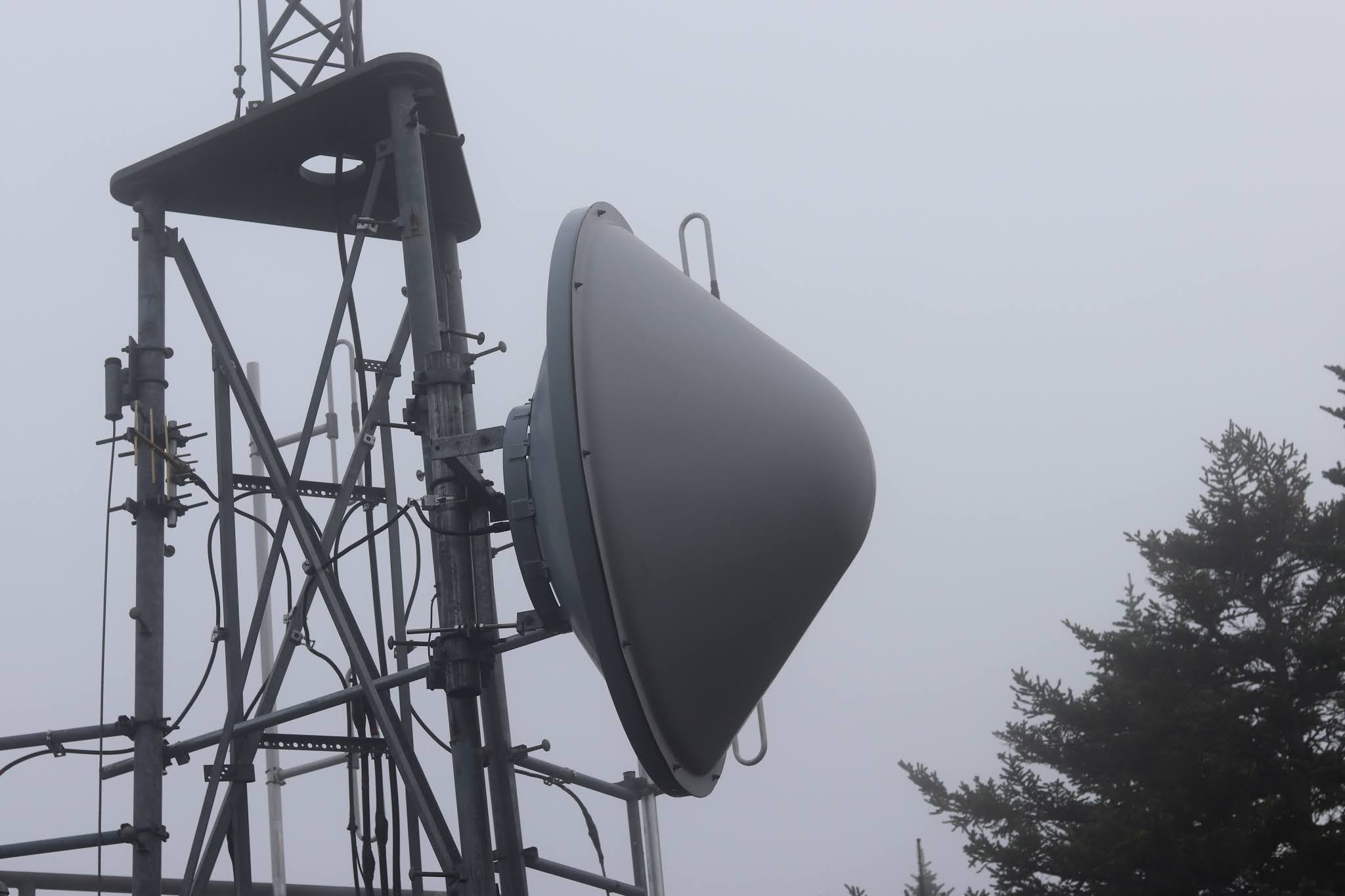
As you driving along the Cadillac Summit Road, and approaching the summit, you come to a dirt road on the right with a strange post with the large numbers, 11, 12, 13 on the post, located a locked gate. If you walk a short ways up that dirt road, the one to the left, (the one to the right is a dead end) you come to a government instillation with antenna towers and various buildings located in a well fenced in and locked area. The reason I even stumbled upon this location was because the Green Mountain Railway route passed close to this area. I did come across another find, but I will not post about it, as I am pretty certain the Park Service would not like it as it is not fenced in.
Abandoned Trails Of Acadia national Park is a site dedicated to covering lost and abandoned hiking trails in Acadia. We cover old ghost trails as well as phantom trails, offering visitors to our site more trail listings, more trail details and more maps than any other online site. We regularly update the site and add newly discovered information as it becomes available.
Wednesday, September 9, 2020
CADILLAC MOUNTAIN GOVERNMENT INSTALLATION
UPPER SECTION OF GREEN MOUNTAIN RAILWAY LOCATED
Today we finally located the final stretch of the Green Mountain Railway, but not without some effort. The newly discovered section picks up from where the middle section of the trail leaves off, a few yards across the Cadillac Summit road hidden in the woods lies a pile of rusting railroad spikes, and several yards across the brook along the bank one discovers what appear to be railings from the cog train. While it is true more research needs to be done on this upper most section of the route the train once carried passengers along, we were able to wander about the woods and find enough spikes in the ground to arrive at the upper section of the Summit road. About five feet from the roadside a spike sticks out of a section of granite, directly across the roadway, concealed in very thick brush are a good number of other railroad spikes which stretch upward to flat ground where the spikes come to an end. We continued straight ahead and passed close to one side of the government installation and exited the woods, an examination of the open granite revealed what appears to be the final railroad spike, cut off even with the granite surface but still very much visible. As much as we have documented and uncovered, we recognize there is still work to be done before we can b=label this complete.
The railroad spike pile very close to the Cadillac Summit Road is at N 44 21.272 - W 068 13.782
The train parts are at N 44 21.264 W 068 13.782
Spikes behind large granite block side of Summit Road
N 44 21.148 W 068 13.622
Here the spikes follow a gully on the other side of the road for a ways, before stopping. Straight ahead you come out on open granite where the last spike can be found, the spike has been cut off even with the granite but can still be easily seen, it is at
N 44 21.083 W 068 13.583
The Summit House was located only yards away from this final spike.
I have documented this route the cog train took pretty good and this will be my last visit to this location. I would of loved to been able to do a gopro of this upper most section of the route, however, the brush is thick, the ground rough, and working a camera and getting quality footage would be near impossible.
The final spike, cut off flush with the granite.
Tuesday, September 8, 2020
CLEFTSTONE ROADS ODD FOUNDATION
Cleftstone Roads odd foundation is easy to locate but not so easy to explain. Back in the day one of the paths up Great Hill passed right through that area of woods and whatever was located there was once landscaped and had gardens, or so the surrounding ground below the old rock foundation suggests. And clearly whatever structure once stood there, it was not a large structure, for the small hill with its steep banks would only support a small structure, so what was located here?
I refer to this as the odd foundation of Cleftstone Road because the narrow dirt road, in the woods just as you enter Acadia National Park off of West Street Extension, does a half circle through the woods, one end of the dirt road beginning just past the entrance into the park, on the left, and the other end of the half circle coming out almost across the road from the Duck Brook Road, and I do believe at one time the end closest to Cleftstone Road may of once connected to that road, but evidence was destroyed when The new entrance in to the park was constructed, because up to a point there was no West Street Extension, and the main entrance into the park from town was by way of the abandoned entrance into the park which I have written about and documented. In fact, I believe the other end of the dirt road once connected to that old entrance into the park, in any case the old stone foundation does appear to date back to a time before West Street Extention was built. There is suppose to be a couple newspaper articles talking about the structure that once stood here, but I have not been able to find them as yet.
At this point I will tell you how to locate this odd foundation, the easiest way is to drive into the park along West Street Extension and park at the blocked off end of Duck Brook Road. Across the roadway is a granite hill, and just to the right woods where an old dirt road is located. Follow the road as it moves upward through the woods, and watch that granite hill now to your left, you will be looking for an area of stones that form one side of a foundation, with a path that leads up to the top of the hill. From there you can now view the other side of the hill where another wall of the foundation is located. The second way to locate the odd foundation is by driving up West Street Extension, as soon as you approach the entrance into the park, pull over and walk up the left hand side of the road a short ways, looking down the banking for a well defined dirt road, and follow the old road through the woods to the foundation.
I do believe I have an old hand drawn map that shows the structure, it is a small structure on a hill, with Great Hill rising up behind it, the location fits perfectly. I was walking through the woods one day recently in search of deer to photograph and ran into two individuals who shed light on exactly what it was that once stood on that small hill, it was a tea house. From the old map I found the small structure pictured would seem to be about the size of a small tea house. But as is often the case, one mystery opens the door to another, and in various places in the woods there I have seen golf balls.....anyone have any clue why golf balls are in the woods off of Cleftstone road?
Sunday, September 6, 2020
FOUNDATION BY DUCK BROOK
The first foundation at Duck Brook is an old foundation I stumbled across nearly 30 years ago, hidden not far in the woods by the Duck Brook Paradise Hill road bridge. The foundation has several rooms, one room off of which was clearly the kitchen is flooded with water, and the ground was very wet leading up the banking away from the foundation. I followed the wet area which led me to a small pipe like the ones that go to a faucet, sticking out of the ground it still has water gushing out of it after all these years. An old road almost from the corner of the large triple arch bridge runs uphill into the woods, the more you follow the road the more defined it becomes, leading to the area of the foundation, another nearby road runs through the woods and circles back toward the bridge but further below the bridge, this may of been a service road put in place when the large stone bridge was being built.
At the top of the banking above the old foundation is the old Bar Harbor Water pipe, which runs through the woods to this area from the Eagle Lake Road.
In foundation 2, I was told to check out this site by a tip, who believed one of the Bar Harbor Water Company reservoir's might of been located there. It was fairly easy to find, though I am not certain it was an old reservoir, that said, there was a couple large pieces of broken water pipe at the site, and clearly a very large circular structure was once located there. An old road appears to have made its way to the site, way before the Paradise Hill Road bridge was built, and a nearby tree is deeply scarred from where a chain grew into the side of the tree, most likely placed there to block cars from reaching the site. Nearby in the woods with a fallen tree over it is a deep small hole going down into the earth, maybe an old well, not sure. If you have any more information on this second foundation, or the first, drop me a line at fendermail56@yahoo.com
Section of large broken water pipe
Sunday, August 23, 2020
LOST DUCK BROOK STAIRWAY LOCATED
Years ago I came across an old newspaper article that mentioned how two stairways had been constructed from Duck Brook Trail up the steep banking, today we located one of those stairways, incredibly most of the steps remain in place. Long before the current bridge spanned Duck Brook and its gorge, a much smaller bridge crossed the brook upstream., near where a dam was once located.
The accidental discovery of the stone stairway came as an unexpected surprise, as this was not the prize we were seeking out; which was signs of the old flume. The stairway is accessible from the brook, the first steps appearing along a well worn path which may be a section of the forgotten Duck Brook Trail. The steps move upwards, moving to the right as they do so and conclude a short distance from the shoulder of Duck Brook Road, where a faint path serves to connect the route to the road. These steps may of been very effective guiding hikers from the brook to the road above years ago, but today the steep sides of the gorge along with loose debris makes for an interesting climb that some may want to steer clear of. I highly recommend this stairway be approached from below, moving upward.
Directly across the brook from this stairway is another slightly worn path which veers left in the direction of Duck Brook Bridge which towers over the narrow brook. The further you follow it the more defined it becomes, but ends where a rock slide appears to have destroyed that section of trail. This is a nice find but be warned, loose debris and steep sides does add an element of danger.
GPS - steps begin by brook at
N 44 23.524 - W 068 14.125
slightly worn path begins by Duck Brook Road
N 44 23.492 - W 068 14.126
Photos were taken as I made my way up the stairway from the brook;
These three large stone steps mark the start of the stairway by the brook.
This is a section of the old Duck Brook Path, as taken from the first three stones of the stairway.
As the path gets very close to the Duck Brook Road you can see where one side of it is slightly built up.
Duck Brook Road where its blocked off to traffic, old Duck Brook Path and stairway is down banking a very short ways by this closed off section of roadway, between here and the bridge you can locate the lightly worn path leading to the stairway.
Saturday, July 4, 2020
IS THIS THE FINAL RESTING PLACE OF THE WAUWINET?
Books and old newspaper accounts describe different accounts of how the Wauwinet ended up in a watery grave, one account states the vessel was stripped down and moved into Nick's Cove where it was sunk, and that today, on a clam day, you can take a boat out on Nick's Cove and look down into the water and see some of the timbers of the vessel.
But there are two other accounts of what happened to the Wauwinet and both accounts place the vessel not too far from the wharf the Wauwinet called home. One says the vessel was hauled a short ways out on the lake and sunk, while another account paints a more dramatic picture, with the vessel becoming surrounded by ice as it made its way to the pier, the pressure from the froming ice on the lake wrecking havoc with the sides of the vessel and sending it to its current resting place.
On the map I marked the only spot on the lake in that area that appears to be an underwater wharf. I also marked an object under water, not far from the wharf, that looks like it might be the remains of a large vessel. How large was the Wauwinet, large enough to carry about 100 passengers. And in an old newspaper article a fisherman states he was out on the lake on a calm day and could see sections of the vessel under water.
As for the story of Nick's Cove, at least on Google and Bing maps I have not discovered any evidence of a vessel at the bottom of the lake in that location. Nick's cove got its name from Nick Currin who owned and operated Currin House by the shore of the lake. Currin House was a place one could catch a good nights sleep or fill ones stomach with a home cooked meal.
![]() |
| This person places theIS THIS THE FINAL RESTING PLACE OF THE WAUWINET? not far from the wharf |