IN SEARCH OF THE FLUME
Some people have asked me a number of questions about the flume and the route it may of taken, would there still be any evidence of it today. The answer is though we don't know the exact route the flume took, there are clues out there is you look for them. One question I got a few times is do I think any of the boards would of survived all these years, the clear answer is yes, we have to look no further than the site of the Water Reservoir itself for proof of this, which is where I will begin at, since this site was part of the flume operation, find timers or boards here and there are bound to be more out there somewhere.
The first photo is of boards located in the far left rear of the Reservoir, with wire attached to them, which may or may not of been part of a fence at one time.
Board two we discovered as we examined the rear of the Reservoir from along the top rear of the site, I had seen that years ago and at the time, with leaves on it, thought it to be part of an old tree, but a closer look revealed it is actually a long timer.
In the next photo this board was not too far from the first, and a good deal of the section of timer is under dirt and leaves. So now we have answered if wood could of survived all these years in the outdoor elements, it could.
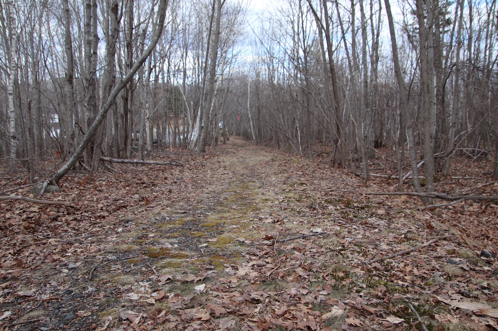
From here we moved to the base of the mountain behind the Reservoir and followed it a ways before moving up to the next level where there was a good deal of flat open granite, I had walked through this area many times over the years, but never from this angle, and there sticking up about a foot and a half was a metal rod, kinda like the rods you see sticking up out of the ground along the Green Mountain Railroad route up the side of Cadillac Mountain, but here, on the side of Great Hill, on flat granite, why? This rod is not too far from the Reservoir and highly likely to be connected to it and perhaps the flume itself. The GPS location of this rod is at N44 23.576 Wo68 13.895

It was threatening to rain but we pushed on, making out way to a wet land area where a tiny brook flows out of, its pretty much dry right now, so we followed the brook to the Duck Brook Road where a storm drain was near by. Up the road to my right was where the side of the road was blocked off by a concrete barrier, and for some reason I moved across the roadway and looked down the embankment almost across from that brook we followed and told my son, wow, look at that nice section of cut granite down there. He looked and replied, yeah, and look at that long old board between the trees behind it. How was it I never saw that long board, I have no idea but there it was, propped up between some trees.

The board above is down the embankment but easy to see along with the cut granite stone in front of it. GPS for the top of the banking along duck Brook Road is N 44 23.600 W 068 14.441, the banking is not too steep there and you can go all the way down to Duck Brook where a nice section of the old Duck Brook path is, but unless your experienced at this type of exploration you may be better off just viewing the board and stone from the roadway.

I had brought a zoom lens with me so I was able to get a nice photo of it, we then realized the banking in that one area was not too steep, and slowly made our way down to the board - looking for maybe some writing on it, no luck, but we left the board undisturbed. It is just a short ways further below the site of the board that you come to Duck Brook, the section where a nice stretch of the old Duck Brook path can still be seen, but by now it had began to rain a bit so we headed back up the banking to the road above. Because of the rain I totally forgot to get the GPS of this site but will try and get it and post in here sometimes this weekend.
Some Native American art going on here as well found this tee pee inside the Great Hill water
Reservoir
No one said this was going to be easy...we found this - the remains of an old iron chair, three fourths of the way up the hillside behind the Reservoir - very strange find
Check out Google map below of the Great Hill reservoir, is that crazy or what, its sticking out like a sore thumb, I did the exact search on Bing map but it lacked detail.
I keep going back to the fact that Scott's Hill was the site where the flume ended its journey near the top of the hill by what was Mrs. Scott's cottage. Today an abandoned mansion sets at about that location, and most likely no trace of the wooden reservoir still exists, but there are two suspicious locations near the top of what is now Schoolhouse Hill that I would love to know what they are. The site to the left appears to be a very large structure with walls but no roof, maybe a third the size of the mansion I am guessing by comparing the two, what is it? No road appears to go to it.
The second site is to the right and when I first saw it years ago I had no idea what I was looking at, it has a really large wooden cover with spacing between the boards, way too large to be a well, yet it appears to be some type of super well, really large and deep and appears to have a large amount of water in it. I have never found much on the Scott's Hill reservoir other then the fact that it was near the top of the hill and constructed of wood, could this mysterious deep structure be an underground reservoir? If not, what is it?
I have taken a couple looks at this site above and it does appear to be a very large underground water storage of some type, newspaper articles state the reservoir on Scott's Hill was built of wood, but does not state if it was above ground or under ground, and this structure does appear to be built of wood.
In the History Of The Bar Harbor Water company, it states two things which were not known when that publication was written, but which, from old newspaper reports, are now known. The first thing it states is that the reservoir on Scott's Hill was most likely built of stone, this was not the case and several articles state that the Scott's Hill Reservoir was built of boards. The publication also states that the location of Scott's Hill is unknown, again, old newspaper articles tell us exactly where Scott's Hill was located, and over the years that hill has gone by several names including; Scott's Hill. Malden Hill, Hamilton Hill and Schoolhouse Hill. The map below is of that hill, showing property owners at the time the map was made.
 |
| Scott's Hill, Schoolhouse Hill, Hamilton Hill |
If you read the newspaper article below you will notice that the names of property owners corresponds with the property owners on the above map.
This from the Bar Harbor Record, the section of the news story that describes the water reservoir;
Bar Harbor Record
June 12, 1901
It is constructed with three distinct walls which insure against breakage or leakage, the otter or retaining wall being of stones of various sizes laid without mortar. The second or masonry core wall from bed rock to level being of large stone laid in mortar. The inner slope is paved with selected stones laid as closely together as practicable in a cushion packing of broken small stones.
The lining is of cermet concrete put on in layers, introducing a waterproof system which is very effective in the shape of a waterproof lining which is placed between the layers of concrete. Some fifty or sixty men have been employed during the spring, and a steam drill and stone crusher have played an important part. About 3,000 feet of 16 and 20 inch pipe have been laid from the reservoir to the village at a large expense. The reservoir will be filled by the main pipe which leads from Eagle Lake about two miles distance, and capable of holding some 800,000 gallons. When completed Bar Harbor will have one of the finest water systems in the country. The contractors from the above work were Taylor and Tylee of Boston, Mr. F.C. Coffin of Boston being chief engineer, and Mr. S.S. Bunker of Bar Harbor resident engineer. Mr. J.F. Fifield of Boston is general superintendent of the entire work.
(The actual site of this reservoir is only mentioned in general terms, with the reservoir being located beyond How Park along the Bracken Path, to the best of my knowledge the Bracken Path only ran along one side of Great hill, the end the furthest away from the Great Hill Reservoir, coming out on the Duck Brook Road in two places, with one path continuing on the other side of the road, making its way past Brewer Mountain and ending by the Breakneck Ponds. This story appears to be about the Great Hill Reservoir.)
Bar Harbor Record
July 4, 1906
The Bar Harbor Water Company was organized in the seventies at a time when some system of water works was absolutely necessary to any further progress of Bar Harbor as a watering place. Too much credit can not be given to Messrs Fountain and Serenus Rodick for their courage in building the plant with practically no assistance and with but little apparent income from such an outlay as was necessary. The initial system was a crude affair, the water being taken from New Mill Meadow, over a mile below Eagle Lake, carried in a wooden sluice part of the way and part of the way running in an open ditch, it was brought to a wooden reservoir located near the lot now occupied by Miss Saunders cottage (owned prior by Mrs. Scott) on the Eagle Lake Road. From this humble beginning there has been developed one of the best water works systems in the state. In 1893 the Rodicks sold their stock to the present owners, who are mostly of the summer colony. A pipe line had previously been laid from Eagle Lake to the town and in 1895 a new pipe line was brought from New Mill Meadows costing some $25,000. A year or two later, an 8 inch main was constructed to Hulls Cove, making a permanent supply of water to this suburb of Bar Harbor.
A dam has been built at Eagle lake to ensure the holding back of a sufficient amount of water to supply Bar Harbor and Hulls cove during the severest drought. In 1900 a reservoir was built on the hill back of How's Park with a capacity of 700,000 gallons, in order that the pressure might at all times be sufficient in case of fire. These, with various other improvements in the pipe line system have cost many thousands of dollars. The company is still further improving its plant at the present time by the erection of a filter under the engineering supervision of Freeman C. Coffin of Boston.
The directors of the water company are Mr. John S. Kennedy, Mr. David B. Ogden, Mr. W.H. L. Lee of New York, Dr. Robert Amory of Boston, and Mr. Fred C. Lynam of Bar Harbor. The latter is president of the company, and Mr. Edward B. Mears Secretary and treasurer Mr. A.H. Grlnfle is the ellicienl superintendent of the water company.
The management of the water company has been most progressive, meeting with promptness and efficiency the problems forced upon it by the requirements of a rapidly growing community.
I added the note (owned prior by Mrs. Scott) because in other stories it clearly states that Mrs Scott sold her property to Miss Saunders. Old maps clearly show that Mrs. Scott's cottage was located on top of what is today known as Schoolhouse Hill, but also went by several other names as well over the years.
What I find most interesting is the reason behind the building of the Great Hill reservoir, it was built in case of a bad fire. Also of interest is that this is yet another account that states the reservoir on Scott's Hill was a wooden one.
SECOND SECTION OF FLUME ?
This photo below is a very interesting photo, I believe it came from the book 'Sherman's Bar Harbor Guide" which I located on Google books, but I could be wrong(map was from Southwest Harbor Public Library digital online site). I at first was convinced what I was looking at was an extremely long and highly elevated bridge, but it made no since, why build a wooden bridge in that area at all, let along make it so high, than I realized it looked strangely familiar, much like the Bar Harbor Water Company flume that crossed Duck Brook. I have already shown that Scott's Hill was indeed what we today call schoolhouse Hill, and this structure runs right toward Schoolhouse Hill.
The Brook runs down along today's West Street Ext., not yet built when the map was made, in fact one end of West Street had also not yet been built. The brook I believe is called Eddie Brook, and clearly this is not Duck Brook, Holland Ave. is not far from one end of the brook. In the book #5 was identified as 'Abby's Retreat' but first known as Avamaya, about the location of where the Summit House was located and today's Hampton Inn. So that places this section of flume like structure west of Highbrook Road crossing Eddie Brook.
So tonight I happened across yet another old newspaper article on the flume, and unlike the others that named School House Hill by other names it was known as, such as Malden Hill, Hamilton Hill, Scotts Hill and such, this writer, A.L. Higgins actually names the hill where the wooden reservoir was constructed as School House Hill, so we are actually making some progress.
A.L. Higgins
Bar Harbor Times
November 14, 1928
(Copies from a section of the article word for word)
"An open spruce wood flume was started at a convenient place near the Eagle Lake. The bottom of said flume was of a board eight inches wide by one inch thick; cotton wicking was trailed along either edge and the two side boards were then nailed on securely; the sides were boards in the rough, six inches wide by one inch thick. As I remember it, after surveying the route, measuring the distance to and getting the elevation of this beautiful body of water, Mr. Fountain Rodick and Mr. Desisle started their 'box flume' at a convenient position near the lake, and giving it as near as possible an approximate grade of one inch to one foot, they succeeded in completing it that winter to the Eagle lake Road near Central Avenue, where it was carried under the surface of the street by the cyphon principle, and I am quite sure that not a single foot of iron or other metal piping was used in any of this work, until the water flowed in abundance into the new wooden reservoir which had been already constructed on the summit of 'School House Hill' that spring of 1873.
Not only does this confirm the reservoir was made of wood, and its true location, School House Hill, we now know where on School House Hill, the summit. This brings me back to that really huge well that drops deep into the earth, it lies on the summit not far from that mansion with a very large wooden cover, between the boards you can peer down and see just how deep and wide it is, I can't help but believe that is the reservoir, build of wood and placed in the ground. Sadly, we may never know, a ton of blasting has been going on and heavy equipment is pushing and moving earth everywhere up there, even neat the summit - as of a few weeks ago the huge oversize well was still there, but sections of the Castle had already had earth bulldozed over sections of it, there will be little left to find once they get done up there.
 |
| Photo of a very large and deep structure on summit of School House Hill |
 |
BAR HARBOR WATER COMPANY RESERVOIR
GREAT HILL - ACADIA NATIONAL PARK |
THE ITALIAN ENCAMPMENT AT HOW'S PARK
The Bar Harbor Record
Jan. 16, 1895
I visited the Italian encampment last week and found it quite a settlement. These sons of sunny Italy are working like beavers on the line of the Bar Harbor Water System, and accomplishing a vast amount of work. When I drove up to the encampment I was fortunate in finding Mr. Savage there, who took me into the camp and explained their method of living.
One big camp contains their bunks with accommodations for about 80. The store room is at the end, in charge of an intelligent looking Italian who portions off the edibles to the others. The room was redolent with the fumes of garlic.
Scattered about the big camp are dozens of smaller huts or wigwams built in all manner of styles. In these different huts cliques get together and cook their rations over a fire built in the center, right on the ground.
It is a picturesque scene though not particularly attractive.
Accompanied by Mr. Savage, I walked the length of the trench from How's Park, where about twenty-five local laborers are at work, to duck Brook, and saw the Italians digging away all along the line. Mr. Cusker, the contractor, was giving his personal attention to the work, which must be progressing to his satisfaction.
We will be updating this post from time to time as we make any other discoveries.