Old maps show where a number of farms were located on Bar Island at one time and if you explore the woods and fields you will discover a number of old foundations. I am posting some of the foundation photos I came across, others are marked on the map I did of the island.
By no means does the map cover everything, in fact there are several old roads and trails I left off the map to give others a chance to explore on their own and make their own discoveries. The beach area in the back of Bar Island is pretty cool, but getting down to it is not an easy task as the ground is very steep
 |
| OLD FIREPLACE - ACADIA NATIONAL PARK |
Bar Island has always been a place sought out by people looking for a place to camp out overnight on and while exploring you just might stumble upon an illegal tent site or fire pit. I came across one fire pit and one abandoned tarp the other day.
The quickest way to reach the back of the island is by the path to the left side of the map. It begins at the sharp bend in the old road and is very easy t follow to the back side of the island.
 |
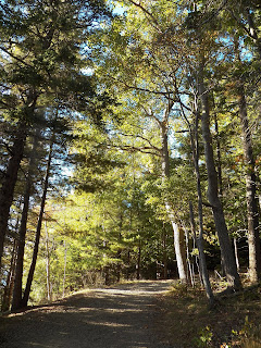
| BAR ISLAND SUMMIT TRAIL - ACADIA NATIONAL PARK |
At one time Jack Perkins who did a lot of work for PBS once owned half the island. He sold it to the Park Service so the entire island is free to explore today. For whatever reason, the park service left the private property sign in place where an old road once led to Jack Perkins house. The house itself sat idle for some time before it got broken into. It was people who worked for the park service that broke into it and were having a party. The party got broken up when park rangers got word of it and raided the party. Little wonder they ended up tearing down the house.
FOUR SEASONS OF BAR HARBOR MAINE VIDEO
One of the more interesting sights on Bar Island are the huge glacial boulders which can be found on the small island, one of the unofficial trails follows the edge of the island to the back where one of the huge boulders overlooks the sea, and a second one is nearby in the tree's and easy to see.
 |
| Bar Island - Acadia National Park |
 |
| HUGE GLACIAL BOULDER - ACADIA NATIONAL PARK |
 |
| PANORAMIC VIEW OF BAR HARBOR MAINE FROM BAR ISLAND |
 |
| MAP OF BAR ISLAND - ACADIA NATIONAL PARK |

